


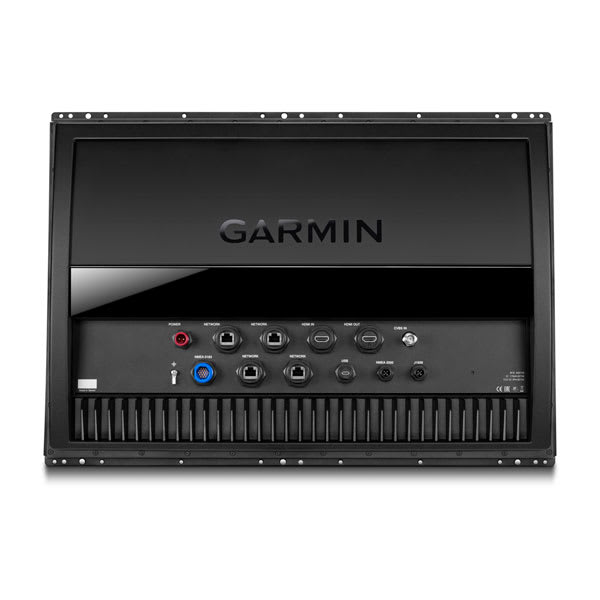
Garmin GPSMAP 8424 MFD – Chartplotter With Worldwide Basemap
Price Match
$19,999.00
-
Garmin, Garmin Chartplotters
Garmin GPSMAP 8424 MFD – Chartplotter With Worldwide Basemap
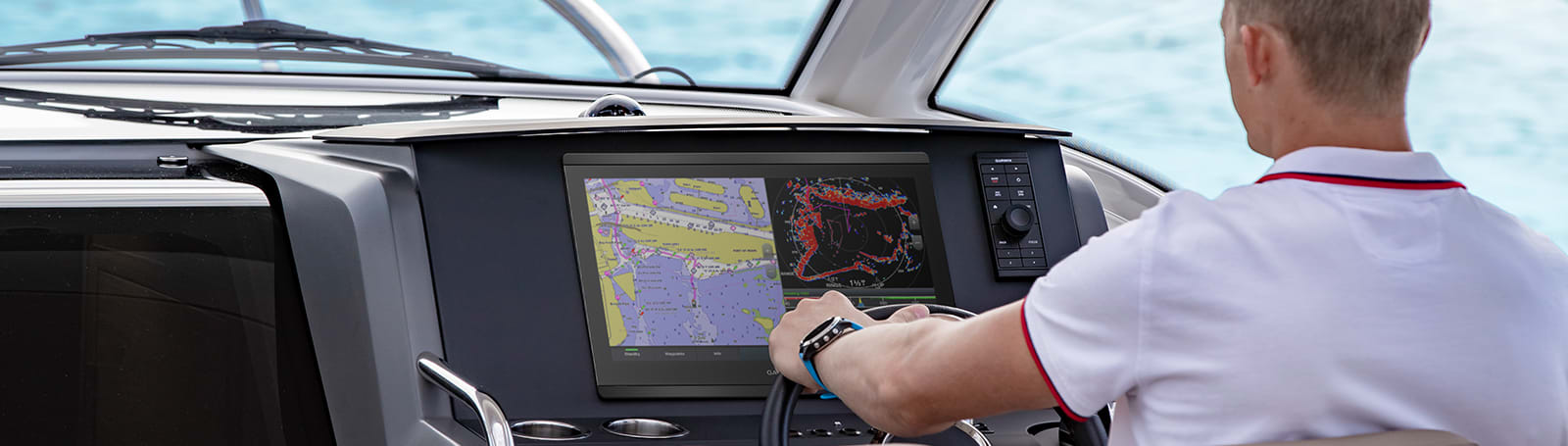
Garmin GPSMAP 8424 MFD – Chartplotter With Worldwide Basemap – TAKE CONTROL OF A BEAUTIFUL HELM
The large-format MFD lets you experience a beautifully powerful, completely networked helm at your fingertips.

Premium full HD touchscreen features Garmin’s highest resolution display.

It’s compatible with premium maps and charts for the best in Garmin navigation.

Easily build your marine system using the best of network connectivity.

From ANT® technology to Wi-Fi® networking, there are countless ways to connect to your system.

Take the guesswork out of sailing with clear laylines and more right on the screen.

With SmartMode™ station controls, everything is designed to give you quick, one-touch access to the information you need.
SKU: 010-01512-00
Garmin GPSMAP 8424 MFD – Chartplotter With Worldwide Basemap – TAKE CONTROL OF A BEAUTIFUL HELM
The large-format MFD lets you experience a beautifully powerful, completely networked helm at your fingertips.
![]()
Premium full HD touchscreen features Garmin’s highest resolution display.
![]()
It’s compatible with premium maps and charts for the best in Garmin navigation.
![]()
Easily build your marine system using the best of network connectivity.
![]()
From ANT® technology to Wi-Fi® networking, there are countless ways to connect to your system.
![]()
Take the guesswork out of sailing with clear laylines and more right on the screen.
![]()
With SmartMode™ station controls, everything is designed to give you quick, one-touch access to the information you need.

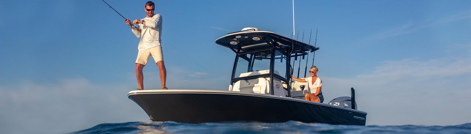
Made for your helm.
HD IPS TOUCHSCREEN
This display offers wider viewing angles, superior clarity and sunlight readability, even with polarized sunglasses.
SIMPLE, ATTRACTIVE MOUNTING OPTIONS
You can install multiple displays, either flat mounted edge-to-edge for a sleek glass helm look or mounted flush — creating a stunning helm.
GRID™ 20 REMOTE CONTROL
The optional, easy-to-use GRID 20 remote input device provides intuitive remote access and control of your entire Garmin marine system.
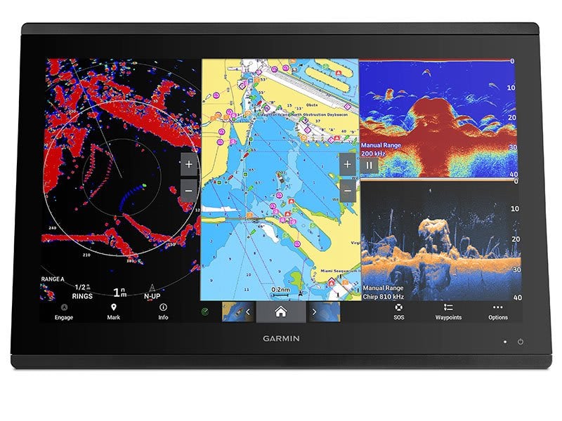
See the world below.
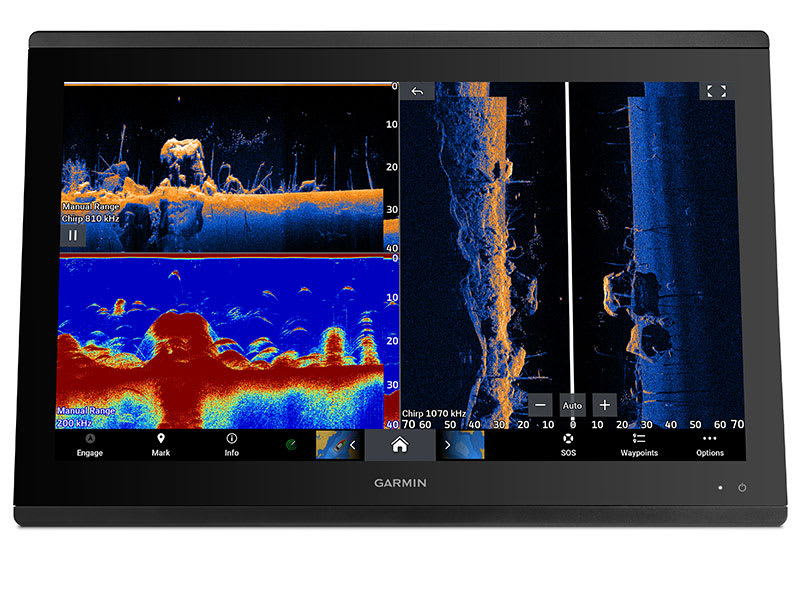
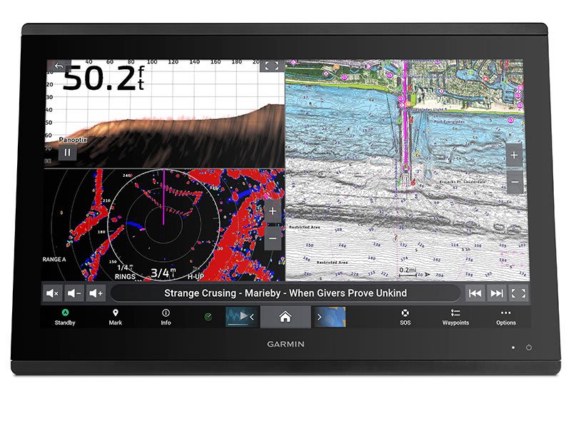
TRADITIONAL AND SCANNING SONAR SUPPORT
Get built-in support for 1-kW Dual-Channel CHIRP traditional sonar for superior target separation and ClearVü and SideVü scanning sonars to see up to 1,000’ below and around your boat at 260 kHz (requires transducer, sold separately). Built-in sonar compabiliity only available on xsv models.
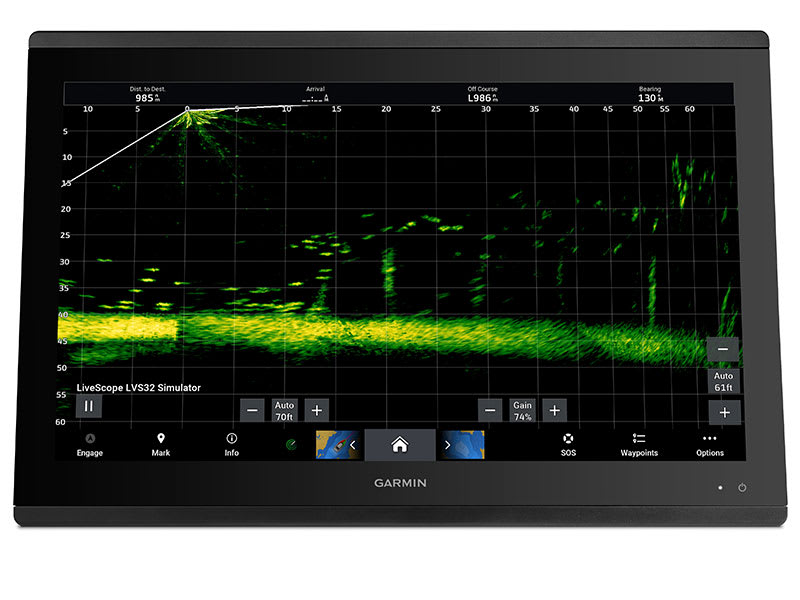
PANOPTIX™ SONAR SUPPORT
Pair your chartplotter with Panoptix or Panoptix LiveScope™ easy-to-interpret live sonar (transducer sold separately) to see all around your boat in real time.
Sail and navigate with ease.
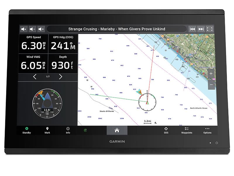
GARMIN SAILASSIST™ SAILING FEATURES
View laylines, race start line guidance, enhanced wind rose, heading and course-over-ground lines, true wind data fields and tide/current/time slider, wind angle, set and drift, wind speed and more.
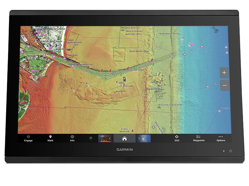
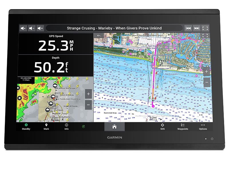
CHARTS & MAPS
Bring a fresh new look and feel to your chartplotter with optional Garmin Navionics+™ or premium Garmin Navionics Vision+™ cartography featuring integrated coastal/inland content, access to daily updates, Auto Guidance+™ technology2 and more.
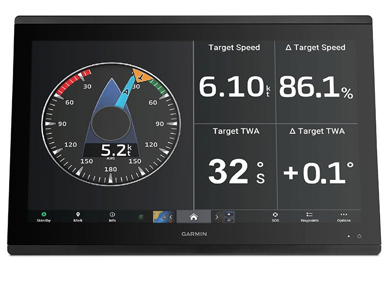
SAILING POLARS
Use the polar table to see key data, including how fast you should go at a certain wind angle and speed — so you know whether you need to adjust sail trim.
Connect to everything on your boat.
GARMIN MARINE NETWORK
If you have multiple compatible Garmin devices on your boat, you can share information — such as maps, user data, radar and IP camera video — among them.
NMEA 2000® AND NMEA 0183 NETWORKS
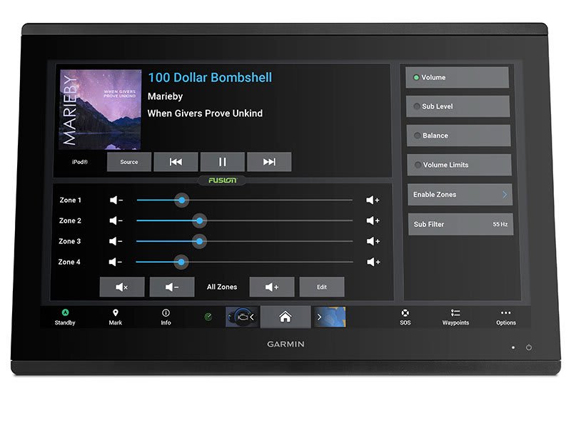
Connect to autopilots, digital switching, weather, your FUSION-Link™ audio system, media, VHF, AIS and more from one screen.
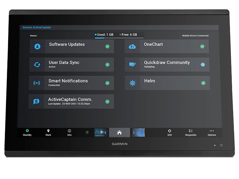
ACTIVECAPTAIN® APP
Built-in Wi-Fi® connectivity pairs with the free all-in-one mobile app for access to the OneChart™ feature, smart notifications3 , software updates, Helm, Garmin Quickdraw™ Community data and more.
INTEGRATED BLUETOOTH® AND ANT TECHNOLOGIES
Connect with some of your favorite devices, such as quatix® marine watches, gWind™ Wireless 2 transducers, GNX™ Wind marine instruments and wireless remote controls.
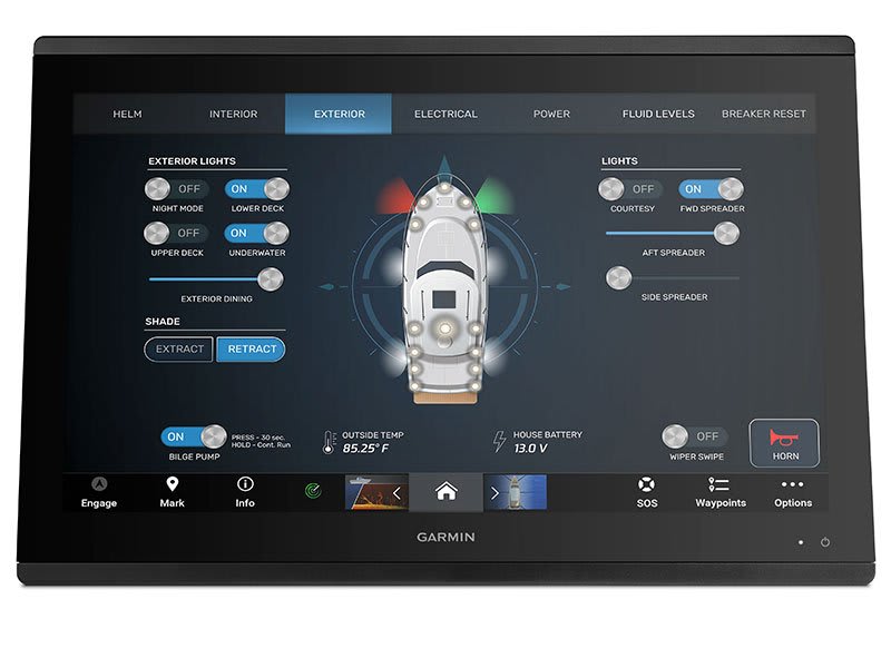
ONEHELM™ FEATURE
This feature brings together all the operations and capabilities of third-party devices, such as EmpirBus™ digital switching, on one screen.
SMARTMODE STATION CONTROLS
Get quick, one-touch access to the information you need to ease high-stress situations such as docking. You can incorporate networked sonar, radar, cameras, media and more.
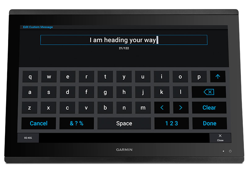
SEND INREACH® DEVICE MESSAGES
Pair your inReach satellite communicator5 to your chartplotter, and type custom messages using your MFD’s on-screen keyboard. Access your contact list or enter an email, inReach address or phone number. You can also group messages by conversation for a texting-like experience.
 What’s in the box?
- GPSMAP 8424
- Trim piece snap covers
- GPS 24xd NMEA 2000 (with pole mount, flush mount and under deck mount adapters)
- Protective cover
- Flush mount hardware
- Power cable
- NMEA 2000 2 m backbone/drop cable
- NMEA 2000 6 m backbone cable
- NMEA 2000 power cable
- NMEA 2000 T-connector & terminator kit
- Documentation
View Owner’s Manual
View Installation Instructions
| Weight | 8.6 kg |
|---|
General |
|
| DIMENSION | 22.8″ x 16.1″ x 2.8″ (60.0 cm x 41.0 cm x 7.1 cm) |
| WEIGHT |
18.95 lbs (8.60 kg) |
| WATERPROOF |
IPX7 |
| TOUCHSCREEN | ✔ |
| DISPLAY TYPE | FHD, IPS |
| DISPLAY SIZE | 20.4″ x 12.8″; 24.0″ diagonal, 51.8 cm x 32.5 cm; 61.0 cm diagonal |
| DISPLAY RESOLUTION | 1920 x 1200 pixels |
| MOUNTING OPTIONS | Flush or flat |
Maps & Memory |
|
| ACCEPTS DATA CARDS |
2 SD Cards (with Garmin SD card reader accesory) |
| WAYPOINTS |
5000 |
| TRACK POINTS | 50,000 |
| TRACKS | 50 saved tracks |
| NAVIGATION ROUTES | 100 |
Sensors |
|
| NMEA 2000 COMPATIBLE | ✔ |
| NMEA 0183 COMPATIBLE | ✔ |
Built-in maps |
|
| TIDE TABLES | ✔ |
Optional map support |
|
| BLUECHART G3 | ✔ |
| BLUECHART G3 VISION | ✔ |
| LAKEVÜ G3 | ✔ |
| LAKEVÜ G3 ULTRA | ✔ |
| GARMIN NAVIONICS+™ | ✔ |
| GARMIN NAVIONICS VISION+™ | ✔ |
| TOPO | ✔ |
| STANDARD MAPPING | ✔ |
| GARMIN QUICKDRAW CONTOURS | ✔ |
| RASTER CHART SUPPORT | ✔ |
Chartplotter Features |
|
| SMART MODE COMPATIBLE | ✔ |
| AIS | ✔ |
| DSC | ✔ |
| SUPPORTS FUSION-LINK™ COMPATIBLE RADIOS | ✔ |
| GSD BLACK BOX SONAR SUPPORT | ✔ |
| GCV BLACK BOX SONAR SUPPORT | ✔ |
| ACTIVECAPTAIN MOBILE PLANNING COMPATIBLE | ✔ |
| GRID (GARMIN REMOTE INPUT DEVICE) COMPATIBLE | ✔ |
| WIRELESS REMOTE COMPATIBLE | ✔ |
| SAILING FEATURES | ✔ |
| SPOKEN AUDIO ALERTS | ✔ |
| ONEHELM SUPPORT | ✔ |
Electrical features |
|
| POWER INPUT | 10-35 Vdc |
| TYPICAL CURRENT DRAW AT 12 VDC | 6.1 A |
| MAXIMUM CURRENT DRAW AT 12 VDC | 7.6 A |
| MAXIMUM POWER USAGE AT 10 VDC | 87W |
Sonar Features & Specifications |
|
| DISPLAYS SONAR | ✔ |
| TRADITIONAL SONAR (DUAL FREQUENCY/BEAM) | Yes (with external black box, sold separately) |
| CLEARVÜ | yes (with GCV™ black box, sold separately) |
| SIDEVÜ | yes (with GCV™ black box, sold separately) |
| PANOPTIX™ SONAR | ✔ |
| LIVESCOPE | ✔ |
Connections |
|
| NMEA 2000® PORTS | 1 |
| CONNECTIONS NMEA0183 INPUT PORTS | 4 |
| NMEA 0183 INPUT (TX) PORTS | 2 |
| VIDEO INPUT PORTS |
1 (BNC composite); 1 HDMI (HDCP compliant) |
| VIDEO OUTPUT PORTS |
1 HDMI |
| J1939 PORTS | 1 |
| GARMIN MARINE NETWORK PORTS |
4 |
| USB PORTS | ✔ |
| BLUETOOTH® PAIRING | ✔ |
| ANT+ (CONNECTIVITY) | ✔ |
| GARMIN WI-FI NETWORK (LOCAL CONNECTION) | ✔ |
You may also like…
-
Garmin, Garmin Accessories
Garmin Yamaha Engine Bus to J1939 Adapter Cable
Garmin Yamaha Engine Bus to J1939 Adapter Cable
Connect your J1939 equipped GPSMAP® series chartplotter directly to your Yamaha engine bus multi-hub to bring Yamaha’s custom touchscreen engine interface to your Garmin installation.
Pigtail Bus Wire Reference
YAMAHA PART NUMBER DESCRIPTION 6Y8-82521-01-00 1 ft. Pigtail Bus Wire 6Y8-82521-11-00 2 ft. Pigtail Bus Wire 6Y8-82521-21-00 3 ft. Pigtail Bus Wire 6Y8-82521-31-00 6 ft. Pigtail Bus Wire 6Y8-82521-41-00 9 ft. Pigtail Bus Wire 6Y8-82521-51-00 12 ft. Pigtail Bus Wire Instructions
SKU: 010-12770-00 -
Garmin, Garmin Accessories
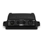
Garmin GND™ 10 Black Box Bridge
Garmin GND™ 10 Black Box Bridge
- Converts data between the Nexus network and NMEA 2000®
- Provides compatibility between Nexus and Garmin products
- Simple plug-and-play installation between Nexus, NMEA 2000 and USB
- No user setup or system configuration required
- Allows PC applications, such as NexusRace™, Expedition, Adrena or SeaTrack, to communicate sailing-specific functions between Nexus and NMEA 2000 networks
The GND 10 black box bridge seamlessly integrates Nexus instruments and sensors with the Garmin family. It converts data between the Nexus Network and NMEA 2000 to provide compatibility between Nexus and Garmin products, including gWind™ and gWind™ Race transducers. Simple plug-and-play installation between Nexus and NMEA 2000, with USB connectivity, eliminates the need for user setup and system configuration.
GND 10 allows PC applications, such as NexusRace, Expedition, Adrena or SeaTrack, to communicate sailing-specific functions between Nexus and NMEA 2000 networks. It also enables GND 10 software updates over NMEA 2000. Existing NexusRace PC application can be used to update software, configure and calibrate Nexus devices over USB using the FDX protocol.
SKU: 010-01226-00 -
Garmin, Garmin Accessories
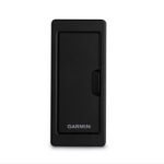
Garmin Card Reader
Garmin Card Reader
Provide convenient remote mounting and a single access point for 2 SD™ card slots for mapping with our Garmin Card Reader. A waterproof, magnetic door allows the card reader to be mounted horizontally or vertically – and you can add multiple card readers for additional access points.
What’s in the box?
- Garmin Card Reader
- Mounting hardware
- Power cable
- Network cable (6 ft)
- Documentation
Installation Instructions
SKU: 010-01023-00 -
Garmin, Garmin Accessories
Garmin Marine Network PoE Isolation Coupler
Garmin Marine Network PoE Isolation Coupler
Connect a thermal camera, underwater lighting or boat stabilizing system to a compatible GPSMAP® series Garmin chartplotter with this PoE (Power over Ethernet) isolation coupler. The coupler provides connectivity to the Garmin Marine Network; without it the network will not function correctly and could possibly damage your Garmin unit and/or PoE device.
SKU: 010-10580-10
Related products
-
Trailer Parts, Wheels
13” Multi Fit 5 Stud HT/FD Trailer Wheel Assembly Galvanised 155LT (Tyre Size: 155LTR13)
 Trailer Parts, Wheels
13” Multi Fit 5 Stud HT/FD Trailer Wheel Assembly Galvanised 155LT (Tyre Size: 155LTR13)
13” Multi Fit 5 Stud HT/FD Trailer Wheel Assembly Galvanised 155LT (Tyre Size: 155LTR13). Suits both HT Holden Hubs and Ford Hubs.
*Specifications from suppliers’ information. This product due to its bulky nature requires an additional surcharge on freight – as a guide freight to South East Queensland [Gold Coast to Sunshine Coast & west to Toowoomba] is approx. $15; Melbourne, Sydney, Adelaide is approx. $20-30; Central & Northern Queensland – Coastal [Bundaberg to Cairns] is approx. $20-30; Perth is approx. $20-30 (we will contact you regarding this depending on location – or simply contact us on 0732658016 for a quote).
SKU: 92755 -
Uncategorised
Lowrance 83/200kHz Broadband Transom Mount Depth/Temp Transducer (Part Number: 000-0106-72)
 Uncategorised
Lowrance 83/200kHz Broadband Transom Mount Depth/Temp Transducer (Part Number: 000-0106-72)
### LOWRANCE SUMMER SALE – ONLINE ONLY DEAL – WHILE STOCKS LAST – MUST END 31/01/2018 ###
Lowrance 83/200kHz Broadband Transom Mount Depth/Temp Transducer (Part Number: 000-0106-72)
‘Shallow’ water HST-WSBL 106-72 transducer will operate on 2 frequencies on the HDS models: 200 (20°) & 83KHz (60°). Temperature sensor in-built. Plug: blue 7 pin connector.
Part Number: 000-0106-72
SKU: 000-0106-72 -
Marine Care
Boat Bling Condition Sauce – 946ml Spray Bottle
Boat Bling Condition Sauce – 946ml Spray Bottle
Professional Moisturizing Conditioner and 100% UV Sun Protection
The sun is powerful and Condition Sauce takes protecting your interior to another level with its moisturizing softness, strong UV protection and stunning non greasy “just detailed” look. Its OK to brag about your interior…we encourage it.
Description:
* Bio-degradable, safe, soft water based silicon product
* 100% UV Protection for Vinyl, Leather and Rubber surfaces
* Moisturizes these surfaces and reduces cracking and wear
* Rejuvenates slightly damaged vinyl and leather
* Provides the stunning “just detailed” look
* Spray on, Wipe Off Application
* Recommended for application once per monthTech Tip:
Once a month, just simply spray on Condition Sauce and wipe away the residue. The product is designed to lightly penetrate into the Vinyl/Leather to protect the plasticizers and eliminate the greasy feel and look.How to Video:
SKU: Condition Sauce 990ml -
Safety Gear
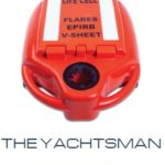
Life Cell Marine – The Yachtsman
Life Cell Marine – The Yachtsman – assists 2-4 people in the water
This product due to its bulky nature requires an additional surcharge on freight. We will contact you regarding this depending on location – or simply contact us on 0732658016 for a quote.
Designed for recreational boats that operate in open waters. Although compact in size this model will store both the EPIRB and all safety equipment in the internal compartment. There is also an external recess that will hold EPRIB in an upright position in the event that you need to activate. Mounting bracket is also included but safety equipment can be purchased separately.
A device designed to reduce the amount of lives lost at sea, by ensuring all safety equipment is contained in one place when abandonment is the only option. Life Cell is made from closed cell PU foam and constructed from U.V. resistant flame retardant polyethylene (PE). They are supplied with a PE mount bracket. The Life Cell is designed to automatically float from the bracket in the event of being submerged. Unlike grab bags, Life Cells float acting as secure hand-holds keeping all crew together and as stable platforms to assist in the deployment of flares and other safety equipment. Life Cell is a floatation device that stores all your essential safety gear including
- EPIRBs
- Flares
- V sheets
- Whistles
- Horns
- Torches
Dimensions:
- External: 59cm x 17cm x 42cm
- Internal: 28.5cm length x 26cm width x 10.5cm depth
- 5.0kg
Colours:
- Orange
- White
Lanyards:
- 4 Included
Mounting Brackets:
- Mounting Bracket (standard)
- Stainless Steel Brackets
SKU: Life Cell Yachtsman - 226452