Sounders
Showing all 4 results
-
EOFY, Garmin, Garmin Chartplotters, Marine Electronics, Sanctuary Cove, Sounders
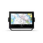
Garmin GPSMAP 1253xsv
-10%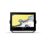 EOFY, Garmin, Garmin Chartplotters, Marine Electronics, Sanctuary Cove, Sounders
Garmin GPSMAP 1253xsv
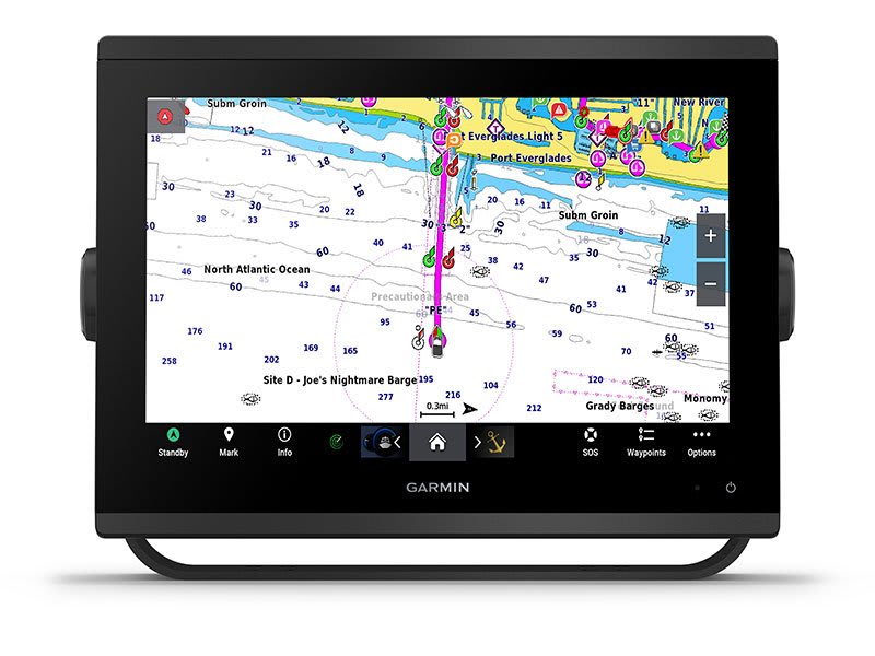
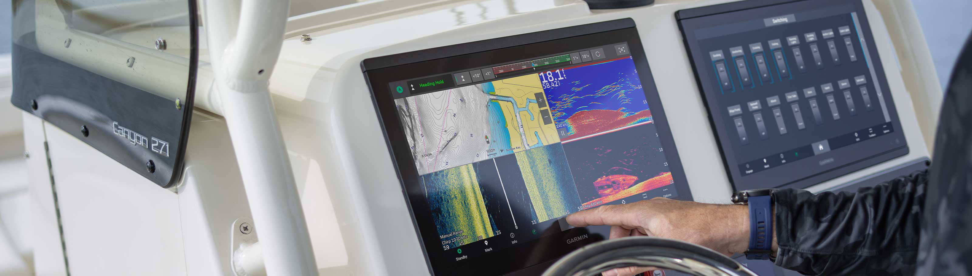
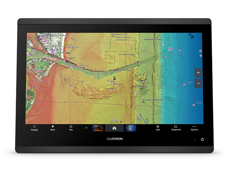
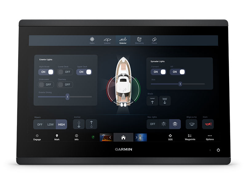
Garmin GPSMAP 1253xsv – GET A SHARPER VIEW FROM YOUR CONNECTED HELM
With its sleek design, powerful processing and upgraded IPS display, this advanced 12″ chartplotter integrates seamlessly into your Garmin marine system.
 Easily integrate with more engines.
 Connect to compatible third-party devices with OneHelm™ digital switching.
 Easily build your marine system using the best of network connectivity.
 Compatible with premium maps and charts1 for the best in Garmin navigation.
 See below your boat with built-in sonar capabilities
 Manage your marine experience from nearly anywhere1.
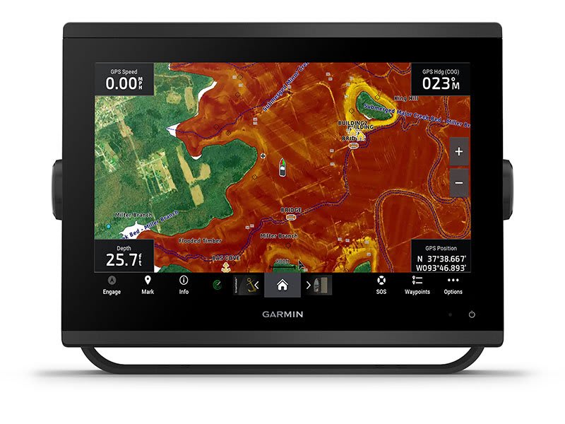
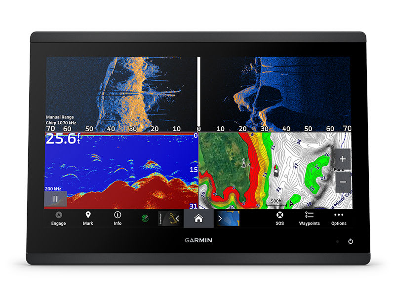
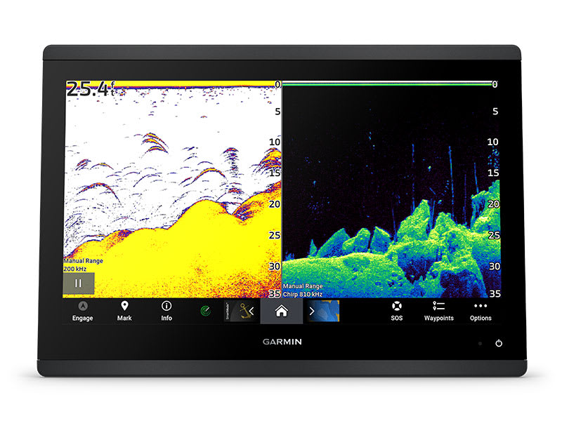
See the world below.
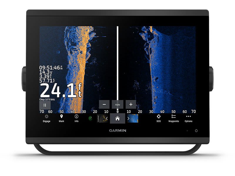
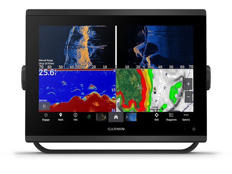
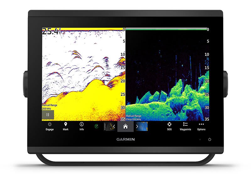
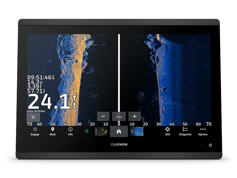
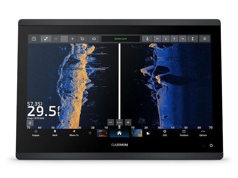
ULTRA HIGH-DEFINITION SCANNING SONAR
Get built-in Ultra High-Definition SideVü and ClearVü scanning sonars with vivid, high-contrast color palettes to help distinguish fish from structure. GPSMAP® X3 series also supports 1 kW CHIRP traditional sonar capabilities. Built-in sonar compatibility only available on xsv models.
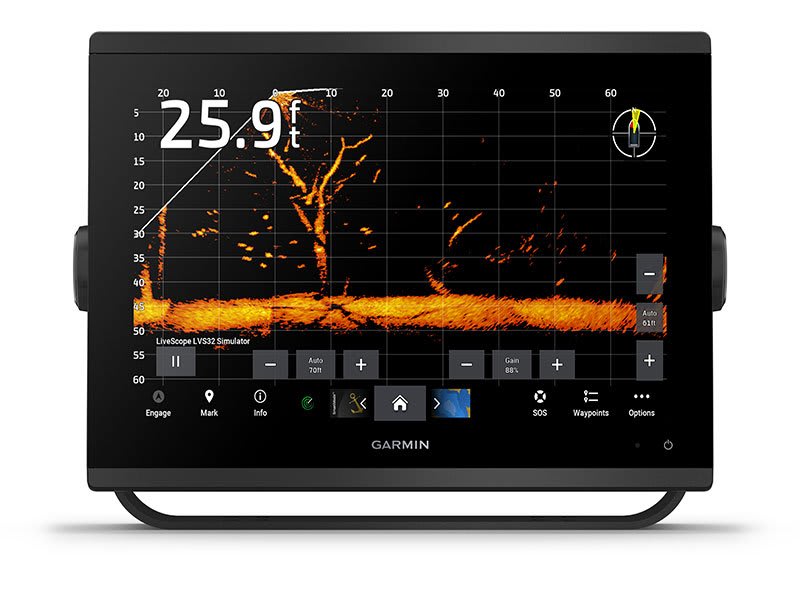
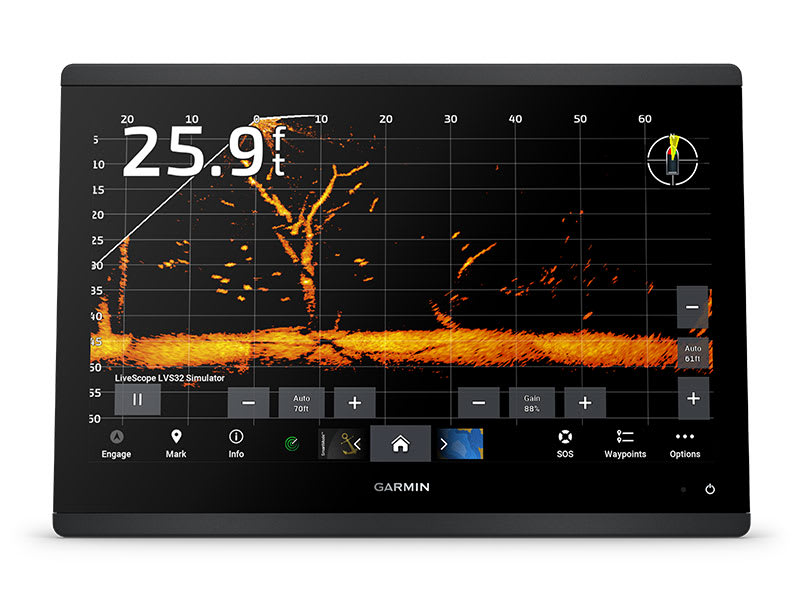
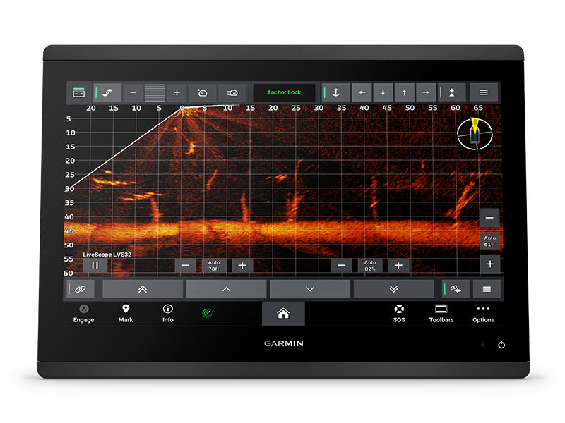
PANOPTIX™ & LIVESCOPE™ SONAR SUPPORT
Pair with Panoptix or LiveScope™ easy-to-interpret live sonar (transducer required, sold separately) to see all around your boat in real time.
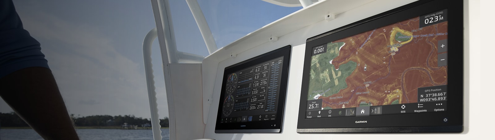
Made for your helm.
FASTER, SHARPER, SMARTER
With its added processing power and new slimline design featuring edge-to-edge glass and a smaller unit footprint, it’s easy to retrofit this plotter in a wider range of dash configurations.
IMPROVED DISPLAY OPTICS
New higher-resolution IPS displays for 9″ and 12″ plotters offer improved sunlight readability and visibility from any angle, with 50% more pixels than previous-generation 9″ GPSMAP devices.
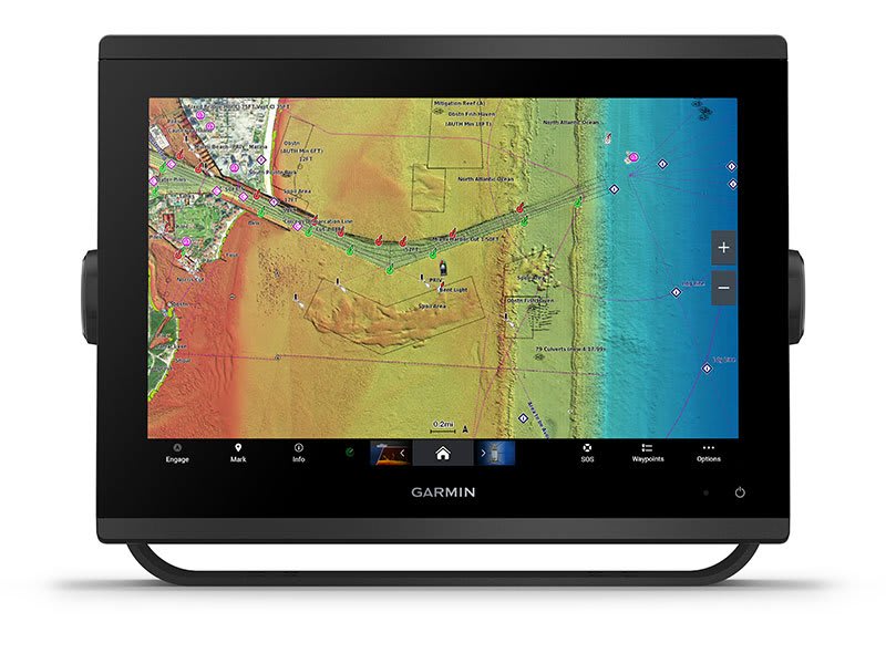
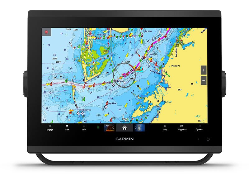
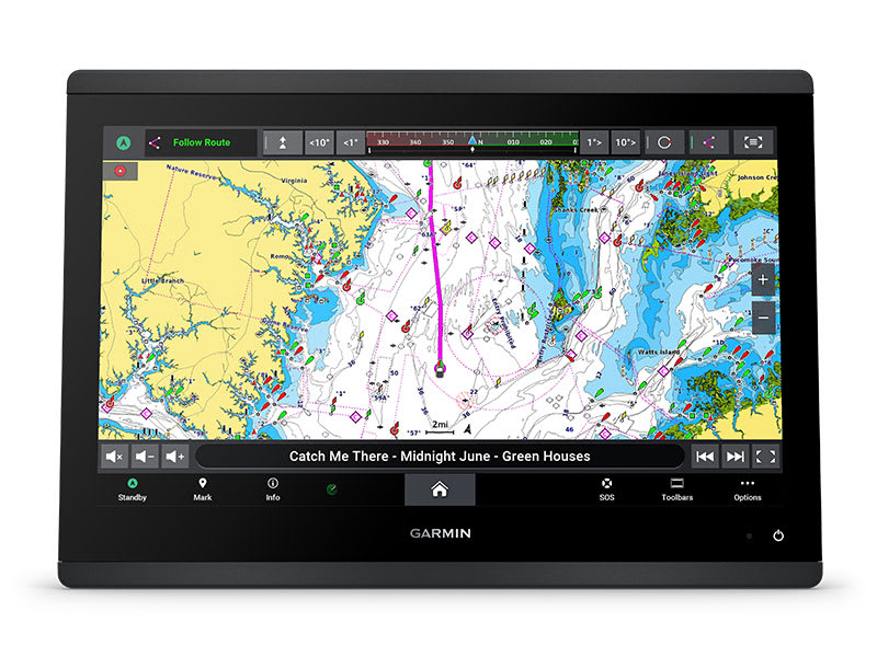
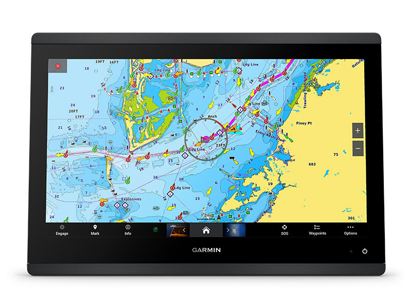
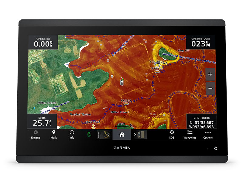
CHARTS AND MAPS
Bring a fresh new look and feel to your chartplotter with optional Garmin Navionics+™ or premium Garmin Navionics Vision+™ cartography featuring integrated coastal/inland content, access to daily updates, Auto Guidance+™ technology3 and more.
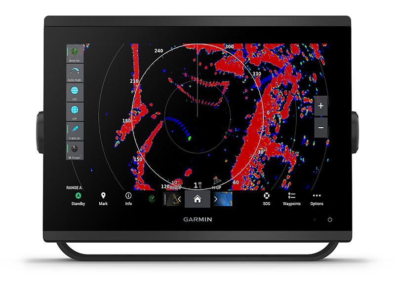
OPTIONAL RADAR BUNDLE
To help you avoid weather and traffic on the water, the compact 4 kW GMR™ 18 HD+ dome radar is available as a bundled option with your GPSMAP chartplotter/sonar package.
Sail and navigate with ease.
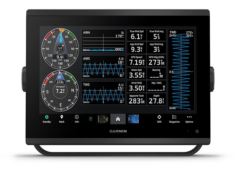
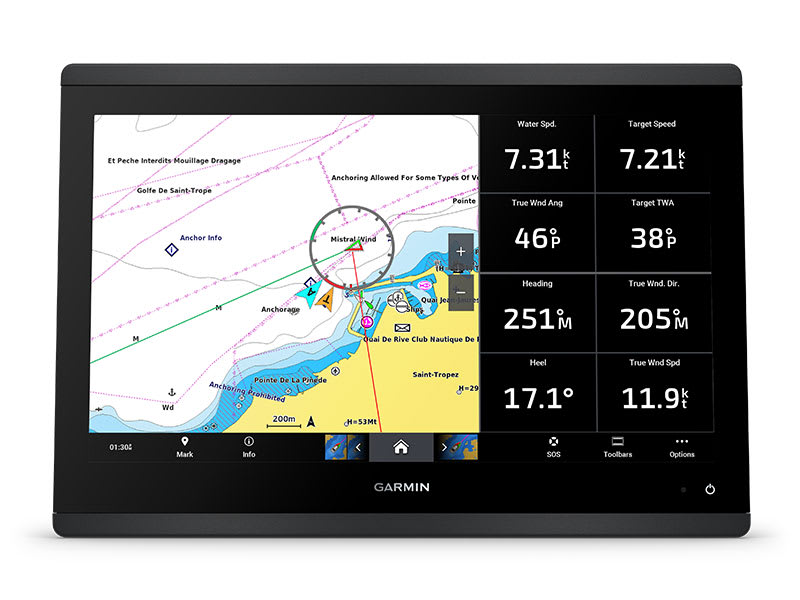
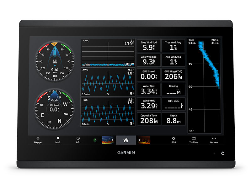
GARMIN SAILASSIST™ SAILING FEATURES
View laylines, race start line guidance, enhanced wind rose, heading and course-over-ground lines, true wind data fields and tide/current/time slider, wind angle, set and drift, wind speed and more.
OPTIONAL PREMIUM NAVIGATION FEATURES
These optional charts offer the best of Garmin and Navionics® data, Auto Guidance3 technology and other premium navigation features.
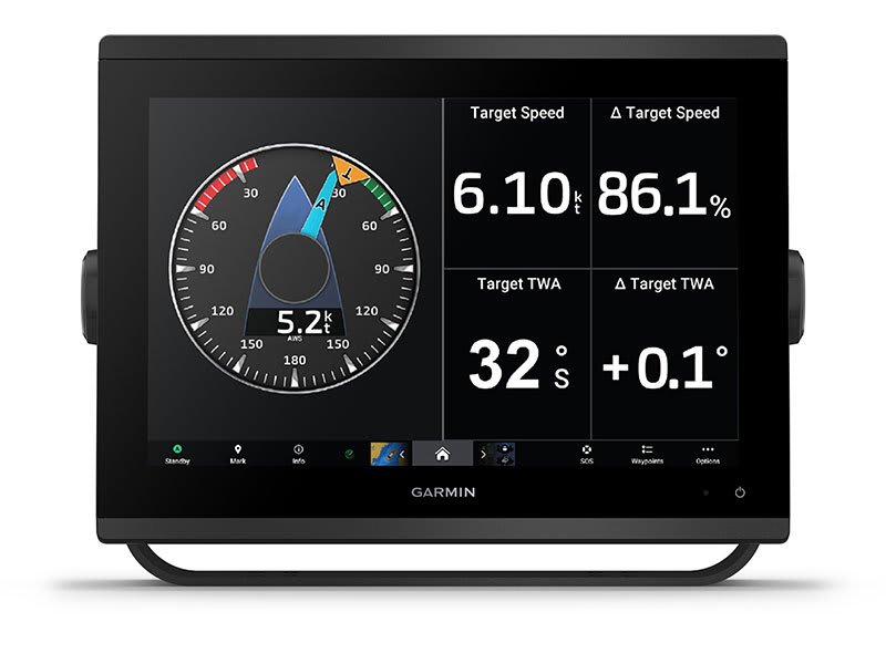
SAILING POLARS
Use the polar table to see key data, including how fast you should go at a certain wind angle and speed — so you know whether you need to adjust sail trim.
GARMIN MARINE NETWORK
If you have multiple compatible Garmin devices on your boat, you can share information — such as maps, user data, radar and IP camera video — among them.
NMEA 2000® AND NMEA 0183 NETWORKS
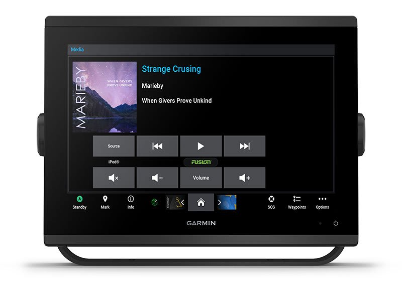
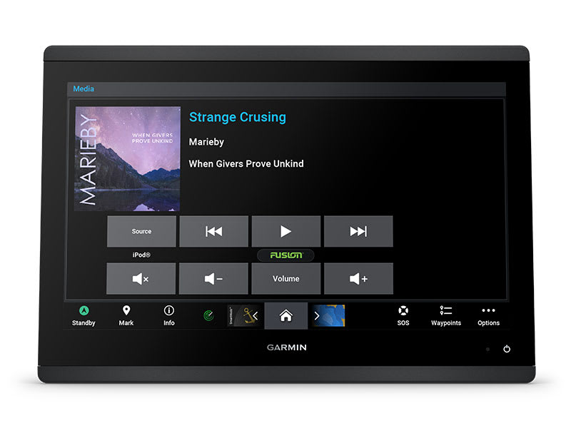
Connect to compatible autopilots, digital switching, weather, Fusion-Link™ audio system, media, VHF, AIS and more from one screen.
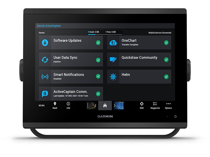
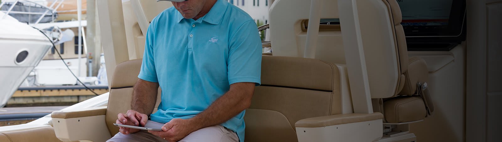
ACTIVECAPTAIN® APP
Built-in Wi-Fi® connectivity pairs with the free all-in-one mobile app for access to the OneChart™ feature, smart notifications, software updates, Garmin Helm™ digital switching, Garmin Quickdraw™ Community 4.
INTEGRATED ANT® TECHNOLOGY
Connect with some of your favourite devices, such as quatix® marine watches, gWind™ Wireless 2 transducers, GNX™ Wind marine instruments and wireless remote controls.
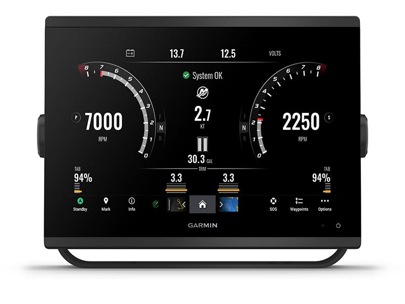
ENGINE CONNECTIVITY
Now you can connect your chartplotter to different kinds of engines, including select Yamaha engines.
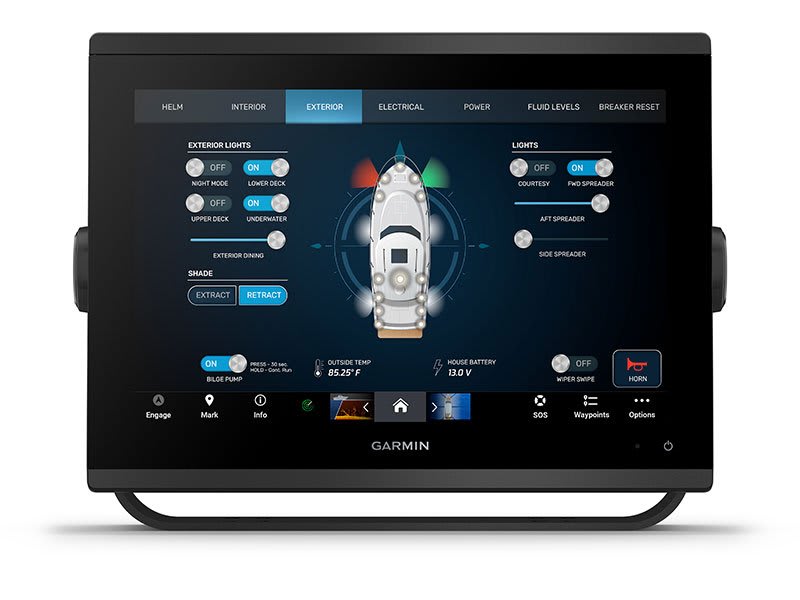
ONEHELM FEATURE
This feature brings together all the operations and capabilities of select third-party devices, such as EmpirBus™ digital switching, on one screen.
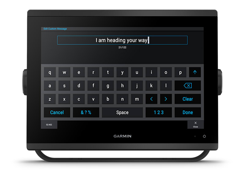
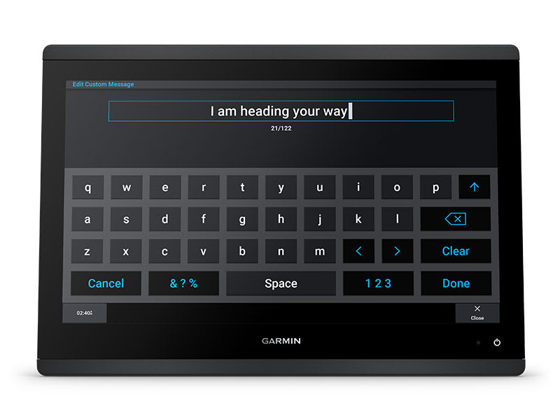
SEND INREACH® DEVICE MESSAGES
Pair your inReach satellite communicator5 to your chartplotter, and type custom messages using your MFD’s on-screen keyboard. Access your contact list or enter an email, inReach address or phone number. You can also group messages by conversation for a texting-like experience.
What’s in the box?
- GPSMAP 1253xsv chartplotter
- microSD™ card preinstalled
- Power cable
- NMEA 2000® T-connector
- NMEA 2000 drop cable (2 meters)
- 8-pin transducer to 12-pin sounder adapter cable
- Bail mount kit with knobs
- Flush mount kit with gasket
- Protective cover
- Trim piece snap covers
- Documentation
View Installation Instructions
View Owner’s Manual
SKU: 010-02367-62 -
EOFY, Garmin, Garmin Chartplotters, Marine Electronics, Sanctuary Cove, Sounders
Garmin GPSMAP 1653xsv – SideVu, ClearVu and Traditional CHIRP Sonar with Mapping
-6% EOFY, Garmin, Garmin Chartplotters, Marine Electronics, Sanctuary Cove, Sounders
Garmin GPSMAP 1653xsv – SideVu, ClearVu and Traditional CHIRP Sonar with Mapping
Garmin GPSMAP 1653xsv – GET A SHARPER VIEW FROM YOUR CONNECTED HELM
With its sleek design, powerful processing and upgraded IPS display, this advanced 16″ chartplotter integrates seamlessly into your Garmin marine system.
 Easily integrate with more engines.
 Easily build your marine system by using our advanced network connectivity.
 Navigate any waters with preloaded Garmin Navionics+™ charts on select models.
 See below your boat with built-in sonar capabilities (only available on xsv models.)
 Manage your marine experience from nearly anywhere1.
See the world below.
ULTRA HIGH-DEFINITION SCANNING SONAR
Get built-in Ultra High-Definition SideVü™ and ClearVü™ scanning sonars with vivid, high-contrast colour palettes to help distinguish fish from structure. The GPSMAP X3 chartplotter series also supports 1 kW traditional sonar capabilities.Built-in sonar compatibility only available on xsv models.
PANOPTIX™ SONAR SUPPORT
Pair with Panoptix™ or LiveScope™ easy-to-interpret live sonar (transducer required, sold separately) to see all around your boat in real time.
Made for your helm.
FASTER, SHARPER, SMARTER
With its added processing power and slimline design featuring edge-to-edge glass, it’s easy to fit this plotter in a wider range of dash configurations.
BRIGHT AND CLEAR OPTICS
High-resolution IPS displays for 16″ chartplotters offer improved sunlight readability and visibility from any angle.
PRELOADED MAPPING
Experience unparalleled coverage and detail with built-in Garmin Navionics+™ integrated coastal and inland mapping that includes Auto Guidance+™ technology2 and a 1-year subscription for downloadable daily updates and more on select chartplotters.
OPTIONAL CHARTS AND MAPS
Bring a fresh new look and feel to your chartplotter with an optional upgrade to a Garmin Navionics Vision+™ premium chart subscription, featuring downloadable relief shading, satellite imagery,
POWER-POLE® SHALLOW WATER ANCHOR
By networking select Garmin chartplotters with a Force® trolling motor and your compatible Power-Pole shallow water anchoring system, you can access advanced boat control features3 from your plotter, including smart anchor auto-deployment, smart anchor jog, auto stow, anchor drag detection and auto guidance2 end-of-route anchoring. Spend more time fishing, less time positioning.
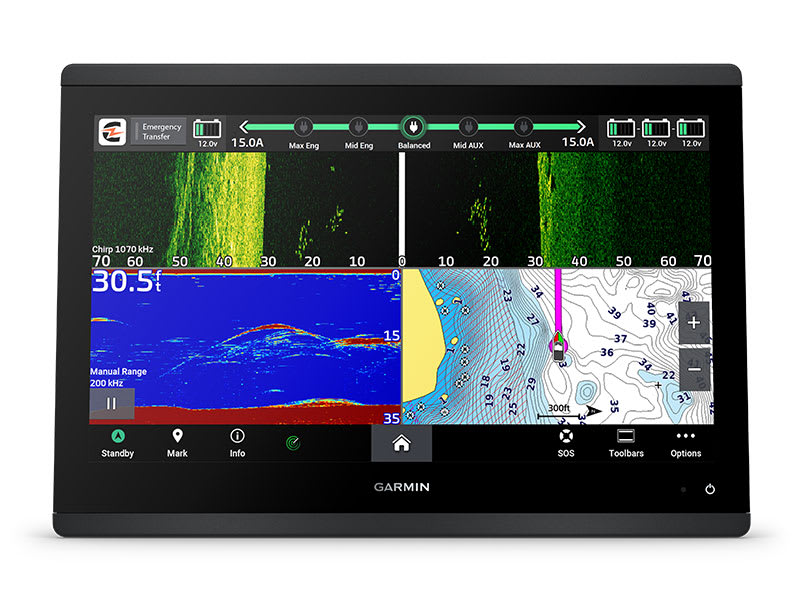
CHARGE INTEGRATION FROM POWER-POLE
Your CHARGE Marine Power Manager from Power-Pole integrates with compatible Garmin chartplotters to help keep your battery power going longer and stronger on the water. You’re able to charge batteries on the run, monitor power use, select where power is allocated, control emergency starts and even transfer power between battery banks — all from your chartplotter display.
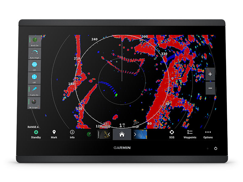
OPTIONAL RADAR BUNDLE
To help you avoid weather and traffic on the water, the compact 4 kW GMR™ 18 HD3 dome radar is available as a bundled option with select GPSMAP chartplotter/sonar packages.
TROLLING MOTOR INTEGRATION
Get support and integration for your Force trolling motor (sold separately) to gain complete control while you fish.

Sail and navigate with ease.
GARMIN SAILASSIST™ SAILING FEATURES
View laylines, race start line guidance, enhanced wind rose, heading and course-over-ground lines, true wind data fields and tide/current/time slider, wind angle, set and drift, wind speed and more.
SAILING POLARS
Use the polar table to see key data, including how fast you should go at a certain wind angle and speed — so you know whether you need to adjust sail trim.
GARMIN MARINE NETWORK
If you have multiple compatible Garmin devices on your boat, you can share information — such as maps, user data, radar and IP camera video — among them.
NMEA 2000® AND NMEA 0183 NETWORKS
Connect to compatible autopilots, digital switching, weather, the Fusion audio system, media, VHF, AIS and more from one screen.
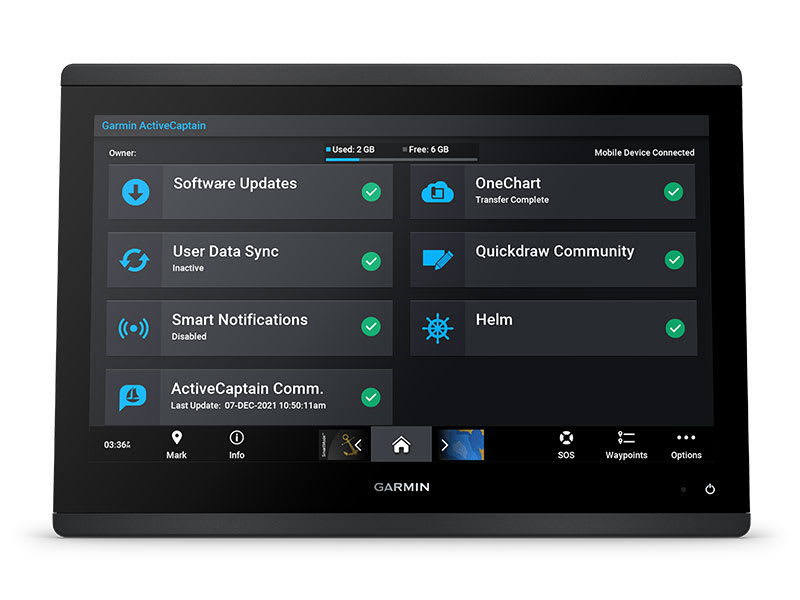
ACTIVECAPTAIN® APP
Built-in Wi-Fi® connectivity pairs with the free all-in-one mobile app for access to the OneChart™ feature, smart notifications, software updates, Helm app, Garmin Quickdraw™ Community data and more1.
INTEGRATED ANT® TECHNOLOGY
Connect with some of your favorite devices, such as quatix® marine watches, gWind™ Wireless 2 transducers GNX™ Wind marine instruments and wireless remote controls.
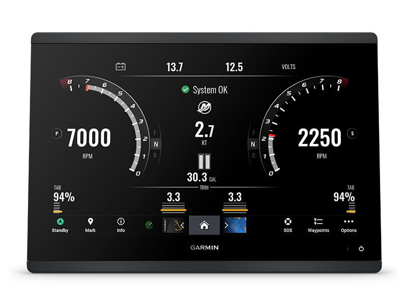
ENGINE CONNECTIVITY
You can connect your chartplotter to different engines, including select Yamaha® engines.
ONEHELM FEATURE
This feature brings together all the operations and capabilities of select third-party devices, such as EmpirBus™ digital switching, on one screen.
SEND INREACH® DEVICE MESSAGES
Pair your inReach satellite communicator4 to your chartplotter, and type custom messages using your MFD’s on-screen keyboard. Access your contact list or enter an email, inReach address or phone number. You can also group messages by conversation for a texting-like experience.
What’s in the box?
- GPSMAP® 1653xsv Chartplotter
- microSD™ card preinstalled
- 8-pin transducer to 12-pin sounder adapter cable
- Power cable
- Flush mount kit with gasket
- Protective cover
- Trim piece snap covers
- Backbone/drop cable (2 metres) and T-connector for the NMEA 2000® network
- Documentation
View Installation Instructions
View Owner’s Manual
SKU: 010-02919-04 -
Garmin, Garmin Chartplotters, Marine Electronics, Sanctuary Cove, Sounders
Garmin GPSMAP 953xsv
Garmin GPSMAP 953xsv – GET A SHARPER VIEW FROM YOUR CONNECTED HELM
With its sleek design, powerful processing and upgraded IPS display, this advanced 9″ chartplotter integrates seamlessly into your Garmin marine system.
Easily integrate with more engines.
Connect to compatible third-party devices with OneHelm™ digital switching.
Easily build your marine system using the best of network connectivity.
Compatible with premium maps and charts1 for the best in Garmin navigation.
See below your boat with built-in sonar capabilities
Manage your marine experience from nearly anywhere1.
SKU: 010-02366-62 -
Marine Electronics, Sounders
Raymarine Axiom 7 – 7″ Touch Screen Multifunction Navigation with integrated RealVision 3D, 600W Sonar with RV-100 transducer and AUS Mapping [Part Number #E70365-03-AUS]
-30%![Raymarine Axiom 7 - 7" Touch Screen Multifunction Navigation with integrated RealVision 3D, 600W Sonar with RV-100 transducer and AUS Mapping [Part Number #E70365-03-AUS]](https://www.northsidemarine.com.au/online-store/wp-content/uploads/sites/9/nc/catalog/Raymarine/Axiom7-tran-150x150.jpg) Marine Electronics, Sounders
Marine Electronics, SoundersRaymarine Axiom 7 – 7″ Touch Screen Multifunction Navigation with integrated RealVision 3D, 600W Sonar with RV-100 transducer and AUS Mapping [Part Number #E70365-03-AUS]
### RAYMARINE AXIOM SALE – ONLY WHILE STOCKS LAST ###
BLAZING FAST PERFORMANCE AND POWER
AT YOUR FINGER TIPSRaymarine Axiom 7 RealVision Multifunction Display is a powerful new Navigation system, delivering exceptional fish-finding performance. Complete with built-in RealVision 3D Sonar, all new LightHouse 3 operating system and fast quad core processor, Axiom puts you in complete control.
RealVision 3D is an all-in-one Transducer that combines CHIRP DownVision, SideVision, High Frequency CHIRP, and RealVision 3D – giving you the ability to see what’s below, behind, and to the sides of the Boat, all at once and in 3D. You can pan, tilt and zoom the 3D image to examine from any angle. Additionally, Raymarine’s gyro-stabilized Sonar technology compensates for Boat movement.
The new LightHouse 3 OS delivers an intuitive and powerful Navigation experience through a redesigned interface that is quick to learn and easy to personalise. Its LiveView Menu Controls allow users to easily customise the Chart and see the Navigation display changes in real time.
Axiom is expandable, so its capabilities can grow as needed. It supports the full range of Raymarine accessories, including Quantum radar, CHIRP Sonar, FLIR thermal cameras, audio integration, instruments, cameras, and Evolution autopilot. Standard Wi-Fi and Bluetooth connectivity allows connection to the latest Raymarine apps for tablets and smartphones.
DISPLAY
Display Size 7.0″ Optically Bonded LCD
Display Resolution 800 x 480 WVGA
Display Type Multitouch
Brightness 1,200 nits
Viewing Angle Degrees: 60 / 70 / 70 / 70 (Top / Bottom / Left / Right)PHYSICAL
Dimensions 210 x 142 x 77mm (7.92″ x 5.24″ x 3.00″)
Weight 1.52kg (3.35lbs)
Mounting Top, Flush, Front, Bracket
Waterproof Rating IPX6 / IPX7
Operating Temperature -25deg C to +55deg C (-13deg F to 131deg F)
Storage Temp -30deg C to +70deg C (- 22deg F to 158deg F)POWER
Voltage 12V DC (8 V to 16 VDC)
Power Consumption (Full brightness) TBD
Power Consumption (Powersave Mode) TBDNAVIGATION
Cartography Lighthouse, Navionics, *C-MAP Essentials & *C-MAP 4D MAX+
[*C-MAP chart compatibility available in future Lighthouse 3 software update]
Find out more about our cartography options
Tides & Currents Requires Navionics or *C-MAP
Waypoint / Routes / Tracks 10,000 wpts / 200 wpt groups / 150 rts – 250 wpt max / 16 tracks – 10,000 max trk ptsMEMORY
Internal 4GB Solid State
External 1 x microSD slots (rear) – microSDHC max 32GB NTFS or FAT32 format / microSDXC max 2TB NTFS or FAT32 format (microSD native format of exFAT must be reformatted to NTFS or FAT32)OTHER
Languages 14
Conformances NMEA 2000 certification: Europe: 1999/5/EC | Australia and New Zealand: C-Tick, Compliance Level 2 | FCC 47CFR part 15 | Industry Canada RSS2102. RealVision 3D Transducers combine CHIRP DownVision, CHIRP SideVision, High Frequency CHIRP, and RealVision 3D into a single transducer housing.
Raymarine’s RV-100 All-In-One Transom Mount Transducer lets you easily identify structures and locate fish with the lifelike clarity of RealVision 3D sonar.
The RV-100 is designed for easy transom mounting on outboard-powered boats. It features a rugged, marine-grade stainless steel mounting bracket with integrated kick-up to prevent damage in the event of a strike with floating debris, rocks, or stumps.
The RV-100 can also be removed from the transom bracket and attached to the stainless jack-plate mounting bracket (sold separately) which is ideal for bass boats, flats boats and skiffs. The RV-100 can also be mounted onto stepped hull vessels using the optional stainless steel step mounting bracket (sold separately).
3. Navionics Gold Marine Charts
Navionics Gold Charts can take you where you want to go. Whether you are on the water or planning a trip. Newly released Navionics XL9 marine Chart provides detailed charts for ALL of Australian coastline on one card! New Navionics+ maps explained.
Navionics Marine Charts offer:
SonarChart Live support for Compatible Lowrance/Simrad/Raymarine/Humminbird displays
Familiar Paper Chart Appearance with Both Fishing & Cruising detail!
New Small Coverage
Regular updates with Navionics Community Data (conditions apply)
Intelligent Clarity IC™ Provides A Clear And Uncluttered Display. Easy To Read At All Zoom Levels.
Superb Detail Navaids With XPlain, Tides & Currents, Shaded Contours, Spot Soundings.
Plug & Play Cartridge Preprogrammed and hassle-free! No CD’s or Downloads Required!
Full Seamless Technology. No Clutter. No Holes. No Discontinuities.SKU: E70635-03-AUS