-
×
 Garmin Dome Radar GMR 24 xHD - 4kW 24”
1 × $4,299.00
Garmin Dome Radar GMR 24 xHD - 4kW 24”
1 × $4,299.00
Subtotal: $4,299.00


$15,500.00 $16,999.00

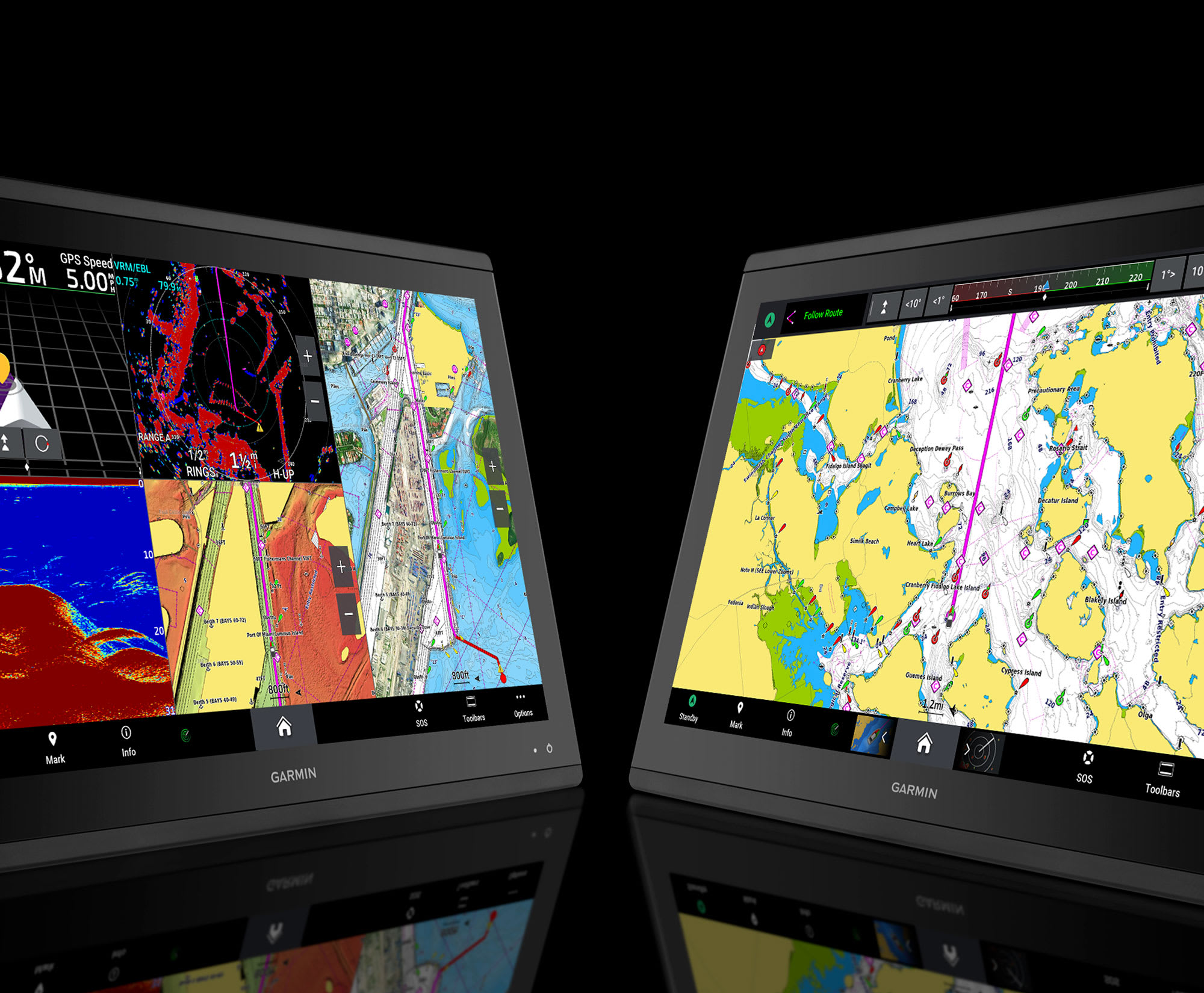
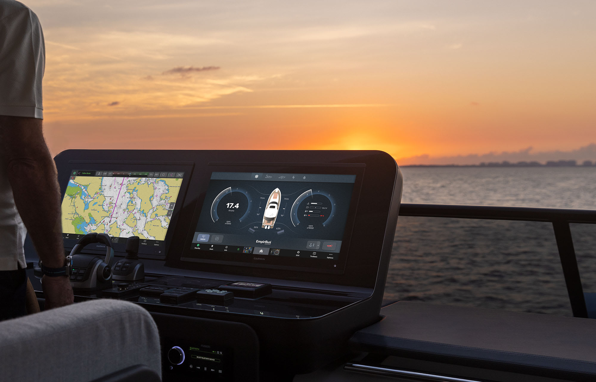

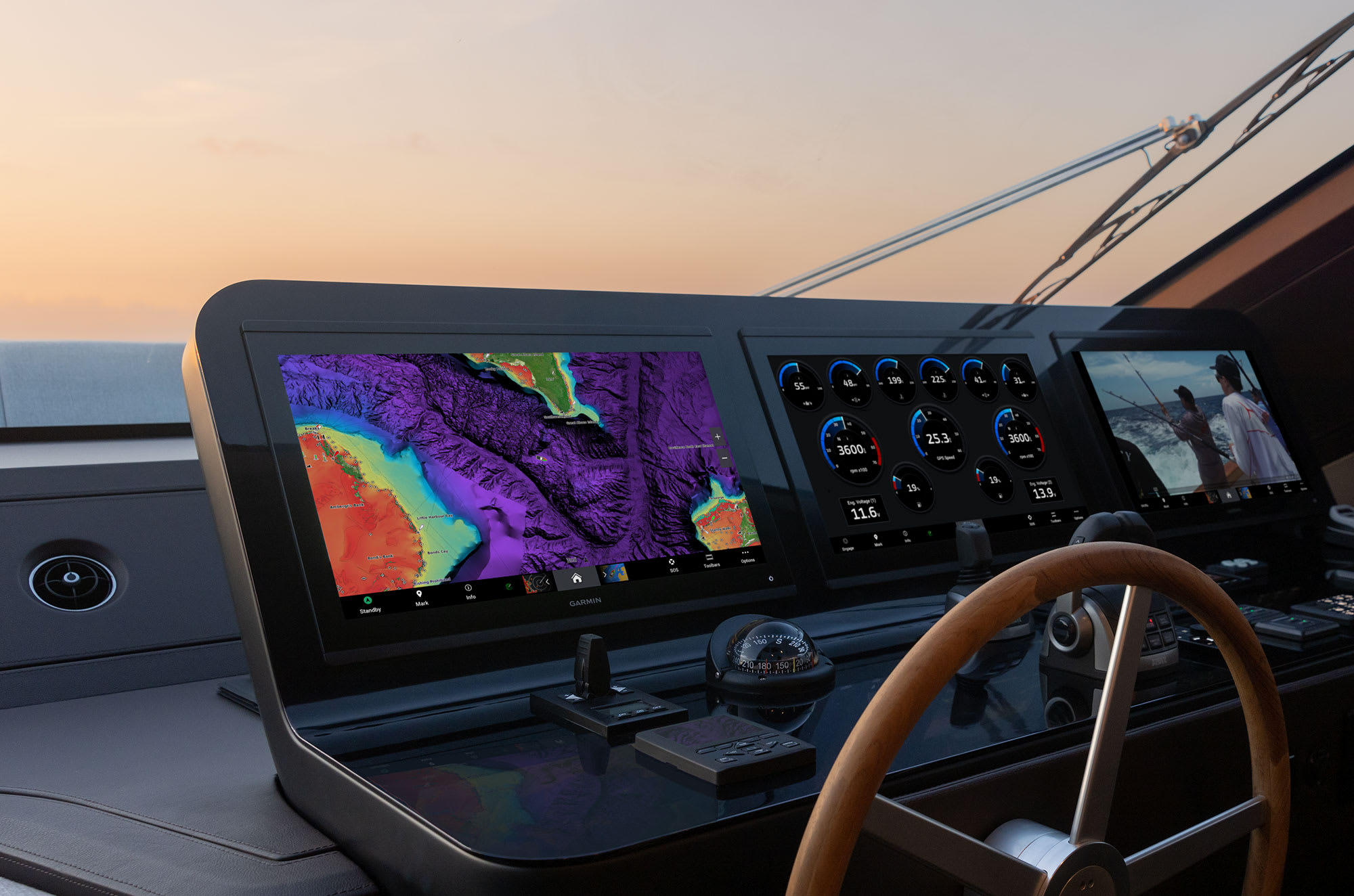
It’s the industry’s first integrated 4K resolution touchscreen chartplotter. Enjoy edge-to-edge clarity and luxury on a glass helm with premium design and materials plus enhanced connectivity and speed.
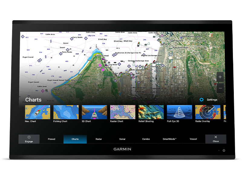
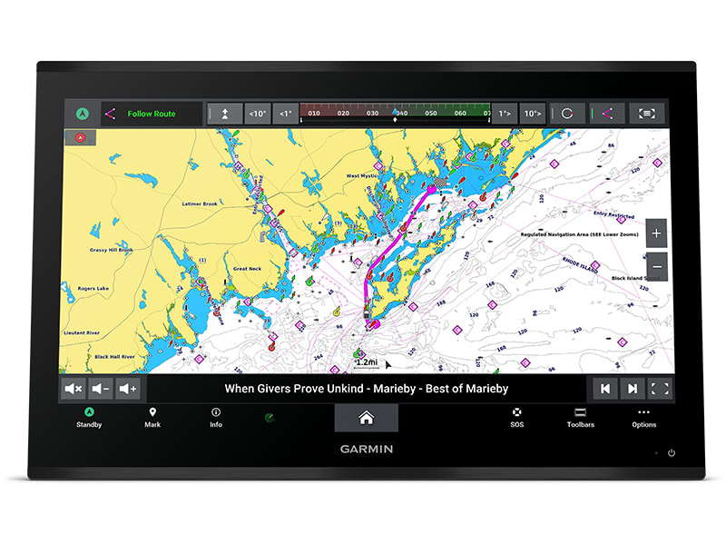
The 4K resolution IPS sunlight-readable touchscreen display is available in the industry’s largest integrated chartplotter size. Edge-to-edge design provides a seamless and luxurious modern look.
Processing power is 7 times faster than previous generations for superior performance; draw charts quickly, and calculate Auto Guidance+™ routes2 with lightning speed with an optional Garmin Navionics+™ subscription.
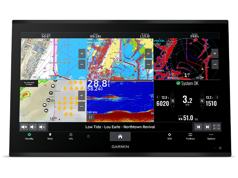
Build extensive networks with multiple chartplotters, cameras, radars and sonars — and enjoy 10 times faster networking speeds with minimal lag.
Enjoy audio and video integrations that allow you to show and hear the same video throughout the screens and speakers on your network.
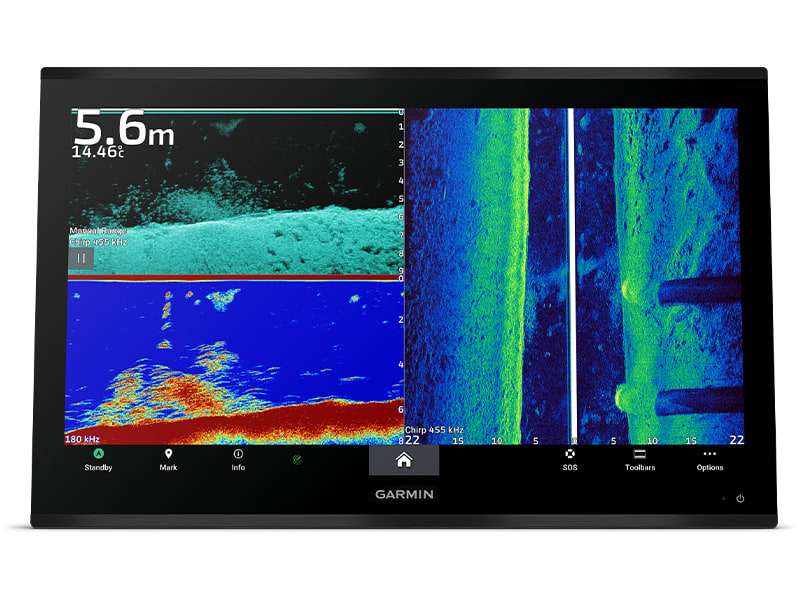
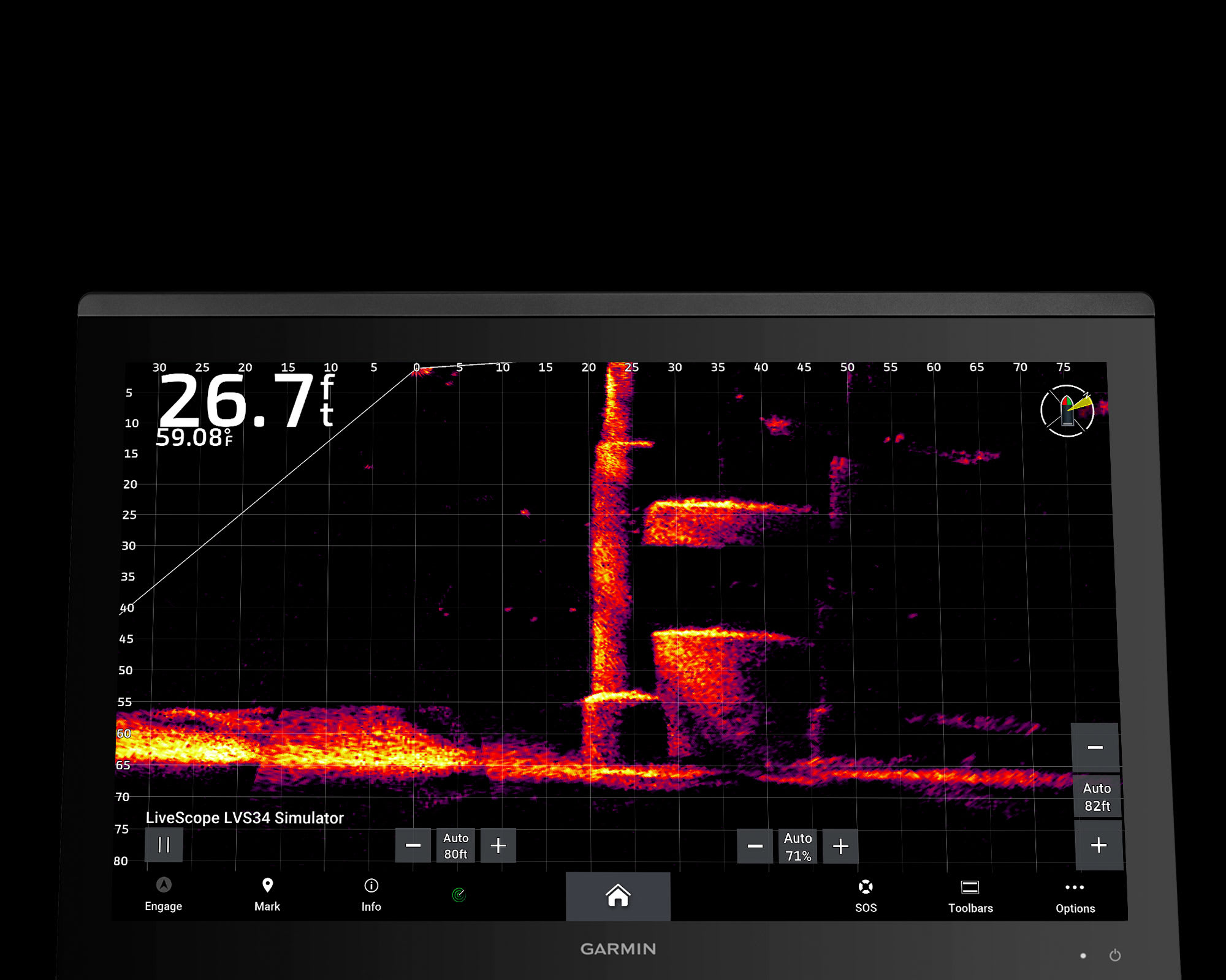
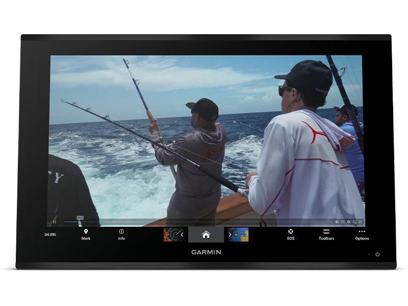
Fish in stunning high definition. Hook up to any of our sonar modules, and view sonar targets on the 4K display (transducers sold separately).
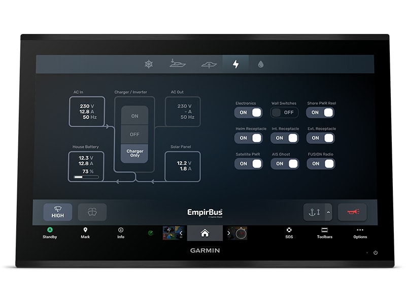
Take command through digital system integrations to monitor, automate and control your vessel. The chartplotter uses the NMEA 2000® and NMEA 0183 networks to connect to your compatible accessories.
Use these field installable connectors to wire a Garmin BlueNet™ network cable that does not have a factory installed connector.
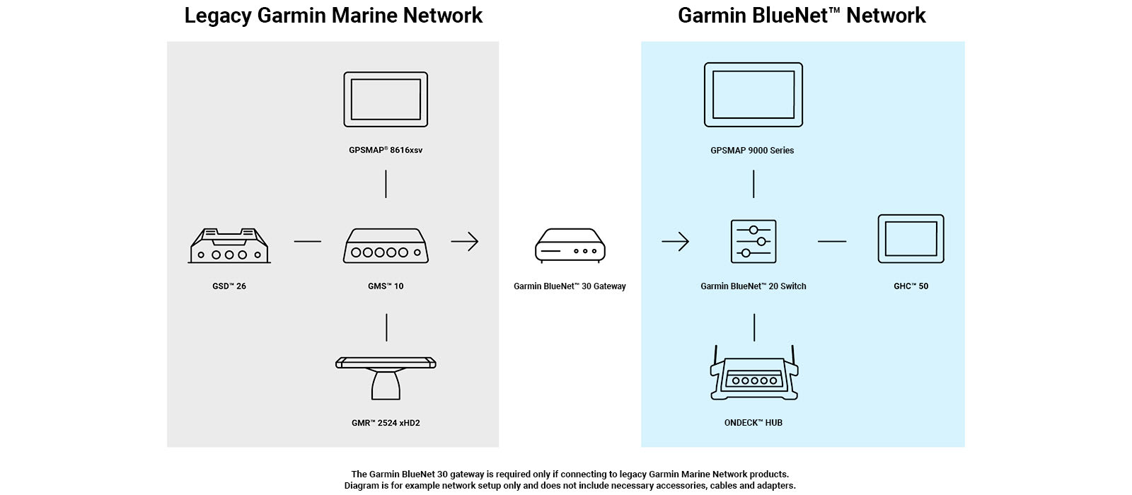
The Garmin BlueNet 30 gateway is required for Garmin BlueNet™ network compatible devices to network with legacy Garmin marine devices. Through this gateway you can connect a Garmin BlueNet network to a legacy Garmin Marine Network for a premium control experience.
SEE YOUR CHARTS, VIEW ENTERTAINMENT AND MORE IN 4K
UP TP SEVEN TIMES FASTER PROCESSING
POWER AND GIGABIT SPEEDS ON THE GARMIN
BLUENET NETWORK
BUILD AN EXTENSIVE, TOP-OF-THE-LINE
ECOSYSTEM
It’s the industry’s first integrated 4K resolution touchscreen chartplotter. Enjoy edge-to-edge clarity and luxury on a glass helm with premium design and materials plus enhanced connectivity and speed.
![]()
PREMIUM 4K IPS SUNLIGHT-READABLE TOUCHSCREEN DISPLAY
![]()
UP TO 7 TIMES FASTER PROCESSING POWER THAN PREVIOUS GENERATIONS
![]()
GIGABIT SPEEDS ON THE GARMIN BLUENET™ NETWORK
![]()
VIDEO INTEGRATION CAPABILITIES WITH HDCP DISTRIBUTION
![]()
SEE SONAR TARGETS LIKE NEVER BEFORE ON THE 4K DISPLAY1
![]()
NETWORK WITH MULTIPLE CHARTPLOTTERS, CAMERAS AND SONARS
The 4K resolution IPS sunlight-readable touchscreen display is available in the industry’s largest integrated chartplotter size. Edge-to-edge design provides a seamless and luxurious modern look.
Processing power is 7 times faster than previous generations for superior performance; draw charts quickly, and calculate Auto Guidance+™ routes2 with lightning speed with an optional Garmin Navionics+™ subscription.
Build extensive networks with multiple chartplotters, cameras, radars and sonars — and enjoy 10 times faster networking speeds with minimal lag.
Enjoy audio and video integrations that allow you to show and hear the same video throughout the screens and speakers on your network.
Fish in stunning high definition. Hook up to any of our sonar modules, and view sonar targets on the 4K display (transducers sold separately).
Take command through digital system integrations to monitor, automate and control your vessel. The chartplotter uses the NMEA 2000® and NMEA 0183 networks to connect to your compatible accessories.
![]()
SOFTWARE UPDATES
Get wireless software updates via the ActiveCaptain® app with your compatible smartphone or tablet.
![]()
ENGINE MONITORING
Keep tabs on engine performance with extensive engine integration.
![]()
CUSTOM LOOK
Manufacturers can customise the homepage layout and splash screen for a brand tailored experience.
![]()
MAPPING
Navigate with optional Garmin Navionics+™ charts that include Auto Guidance+ technology, daily updates and more2 (subscription required).
![]()
PREMIUM CHARTS
Get support for Garmin Navionics Vision+™ charts with premium relief shading and satellite imagery.
![]()
KNOW WHERE YOU ARE
Get your precise location with the included GPS 24xd position receiver and antenna.
![]()
AUTOPILOT
Control the autopilot with any compatible chartplotter on the network with autopilot integration.
![]()
CONNECT CAMERAS
Get extensive camera support and control to see footage directly on the chartplotter.
![]()
SURROUND VIEW SYSTEM
Get a bird’s-eye view with support for our Surround View Camera System (accessory purchase required).
![]()
CONTROL WITH YOUR WATCH
Connect to your chartplotter with your compatible Garmin smartwatch.
![]()
WIRELESS CONNECTIVITY:
Connect compatible devices with integrated BLUETOOTH® and ANT® technologies.
![]()
FISH MAPPING
Get comprehensive fishing data with the Fish Mapping™ feature from SiriusXM® Radio (accessory purchase and subscription required).
![]()
VERBAL COMMANDS
Use spoken commands to control the chartplotter through your compatible headset.
![]()
WEATHER-RESISTANT
The GPSMAP 9000 chartplotter is built for harsh marine conditions with an IPX7 water-resistance rating.
| Weight | 6.5 kg |
|---|
| General | |
| DIMENSION | 18.0″ x 12.0″ x 2.7″
(45.7 cm x 30.5 cm x 6.9 cm) |
| WEIGHT | 6.42 kg |
| WATER RATING | IPX7 |
| TOUCHSCREEN | ✓ |
| DISPLAY TYPE | 4K, IPS |
| DISPLAY SIZE | 16.1″ x 9.1″ x 18.5″ diagonal,
40.9 cm x 23.0 cm x 46.9 cm diagonal |
| DISPLAY RESOLUTION | 3840 x 2160 pixels |
| MOUNTING OPTIONS | Flush or flat |
| INPUT | Touchscreen |
| Maps & Memory | |
| ACCEPTS DATA CARDS | 2 microSD Cards |
| COMPATIBLE WITH GARMIN SD CARD READER | ✓ |
| WAYPOINTS | 5000 |
| TRACK POINTS | 50000 |
| TRACKS | 50 saved tracks |
| NAVIGATION ROUTES | 100 |
| Sensors | |
| GPS | ✓ |
| GLONASS | ✓ |
| GALILEO | ✓ |
| BEIDOU | ✓ |
| RECEIVER | 10 Hz |
| NMEA 2000 COMPATIBLE | ✓ |
| NMEA 0183 COMPATIBLE | ✓ |
| SUPPORTS WAAS | ✓ |
| SUPPORTS MULTI-BAND, MULTI-CONSTELLATION GPS | ✓ |
| Optional map support | |
| GARMIN NAVIONICS+™ | ✓ |
| GARMIN NAVIONICS VISION+™ | ✓ |
| GARMIN QUICKDRAW CONTOURS | ✓ |
| Chartplotter Features | |
| SMART MODE COMPATIBLE | ✓ |
| AIS | ✓ |
| DSC | ✓ |
| SUPPORTS FUSION-LINK™ COMPATIBLE RADIOS | ✓ |
| GSD BLACK BOX SONAR SUPPORT | ✓ |
| GCV BLACK BOX SONAR SUPPORT | ✓ |
| ACTIVECAPTAIN MOBILE PLANNING COMPATIBLE | ✓ |
| GRID (GARMIN REMOTE INPUT DEVICE) COMPATIBLE | ✓ |
| WIRELESS REMOTE COMPATIBLE | ✓ |
| SAILING FEATURES | ✓ |
| SPOKEN AUDIO ALERTS | ✓ |
| ONEHELM SUPPORT | ✓ |
| Electrical features | |
| POWER INPUT | 10 to 35 Vdc |
| TYPICAL CURRENT DRAW AT 12 VDC | 4.6A |
| MAXIMUM CURRENT DRAW AT 12 VDC | 5.0A |
| MAXIMUM POWER USAGE AT 10 VDC | 60W |
| Sonar Features | |
| DISPLAYS SONAR | ✓ |
| TRADITIONAL SONAR (DUAL FREQUENCY/BEAM) | Yes (with compatible black box sonar) |
| CLEARVÜ | Yes (with compatible black box sonar) |
| SIDEVÜ | Yes (with compatible black box sonar) |
| PANOPTIX™ SONAR | ✓ |
| LIVESCOPE | ✓ |
| Connections | |
| NMEA 2000® PORTS | 1 |
| NMEA 0183 INPUT (RX) PORTS | 1 |
| NMEA 0183 OUTPUT (TX) PORTS | 1 |
| VIDEO INPUT PORTS | 1 (BNC composite); 2 HDMI (HDCP compliant) |
| VIDEO OUTPUT PORTS | 1 HDMI |
| J1939 PORTS | 1 |
| GARMIN BLUENET NETWORK PORTS | 4 |
| USB PORTS | yes (2x USB-C) |
| BLUETOOTH® PAIRING | ✓ |
| ANT+ (CONNECTIVITY) | ✓ |
| GARMIN WI-FI NETWORK (LOCAL CONNECTION) | ✓ |
| AUDIO OUTPUT | ✓
|
Garmin GLO Remote GPS Sensor with Bluetooth [Garmin Part Number: 010-01055-00] – RRP $149
Navigate with Garmin-caliber GPS data on the mobile device of your choice. GLO brings you the best of both worlds by combining GPS/GLONASS receivers with Bluetooth® technology so you can enjoy precise position information on your iPad, iPhone or Android device.
The Accuracy of GPS + GLONASS
GLO can receive position information from both the GPS and GLONASS satellite constellations, allowing it to connect to up to 24 more satellites than devices that rely on GPS alone. This allows GLO to lock on to satellites approximately 20 percent faster and remain connected even at high speed. What’s more, GLO updates its position information at 10 times per second — that’s up to 10 times more often than the GPS receivers in many mobile devices.
Set It Up and Go
Using Bluetooth technology, GLO wirelessly pairs to your mobile device. Just set GLO within range of your mobile device, and in moments you’ll be receiving GLO’s position data. It has up to 12 hours of battery life to keep your position on long trips, and charging GLO between uses is easy with the included USB cable or optional 12/24 volt cigarette lighter adapter. The optional friction mount keeps the receiver safe on your dashboard and in full view of satellites.
SPECIFICATIONS:
Physical & Performance
* Unit size, WxHxD: .70″ x 1.65″ x 3.04″ (1.78 x 4.19 x 7.72 cm)
* Weight: 2.12 oz (60.1 g)
* Receiver Technology: GPS+GLONASS
* WAAS: Yes
* Update Rate: 10 Hz
* Accuracy: 3 meters
* Battery Capacity: 1100mAh
* Battery Life: 12 hours
* Hot Start Time: 3–5s
* Warm Start Time: 35s
* Cold Start Time: 60s
WHAT’S IN THE BOX:
* GLO receiver
* USB cable
* Documentation
WARRANTY:
We are an authorised Australian Garmin retailer, as such Full Australian Manufacturers Warranty is applicable for this item. Please note if a Garmin unit is purchased overseas or from a non-authorised Garmin retailer you may not receive warranty coverage in Australia.
*Specifications from suppliers’ information. Actual depth capabilities depend on transducer installation, bottom type & water conditions. All sonars typically read deeper in freshwater than in saltwater. Images for display purposes only.
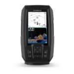
See fish and structure in maximum detail when you pick your display colour, your location and your sonar for your day on the water with the STRIKER Vivid 4cv fishfinder with transducer.
![]()
The sonar colour you pick says a lot about your fishing style. Good thing there are 7 new vivid options.
![]()
What a view. Use the included transducer to get CHIRP traditional and ClearVü sonars.
![]()
Never lose a hot spot again. Use waypoint marking to find your way back.
![]()
What’s under the water’s surface looks pretty good as 1-foot contours, just saying.
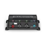
Garmin Marine Heading Sensor Cable to Connect Marine Heading Sensor to NMEA 2000 Network [Garmin Part Number: 010-11419-00] – RRP $1290
Connect a heading sensor to a NMEA 2000 network with this 19.7 ft (6 m) cable.
THIS IS SUITABLE FOR CURRENT MODEL GARMIN GMR 18 xHD RADOME & GMR 24 xHD RADOME.
WHAT’S IN THE BOX:
* Garmin Marine Heading Sensor Cable – NMEA 2000
* Documentation
WARRANTY:
We are an authorised Australian Garmin retailer, as such Full Australian Manufacturers Warranty is applicable for this item. Please note if a Garmin unit is purchased overseas or from a non-authorised Garmin retailer you may not receive warranty coverage in Australia.
*Specifications from suppliers’ information.
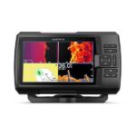
See fish and structure in maximum detail when you pick your display colour, your location and your sonar for your day on the water with the STRIKER Vivid 7sv fishfinder with transducer.
![]()
The sonar colour you pick says a lot about your fishing style. Good thing there are 7 new vivid options.
![]()
What a view. Use the included transducer to get CHIRP traditional and ClearVü sonars.
![]()
Never lose a hot spot again. Use waypoint marking to find your way back.
![]()
What’s under the water’s surface looks pretty good as 1-foot contours, just saying.
![]()
Wi-Fi® connection1 on land opens up a world of possibilities on the water.