 Slimline LED Ultrabright Ceiling Light (Part # 70981)
 Subtotal: $84.99
-14%


Easter, EOFY, Garmin, Garmin Chartplotters, Sanctuary Cove
Price Match
Garmin Echomap UHD2 95sv – 9″ Chartplotter with GT56UHD-TM Transducer and Garmin Navionics+ Australia & New Zealand Mapping
Price Match
$1,899.00 $2,199.00
-
Easter, EOFY, Garmin, Garmin Chartplotters, Sanctuary Cove
Garmin Echomap UHD2 95sv – 9″ Chartplotter with GT56UHD-TM Transducer and Garmin Navionics+ Australia & New Zealand Mapping
-14% Easter, EOFY, Garmin, Garmin Chartplotters, Sanctuary Cove
Garmin Echomap UHD2 95sv – 9″ Chartplotter with GT56UHD-TM Transducer and Garmin Navionics+ Australia & New Zealand Mapping
Garmin Echomap UHD2 95sv – KNOW THE WATER BETTER THAN A LOCAL
When it comes to catching more fish, they say, “Talk to a local.” With the Echomap™ UHD2 95sv chartplotter, which offers our best-in-class sonar and mapping and premium touchscreen display with keyed-assist, you’ll know the water even better than they do.

The bright 6″, 7″ or 9″ touchscreen display with keyed-assist is user-friendly and easy to read.

Good things come in threes. Three sonar types, that is: Garmin traditional, ClearVü™ and SideVü™ sonars.

Improved detail? Check. Distinguished targets? Yep. That’s the beauty of high-contrast vivid colour palettes.

If you’re running another ECHOMAP UHD2 chartplotter, you can wirelessly share sonar, waypoints and routes.

Want our best in mapping? Who doesn’t? Select chartplotters come with Garmin Navionics+™ mapping.
SKU: 010-02690-20 -
Garmin, Garmin Accessories, Sanctuary Cove
Garmin 8-pin Transducer to 12-pin Sounder Adapter Cable with XID
 Garmin, Garmin Accessories, Sanctuary Cove
Garmin 8-pin Transducer to 12-pin Sounder Adapter Cable with XID
Garmin 8-pin Transducer to 12-pin Sounder Adapter Cable with XID
Use this adapter cable to connect an 8-pin transducer with XID to a 12-pin sonar port on a compatible marine device.
SKU: 010-12122-10
$1,939.95 for 3 item(s)
Garmin Echomap UHD2 95sv – KNOW THE WATER BETTER THAN A LOCAL
When it comes to catching more fish, they say, “Talk to a local.” With the Echomap UHD2 95sv chartplotter, which offers our best-in-class sonar and mapping and premium touchscreen display with keyed-assist, you’ll know the water even better than they do.
![]() The bright 9″ touchscreen display with keyed-assist is user-friendly and easy to read.
The bright 9″ touchscreen display with keyed-assist is user-friendly and easy to read.
![]() Good things come in threes. Three sonar types, that is: Garmin traditional, ClearVü™ and SideVü™ sonars.
Good things come in threes. Three sonar types, that is: Garmin traditional, ClearVü™ and SideVü™ sonars.
![]() Improved detail? Check. Distinguished targets? Yep. That’s the beauty of high-contrast vivid colour palettes.
Improved detail? Check. Distinguished targets? Yep. That’s the beauty of high-contrast vivid colour palettes.
![]() If you’re running another ECHOMAP UHD2 chartplotter, you can wirelessly share sonar, waypoints and routes.
If you’re running another ECHOMAP UHD2 chartplotter, you can wirelessly share sonar, waypoints and routes.
![]() Want our best in mapping? Who doesn’t? Select chartplotters come with Garmin Navionics+™ mapping.
Want our best in mapping? Who doesn’t? Select chartplotters come with Garmin Navionics+™ mapping.
It doesn’t get any better than this.
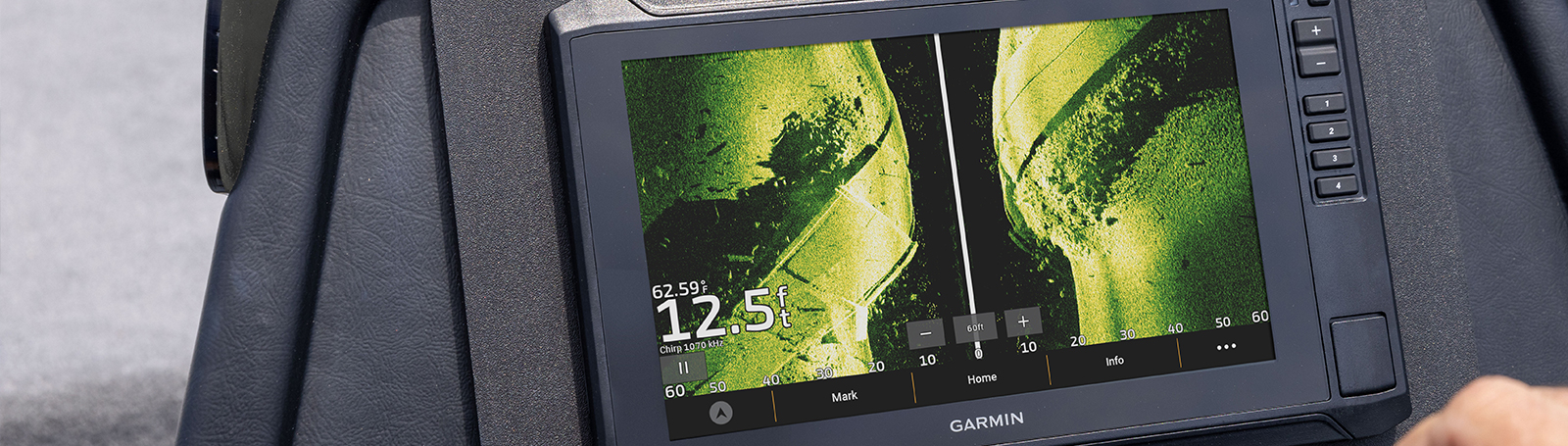
SONAR SUPPORT
With crisp, clear traditional sonar and brilliant ClearVü and SideVü scanning sonars, the fish will have nowhere to hide. Your ECHOMAP UHD2 also supports LiveScope™ live-scanning sonar.

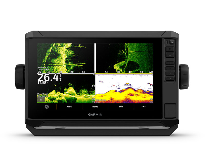
VIVID COLOUR PALETTES
High-contrast vivid scanning sonar colour palettes make it easier than ever to distinguish targets and structure.
![]()
BUNDLE YOUR TRANSDUCER
Your ECHOMAP UHD2 device supports a variety of Garmin transducers. The 6″ and 7″ chartplotters come bundled with a GT54 transducer — while the 9″ chartplotter comes with a GT56 transducer.

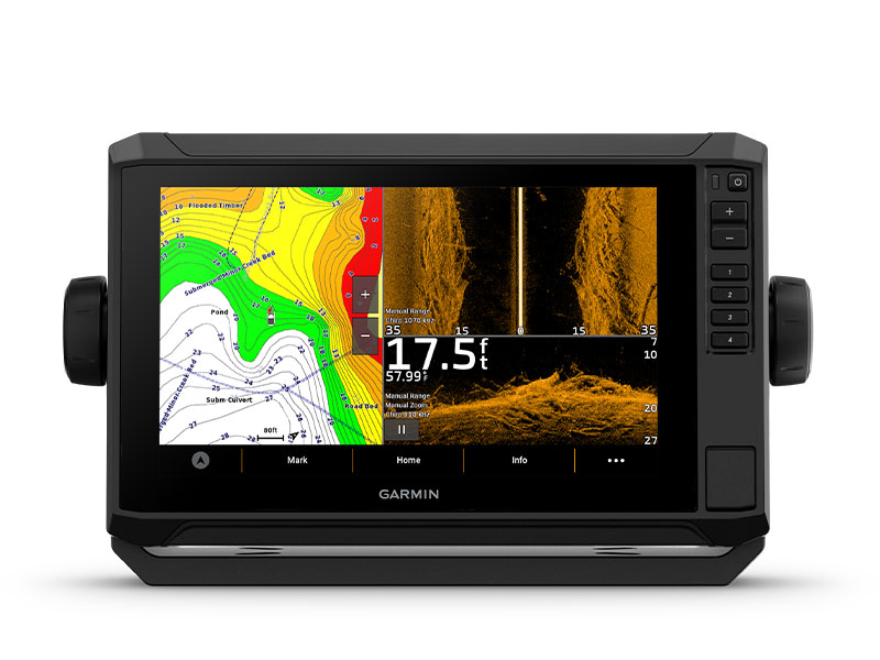
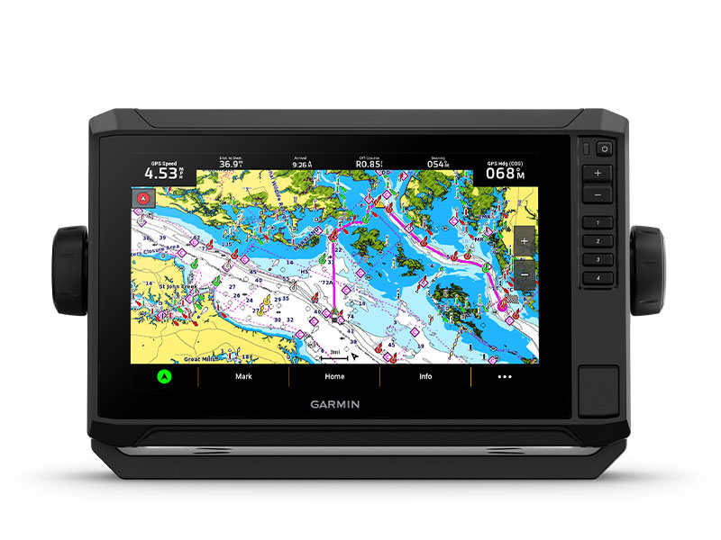
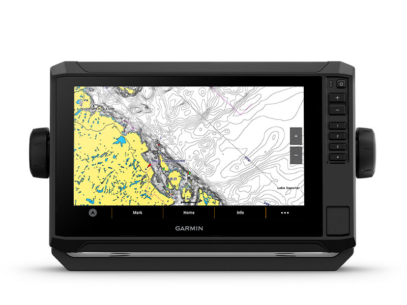
PRELOADED CHARTS
You’ve never seen Garmin cartography like this before. Select chartplotters come with built-in Garmin Navionics+ cartography which includes a 1-year subscription for daily updates, raster cartography and more.
WIRELESS NETWORKING
If you have another compatible ECHOMAP UHD2 chartplotter on your boat, you can wirelessly share information — such as sonar1, waypoints and routes — with them.
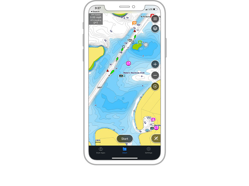
ACTIVECAPTAIN® APP
Built-in Wi-Fi® connectivity pairs with the free all-in-one mobile app for access to the OneChart™ feature, smart notifications2, software updates, Garmin QuickDraw Community data and more.
AUTO GUIDANCE+™ TECHNOLOGY
Chartplotters with built-in Garmin Navionics+ charts include downloadable Auto Guidance+ technology3 with the ActiveCaptain app.
TROLL WITH FORCE®
Your ECHOMAP UHD2 wirelessly connects to your Force trolling motor to create and follow routes, navigate to waypoints, control speed, check battery life and more.

MULTI-BAND GPS
Get improved position accuracy, particularly in areas where signals are reflected or weak, with multi-band GPS.
 What’s in the Box?
- ECHOMAP UHD2 (device varies depending on selection)
- GT56-TM transducer
- Power cable
- Tilt mount with quick-release cradle
- Protective cover
- Hardware
- Documentation
View Installation Instructions
View Owner’s Manual
Garmin Echomap UHD2 | Best-in-class Sonar & Mapping
| Weight | 1.3 kg |
|---|
General |
|
| DIMENSION | 10.4″ x 6.5″ x 3.2″ (26.4 x 16.6 x 8 cm) |
| WEIGHT | 2.9 lbs (1.3 kg) |
| WATERPROOF | IPX7 |
| TOUCHSCREEN | ✔ |
| DISPLAY TYPE | WVGA, TN |
| DISPLAY SIZE | 7.8″ x 4.5″, 9″ (19.8 x 11.5 cm, 22.9 cm) |
| DISPLAY RESOLUTION | 1024 x 600 pixels |
| MOUNTING OPTIONS | Bail or flush |
| INPUT | Touchscreen with Keyed Assist |
Maps & Memory |
|
| ACCEPTS DATA CARDS | 1 microSD™ card; 32 GB maximum size |
| WAYPOINTS | 5000 |
| TRACK POINTS | 50000 |
| TRACKS | 50 saved tracks |
| NAVIGATION ROUTES | 100 |
Sensors |
|
| GPS | ✔ |
| GLONASS | ✔ |
| GALILEO | ✔ |
| BEIDOU | ✔ |
| HAS BUILT-IN RECEIVER | ✔ |
| RECEIVER | 10 Hz |
| NMEA 2000 COMPATIBLE | ✔ |
| SUPPORTS WAAS | ✔ |
| SUPPORTS MULTI-BAND, MULTI-CONSTELLATION GPS | ✔ |
Built-in maps |
|
| BUILT-IN AUTO GUIDANCE+ | Yes (downloadable via ActiveCaptain app) |
| GARMIN NAVIONICS+ INLAND & COASTAL | Yes (see Additional) |
| GARMIN NAVIONICS+™ (COASTAL) | Yes (see Additional) |
| GARMIN NAVIONICS+ (INLAND) | Yes (see Additional) |
| BLUECHART (COASTAL) | Yes (see Additional) |
| TIDE TABLES | Yes (see Additional) |
Optional map support |
|
| GARMIN NAVIONICS+™ | ✔ |
| GARMIN NAVIONICS VISION+™ | ✔ |
| TOPO | ✔ |
| STANDARD MAPPING | ✔ |
| GARMIN QUICKDRAW CONTOURS | ✔ |
Chartplotter Features |
|
| AIS | ✔ |
| DSC | ✔ |
| SUPPORTS FUSION-LINK™ COMPATIBLE RADIOS | ✔ |
| ACTIVECAPTAIN MOBILE PLANNING COMPATIBLE | ✔ |
| SAILING FEATURES | ✔ |
Electrical features |
|
| POWER INPUT | 9 to 18 Vdc |
| TYPICAL CURRENT DRAW AT 12 VDC | 1.72 A |
| MAXIMUM CURRENT DRAW AT 12 VDC | 3.5 A |
| MAXIMUM POWER USAGE AT 10 VDC | 20.7W |
Sonar Features & Specifications |
|
| DISPLAYS SONAR | ✔ |
| POWER OUTPUT | 500W |
| TRADITIONAL SONAR (DUAL FREQUENCY/BEAM) | Built-in (single channel CHIRP, 70/83/200 kHz, L, M, H CHIRP) |
| CLEARVÜ | Built-in 260/455/800/1000/1200 kHz |
| SIDEVÜ | Built-in 260/455/800/1000/1200 kHz |
| PANOPTIX™ SONAR | ✔ |
| LIVESCOPE | ✔ |
Connections |
|
| NMEA 2000® PORTS | ✔ |
| GARMIN MARINE NETWORK PORTS | 1 |
| 12-PIN TRANSDUCER PORTS | 1 |
| BLUETOOTH® PAIRING | ✔ |
| ANT+ (CONNECTIVITY) | ✔ |
| GARMIN WI-FI NETWORK (LOCAL CONNECTION) | ✔ |
Additional |
|
| ADDITIONAL | · Garmin Navionics+ (inland and coastal): 95sv Canada, Australia and New Zealand
· Garmin Navionics+ (coastal): 94sv U.S. coastal, 95sv UK/Ireland · Garmin Navionics+ (inland): 93sv U.S. lakes · Tide tables: 93sv, 94sv, 95sv · |
You may also like…
-
Garmin, Garmin Accessories
Garmin 9-axis Heading Sensor
Garmin 9-axis Heading Sensor
Premium Solution for Exceptional Heading Accuracy
- Provides exceptional heading accuracy, even at lower speeds or when bow is pitching, rolling or heeling over
- Heading accuracy of plus or minus 2 degrees
- Heading and rate-of-turn output at 10 Hz; trim and heel output at 1 Hz
- Simple 2-step calibration process
- 9-axis MEMS technology allows installation in any orientation located away from magnetic interference
The 9-axis heading sensor is our premium solution that is easy to install and provides fast calibration and exceptional heading accuracy.
Accurate Heading Even at Low Speed
Its heading output at 10 Hz and accuracy of plus or minus 2 degrees ensures your chart orientation and boat heading line match up with reality, even at lower speeds. It also allows for MARPA tracking and improves radar overlay experience.
Effective in Rough Waters
You can also be confident your heading information will remain accurate, even in rough sea conditions where your bow is pitching and rolling or — in sailboat applications — when heeled over. Provides heading and rate-of-turn output at 10 Hz and trim and heel output at 1 Hz.
Easy Installation, Fast Calibration
The 9-axis heading sensor installs easily with NMEA 2000® plug-and-play interface and a simple 2-step precision calibration process for compatible Garmin chartplotters. For displays other than Garmin, basic calibration is also supported. The heading sensor’s 9-axis MEMS technology allows installation in any orientation located away from magnetic interference. All of our heading sensors are built to withstand bilge environments.
What’s in the box?
- 9-axis Heading Sensor
- NMEA 2000® T-connector
- NMEA 2000 drop cable (2 meters)
- Documentation
Installation Instructions
SKU: 010-11417-20 -
Garmin, Garmin Trolling Motors, Sanctuary Cove
Garmin Force® 57″ Trolling Motor
Garmin Force® 57″ Trolling Motor – FISH WITH FORCE
Get on fish faster, and stay on the water with the most powerful, most efficient trolling motor available1 — and it’s quiet, too.

Force is more efficient at 24 V than the competition’s 36 V system. No lie.

Wirelessly connect to your Garmin chartplotter, and open up a world of possibilities.

It comes with sonar built in, too? That’s just too good to be true.

All the control of a cable-steered pedal without the cable.

Just point the handheld remote where you want to go, and Force will take you there.
SKU: 010-02025-00 -
Garmin, Garmin Accessories, Sanctuary Cove
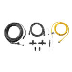
Garmin NMEA 2000 Starter Kit
Garmin NMEA 2000 Starter Kit
Our starter kit has everything you need to build a basic NMEA 2000 network on your boat. The kit includes an NMEA 2000 drop cable (2 m), backbone cable (6 m), power cable (2 m), 2 T-connectors, and male and female terminator connectors.
SKU: 010-11442-00

Related products
-
Lighting
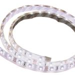
LED Exterior/Interior Strip Light 1m Cool White
LED Exterior/Interior Strip Light 1m Cool White
Super bright multi-purpose LED strip lights available in a range of colours in one and five metre lengths. Features 60 SMD 3528 LED’s per metre set within a clear, low profile, flexible outer casing to provide excellent protection against the elements. Waterproof and rated to IP67.
Each 12 volt strip is pre-wired and may be cut to individual requirements. Supplied with quality ‘3M’ brand self-adhesive tape, plastic mounting clips for added security and additional end caps.
Suitable for marine, outdoor, home, camping, caravan and RV for a wide range of applications. Supplied in bright retail clam packaging.
Features:
Pre-wired and may be cut to individual lengths
Uses quality SMD 3528 LED’s
Ideal for outdoor use, rated to IP67
Long life span with minimal maintenance
Supplied with ‘3M’ self-adhesive tape and mounting clipsBBB Code LED Colour Length metre LED’s per metre Volts LED SMD Type Current draw per metre mHa Lumen per metre BBB-PISL1M3528BLUE Blue 1 60 12 3528 400 180 BBB-PISL1M3528CW Cool White 1 60 12 3528 400 300 BBB-PISL1M3528RED Red 1 60 12 3528 400 180 BBB-PISL1M3528WW Warm White 1 60 12 3528 400 180 SKU: 1M STRIP LIGHT - COOL WHITE -
Uncategorised
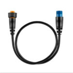
Lowrance 83/200kHz Broadband Transom Mount Depth/Temp Transducer (Part Number: 000-0106-72)
 Uncategorised
Lowrance 83/200kHz Broadband Transom Mount Depth/Temp Transducer (Part Number: 000-0106-72)
### LOWRANCE SUMMER SALE – ONLINE ONLY DEAL – WHILE STOCKS LAST – MUST END 31/01/2018 ###
Lowrance 83/200kHz Broadband Transom Mount Depth/Temp Transducer (Part Number: 000-0106-72)
‘Shallow’ water HST-WSBL 106-72 transducer will operate on 2 frequencies on the HDS models: 200 (20°) & 83KHz (60°). Temperature sensor in-built. Plug: blue 7 pin connector.
Part Number: 000-0106-72
SKU: 000-0106-72 -
Lighting
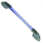
LED Illuminated Hand Rail (Part # 70974)
LED Illuminated Hand Rail (Part # 70974)
• Ideal for use in all interior or exterior marine, caravan, motorhome
and camper trailer applications. Most commonly used as galley or
stairway lighting.
• Chrome plated die cast zinc alloy end caps.
• 2 x stainless steel mounting gaskets.Features:
Part No.: 70974
LED Colour: Blue
Frame Colour:Chrome Ends
Length (mm): 510
Height (mm): 55
Volts: 12
Amps: 0.52
Watts: 6.24SKU: 70974 -
Trailer Parts, Wheels
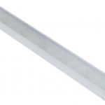
13” Multi Fit 5 Stud HT/FD Trailer Wheel Assembly Galvanised 155LT (Tyre Size: 155LTR13)
 Trailer Parts, Wheels
13” Multi Fit 5 Stud HT/FD Trailer Wheel Assembly Galvanised 155LT (Tyre Size: 155LTR13)
13” Multi Fit 5 Stud HT/FD Trailer Wheel Assembly Galvanised 155LT (Tyre Size: 155LTR13). Suits both HT Holden Hubs and Ford Hubs.
*Specifications from suppliers’ information. This product due to its bulky nature requires an additional surcharge on freight – as a guide freight to South East Queensland [Gold Coast to Sunshine Coast & west to Toowoomba] is approx. $15; Melbourne, Sydney, Adelaide is approx. $20-30; Central & Northern Queensland – Coastal [Bundaberg to Cairns] is approx. $20-30; Perth is approx. $20-30 (we will contact you regarding this depending on location – or simply contact us on 0732658016 for a quote).
SKU: 92755