-
×
 Garmin Panoptix™ PS30 Down Transducer
1 × $2,399.00
Garmin Panoptix™ PS30 Down Transducer
1 × $2,399.00
Subtotal: $2,399.00
Showing 1201–1230 of 3735 results

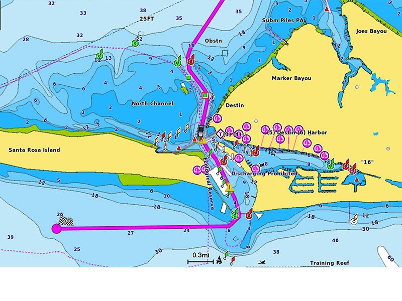
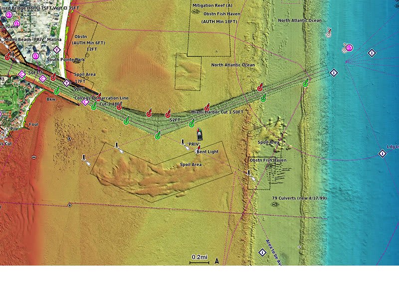
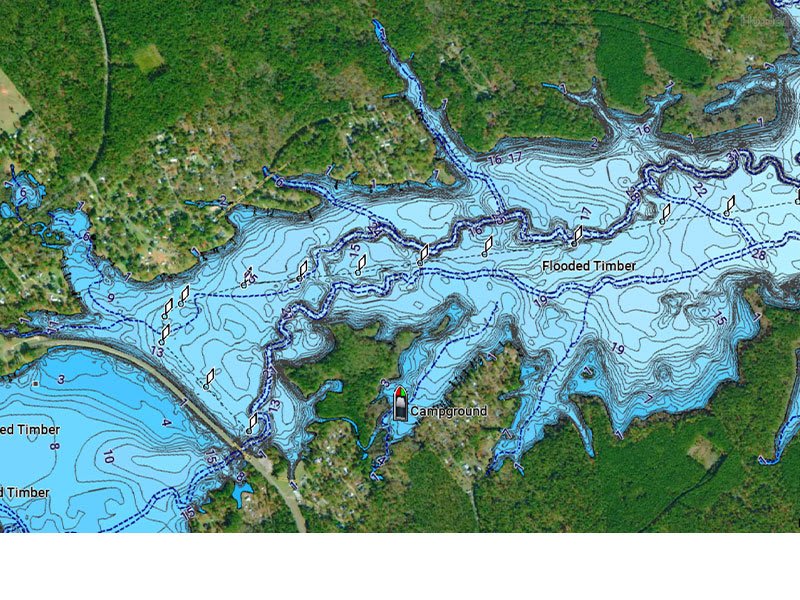
A comprehensive, all-in-one solution, Navionics+ charts and maps combine clear, reliable coastal/inland content with advanced guidance features and compatibility with a wide range of chartplotter brands.

A comprehensive, all-in-one solution, Navionics+ charts and maps combine clear, reliable coastal/inland content with advanced guidance features and compatibility with a wide range of chartplotter brands.

Featuring vibrant colors, a streamlined interface and combined coastal/inland content with a popular Navionics® style color palette, Garmin Navionics+ cartography makes it easy to plot your course with the world’s No. 1 name in marine mapping1.
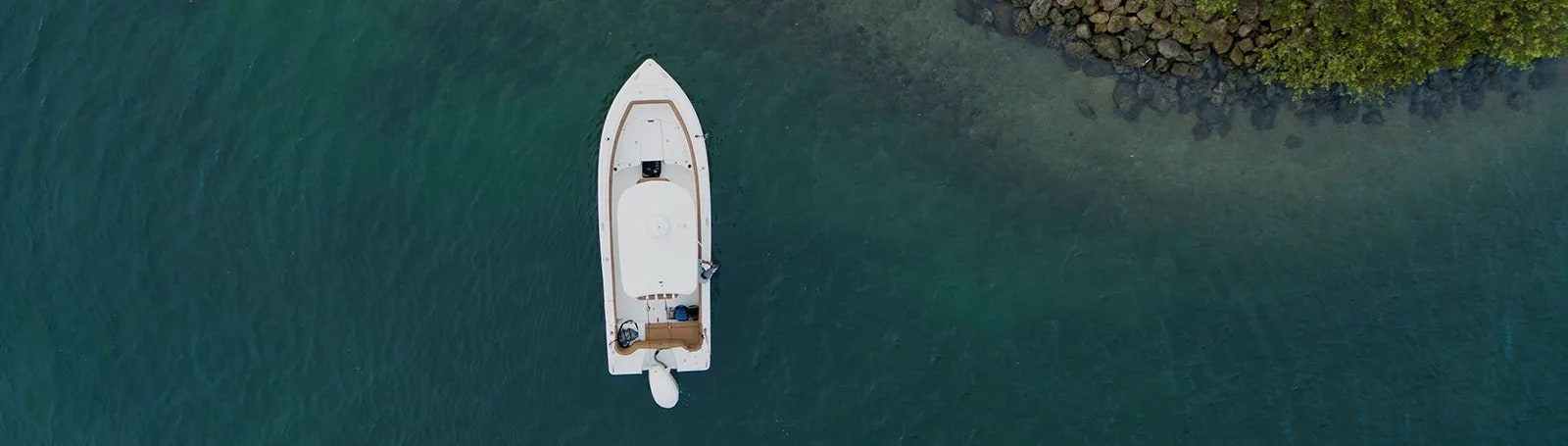
Access detail-rich mapping of coastal features, lakes, rivers and more. Integrated Garmin and Navionics® content offers coverage for boaters worldwide.
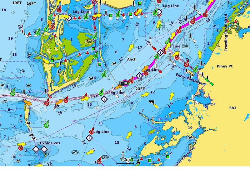
Charts are constantly being enhanced with new and amended content: Thousands of updates are made every day. The one-year included subscription gives you access to daily chart updates via the ActiveCaptain app.
Combining the best of Garmin and Navionics automatic routing features, built-in Auto Guidance+ technology2 gives you a suggested dock-to-dock path to follow through channels, inlets, marina entrances and more.
High-resolution depth range shading lets you select up to 10 color-shaded options and view your designated target depths at a glance.
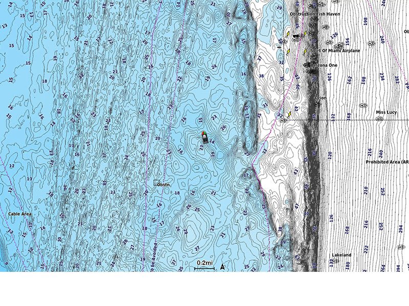
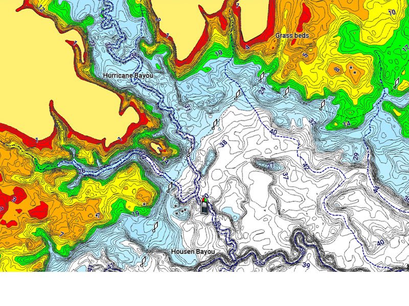
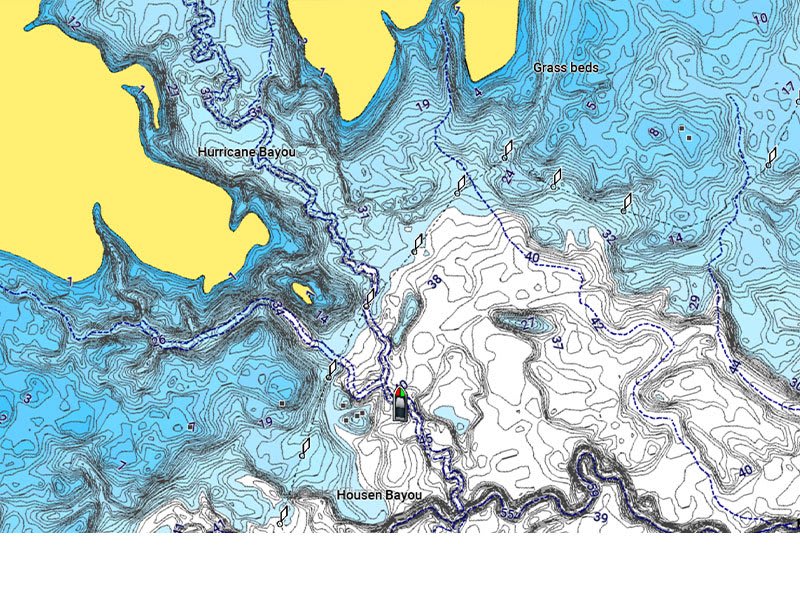
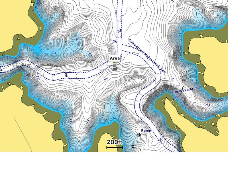
For improved fishing and navigation, up to 1′ contours provide a clear depiction of bottom structure for improved fishing charts and enhanced detail in swamps, canals, harbors, marinas and more.
To give a clear picture of shallow waters to avoid, this feature allows for shading at a user-defined depth.
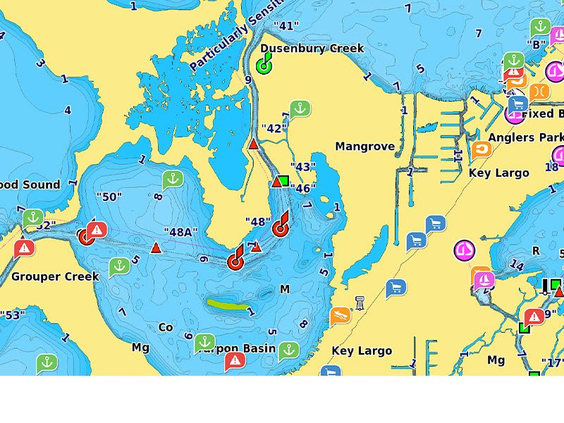
Community-sourced content provides useful points of interest, such as marinas, anchorages, hazards, businesses and more. Get recommendations from boaters with firsthand experience of the local environment.
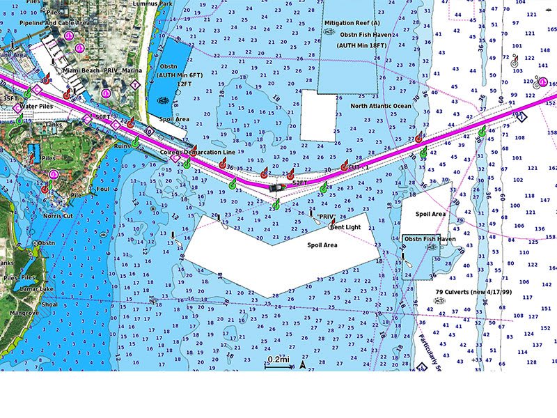
This detailed shading feature3 combines color and shadow to give you an easy-to-interpret, clearer view of bottom structure than contour lines alone.
Downloadable high-resolution satellite imagery3 provides superior situational awareness.
Crystal-clear aerial and surface photos of ports, marinas, bridges, docks, boat ramps, dams and navigational landmarks provide a better sense of your surroundings above the waterline.
This underwater perspective shows 3D representation of bottom and contours as seen from below the waterline. Interface with sonar data for a customized view.
This view provides a 3D representation of the surrounding area both above and below the waterline.
Adjust your maps to the lake’s current water levels to see if spots are accessible or too shallow to explore.

Featuring vibrant colors, a streamlined interface and combined coastal/inland content with a popular Navionics® style color palette, Garmin Navionics+ cartography makes it easy to plot your course with the world’s No. 1 name in marine mapping1.
Access detail-rich mapping of coastal features, lakes, rivers and more. Integrated Garmin and Navionics® content offers coverage for boaters worldwide.
Charts are constantly being enhanced with new and amended content: Thousands of updates are made every day. The one-year included subscription gives you access to daily chart updates via the ActiveCaptain app.
Combining the best of Garmin and Navionics automatic routing features, built-in Auto Guidance+ technology2 gives you a suggested dock-to-dock path to follow through channels, inlets, marina entrances and more.
High-resolution depth range shading lets you select up to 10 color-shaded options and view your designated target depths at a glance.
For improved fishing and navigation, up to 1′ contours provide a clear depiction of bottom structure for improved fishing charts and enhanced detail in swamps, canals, harbors, marinas and more.
To give a clear picture of shallow waters to avoid, this feature allows for shading at a user-defined depth.
Community-sourced content provides useful points of interest, such as marinas, anchorages, hazards, businesses and more. Get recommendations from boaters with firsthand experience of the local environment.
This detailed shading feature3 combines color and shadow to give you an easy-to-interpret, clearer view of bottom structure than contour lines alone.
Downloadable high-resolution satellite imagery3 provides superior situational awareness.
Crystal-clear aerial and surface photos of ports, marinas, bridges, docks, boat ramps, dams and navigational landmarks provide a better sense of your surroundings above the waterline.
This underwater perspective shows 3D representation of bottom and contours as seen from below the waterline. Interface with sonar data for a customized view.
This view provides a 3D representation of the surrounding area both above and below the waterline.
Adjust your maps to the lake’s current water levels to see if spots are accessible or too shallow to explore.
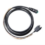
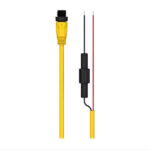
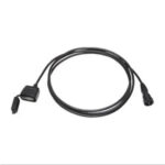
Network your compatible GPSMAP® chartplotter with this NMEA 0183 data communication cable. Includes bare wires and an RCA connector for audio connection to any stereo setup, including FUSION.
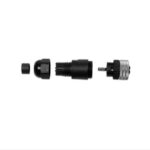
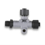
Use our male or female NMEA 2000 field-installable connectors to create custom-length drop cables and backbone extension cables. These connectors (sold separately) also can be used to shorten any NMEA 2000 drop/backbone cable.
Use our male or female NMEA 2000 field-installable connectors to create custom-length drop cables and backbone extension cables. These connectors (sold separately) also can be used to shorten any NMEA 2000 drop/backbone cable.
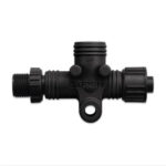
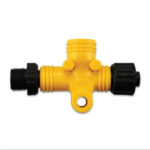
Make NMEA 2000 installations easier with our multi-port T-connector. This solution creates a more robust NMEA 2000 backbone by reducing issues with breaking points as well as stress induced by long back bones. The rigid construction is less prone to failure and decreases installation time.
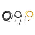
Our starter kit has everything you need to build a basic NMEA 2000 network on your boat. The kit includes an NMEA 2000 drop cable (2 m), backbone cable (6 m), power cable (2 m), 2 T-connectors, and male and female terminator connectors.
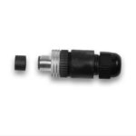
This standard male or female NMEA 2000 light cable connector provides termination resistance for one end of the backbone of the network. Each male or female connector sold separately.
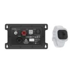
Built so you can move freely and boat confidently, the Garmin OnBoard™ system uses wireless tags instead of traditional tethered cords — integrating with your compatible Garmin chartplotter.
![]()
TAGS ARE WORN ON WRIST, CARABINER OR KEY RING FLOAT
![]()
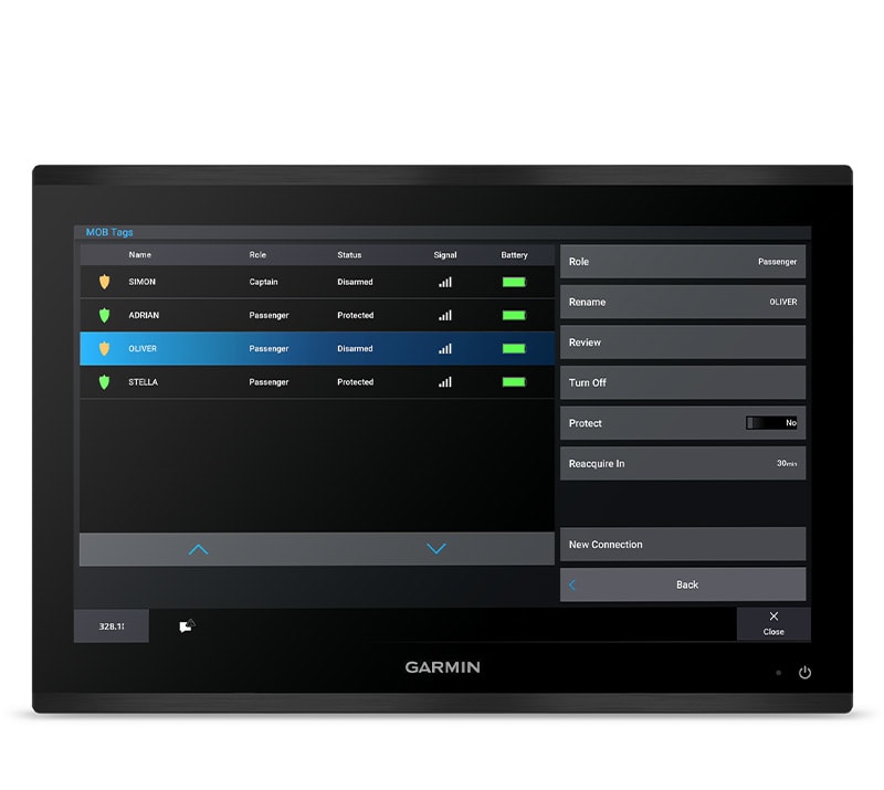
TAGS ARE DESIGNATED AS EITHER CAPTAIN OR PASSENGER
![]()
SET MOB TAG AS CAPTAIN TO ENABLE ENGINE CUTOFF
![]()
TEMPORARILY DISARM TAGS WITH EASE
![]()
THE GOS 10 HUB INCLUDES A LOUD EXTERNAL ALARM
![]()
TAG BATTERY LIFE EXCEEDS A SEASON OF TYPICAL USE
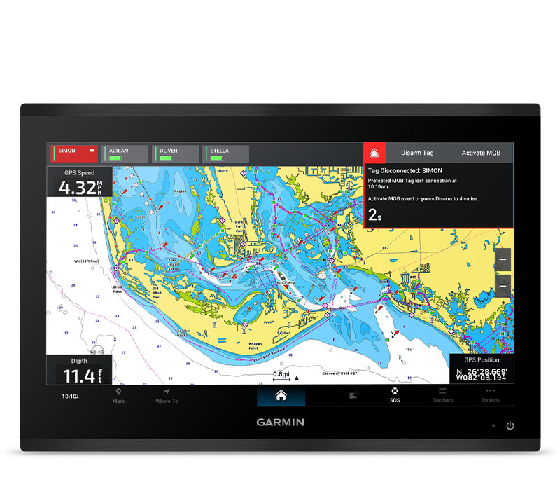
Captain MOB detection will trigger engine cutoff, a MOB waypoint on the chartplotter and an audible alarm on the MFDs and hub.
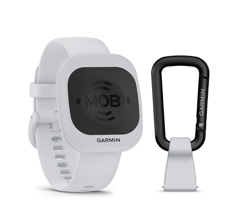
The wearable MOB tags are part of a wireless MOB system — letting you move untethered while still being monitored.
Passenger MOB detection will trigger a MOB waypoint on MFDs plus an audible alarm on the MFDs and hub.

Should a captain tag trigger an MOB event, the system will cut power to the engines — letting the captain return to the vessel.
Through the Garmin chartplotter interface, you can designate each tag as either captain or passenger — changing their MOB action.
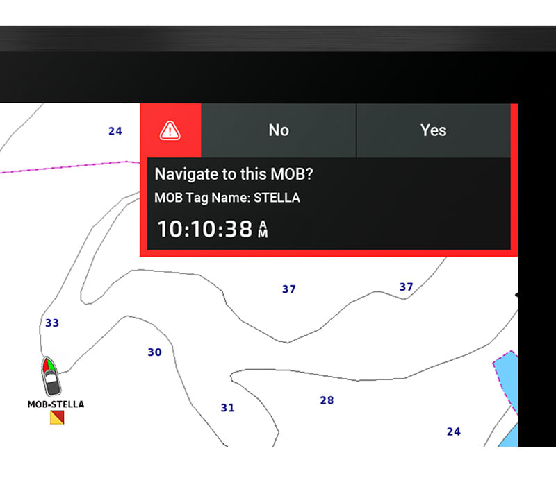
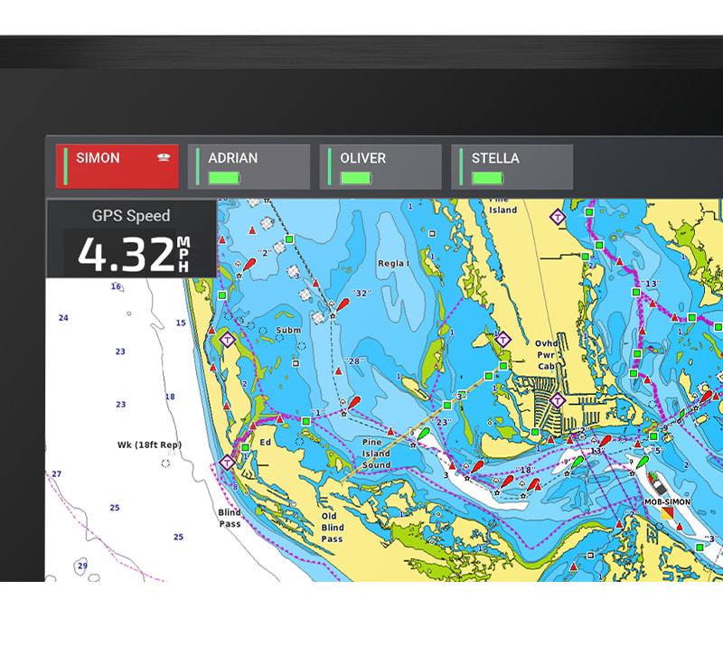
When paired to your compatible Garmin chartplotter, a waypoint will be marked at the location where the MOB tag lost connection with the vessel.
![]()
The GOS 10 hub includes a loud external alarm — alerting you to a MOB event.
![]()
Provide peace of mind for up to 8 tags at a time.
![]()
This product will work with any boat that has an engine cutoff switch.
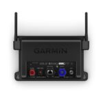
Track, monitor and control any number of switches you need with the Garmin OnDeck Hub system, a fully integrated remote connectivity solution1.
![]()
Door open? Bilge running? Peace of mind comes in the form of text alerts and updates.
![]()
New features, same app. ActiveCaptain® keeps you connected to your boat1.
![]()
The always-on OnDeck Hub connection has the potential to keep you in contact from just about anywhere.
![]()
To protect your passion, you must have a plan. A subscription is required.
Control your vessel remotely using the OnDeck™ Hub and a relay switch. Add up to five switches to your OnDeck Hub to stay in control.
Verify that the input power for your OnDeck Hub operates between 10 Vdc and 15.6 Vdc to ensure compatibility with your system.
Control your vessel remotely using the OnDeck™ Hub and a relay switch. Add up to five switches to your OnDeck Hub to stay in control.
Verify that the input power for your OnDeck Hub operates between 15.6 Vdc and 31.2 Vdc to ensure compatibility with your system.
Monitor the status of your shore power remotely using the OnDeck Hub and one of these sensors.
Choose the hard-wired option to connect directly into AC mains power without the need of an outlet plug. This hard-wired product works with 90-264 VAC input and has 5 VDC output voltage.
Choose the AC power plug option to connect to an electrical outlet. The AC power plug option is compatible with North America, Europe, U.K., and Australia standard electrical outlets from 100 VAC to 240 VAC and has 5 VDC output voltage.
Charge USB devices from your GPSMAP 8400 or 8600 series chartplotter with this 6-foot adapter cable. The water resistant and secure connection allows you to power an external device via USB, such as a phone or media player, from your Garmin chartplotter. You can also power your Chromecast or Roku – with a coupler and HDMI cable (sold separately – and then stream video wirelessly to your chartplotter.
You’ve never fished like this before, with a view below your boat so clear you even see your lure as you retrieve it.
![]()
Who wouldn’t want stunning, real-time imagery below and around their boat?
![]()
Need a new view? No sweat. This transducer is easy to adjust.
![]()
Up to 200 feet down. Up to 200 feet away. That’s an impressive view for real-time sonar.
![]()
Even if the waters are rough, this system stabilises the view on your chartplotter screen.
![]()
No matter your setup, the simple plug-and-play connector makes installation a breeze.
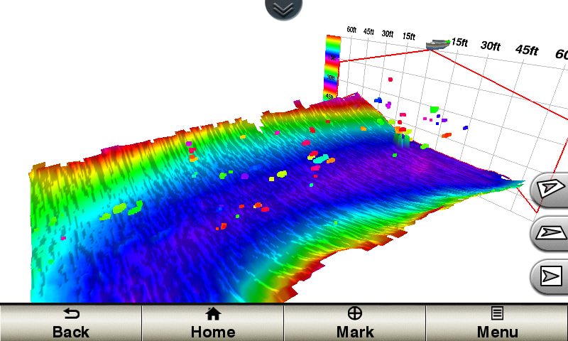
You didn’t think it could get better, but it did with the extended range of the LiveScope XR System. It’s the latest in LiveScope technology, now for coastal and open-water fishing.
![]()
Explore the deep with an extended range up to 500’ in freshwater and 350’ in saltwater.
![]()
Find fish circling your boat with clear views close around your hull.
![]()
Upgrade your current LiveScope System black box (GLS™ 10 sonar module) with just a new transducer.
![]()
Get maximum contrast and clarity in your images with vivid color palettes.
![]()
Don’t miss a thing with supported Forward, Down and Perspective modes plus necessary mount.
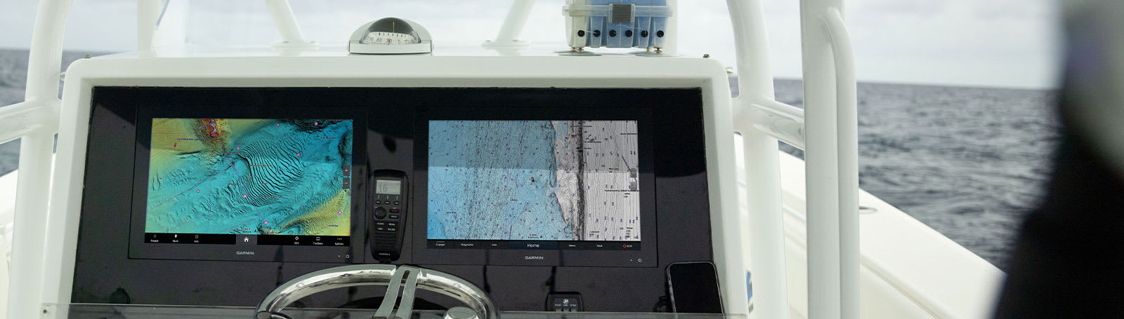
This transducer is part of the Panoptix LiveScope System and requires the GLS 10 sonar black box to function. You get both LiveScope™ Down and LiveScope™ Forward modes in one transducer. It’s easy to adjust the transducer mode to fit your fishing techniques; use LiveScope Forward to see remarkably clear images of structure and swimming fish around your boat, and use LiveScope Down to see directly below your boat. The view automatically updates on your compatible Garmin chartplotter. Attitude Heading Reference System (AHRS) stabilization keeps your sonar view steady, even in rough conditions.
Garmin is the first to bring 2 modes of Panoptix sonar imaging to 1 transducer for your boat. Panoptix all-seeing sonar is unlike anything you’ve ever seen on the water. It gives you the ability to see all around your boat and below it — in real time — up to 100’ away.
Watch your lure as it sinks, and see its depth and movement as you retrieve it. See it move in relation to structure in the water. See fish swimming and reacting to your bait. If they attack, you’ll see and feel the hit! Once on the hook, watch the fight on your screen as it happens. With Panoptix LiveVü Forward and LiveVü Down, you can see it all come to life up to 100’ away or below your boat.
Panoptix delivers a whole new perspective to fishing. Other sonar only shows images of fish your transducer has passed over. To capture those images, your boat must be moving. Everything that shows up on your screen is technically history; it’s all in the past. With Panoptix LiveVü Forward and LiveVü Down sonars, your boat can be moving or stationary. Wherever your trolling motor is pointed, you’ll see live images of what is happening under the water.
With the Panoptix Down transducer, you can actually see fish and bait swimming around under your boat — in real time; even while stationary. You get 3 remarkable views: LiveVü Down, RealVü 3-D Down and RealVü 3-D Historical.
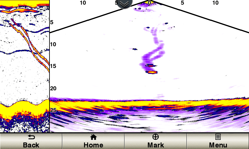 LIVEVÜ DOWNProvides real-time moving sonar images. You can see fish swimming toward or away from the boat. You can see small baitfish and large target fish swimming around, even your lure.
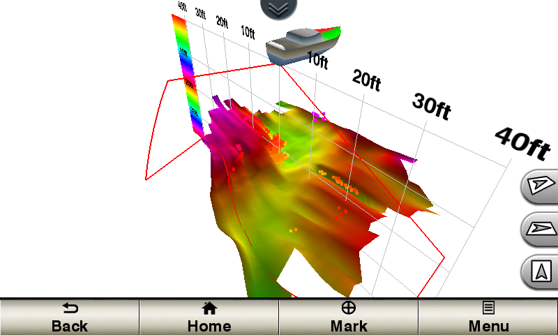 REALVÜ 3-D DOWNAllows your boat to be stationary and still see things in 3-D around your boat. It shows history of only 1 sweep./p>
 REALVÜ 3-D HISTORICALUsed for finding fish while your boat is moving. This shows the entire water column you have passed over in 3-D, from the bottom of the surface and all of the fish in between.
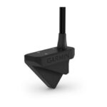
Garmin is the first to bring Panoptix sonar imaging to your boat. Panoptix all-seeing sonar is unlike anything you’ve ever seen on the water. It gives you the ability to see all around your boat in real-time. You can see fish in the water column in 3-D. You can also see your bait cast into the water and watch it as you reel it in. You can see fish swimming in front of or below your boat. You can even see them chase your lure. But to truly appreciate Panoptix, you have to see it. Transducer transom mounting kit included.