Fusion Apollo RA770 Dust Cover
Keep the front of your Fusion Apollo RA770 marine stereo protected and free from dust with this cover.

Keep the front of your Fusion Apollo RA770 marine stereo protected and free from dust with this cover.
| Weight | 0.5 kg |
|---|
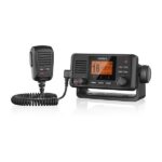
Stay in Contact on the Water
Communication is critical on the water. With the VHF 115i radio, you can stay in contact with the shore and other boats in your area. So, no matter where you are or where you’re headed, you’ll maintain communication.
Increase Your Peace of Mind
During an emergency situation, the 25-watt transmit power of VHF 115i gives fishermen, sailors and cruisers confidence at their fingertips.
Communicate Confidently on the Water
Easy to install and use, just plug and play to compatible Garmin chartplotters and MFDs via the NMEA 2000 network. VHF 115i provides standard Class D DSC functionality (distress calling and direct calling with user-programmed MMSI). The radio includes frequency bands for all U.S., Canadian and international marine channels and 10 NOAA weather channels. It’s also NMEA 0183 compatible.
Communicate with Style
Because your helm is a source of pride, we’ve designed the VHF 115i marine radio to complement GPSMAP® 7×2/9×2, GPMAP 10×2/12×2, GPSMAP 7400/7600 and GPSMAP 8400/8600 chartplotters and MFDs.
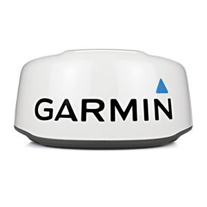
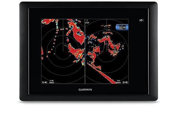
This 18-inch high-definition radar dome pairs ease of use with advanced features typically found on open arrays for enhanced situational awareness.
![]()
If your boat has limited space for radar placement, this compact dome is for you.
![]()
It packs the power and echo definition you need, at all ranges.
![]()
When weather and sea conditions shift, the gain and sea filter do too — automatically.
![]()
See what’s close and far away with dual-range operation.
This 18-inch dome radar delivers 4-kW transmit power and clear echo definition at all ranges. It has a maximum range of 48 nautical miles (88 km) and 48- or 24-RPM rotation speeds for fast screen refreshes.
GMR™ 18 xHD features 8-bit true colour high resolution for outstanding target separation with less screen clutter on your chartplotter.
This radar doesn’t have any complex user settings to deal with, so it’s easy to install and start using.
Gain levels automatically adjust to optimum settings for harbours, near shore and offshore in open waters.
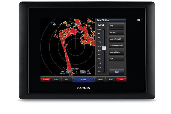
Gain automatically adjusts sea clutter for calm, medium and rough sea conditions.
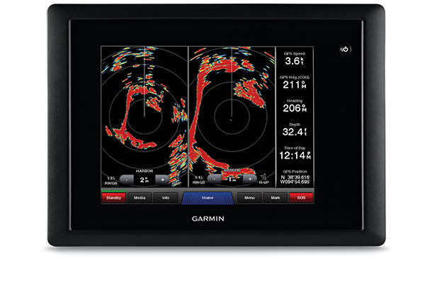
This feature enables the fully independent split-screen display of far and close radar views.
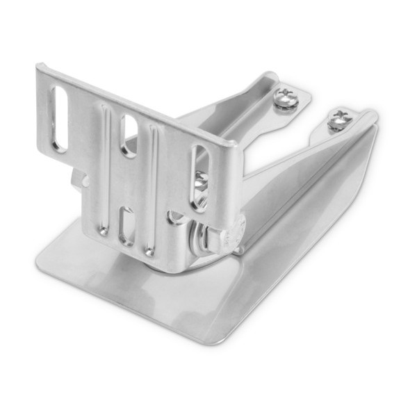
You have the option to protect areas behind the radar from being radiated while providing full forward-looking radar capability. This also makes installation more flexible.
Overlay radar images onto your chartplotter’s map page. You can add an optional autopilot or heading sensor (sold separately) for best results.
GMR™ 18 xHD provides MARPA target tracking when combined with a multifunction display and heading sensor (sold separately).
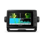
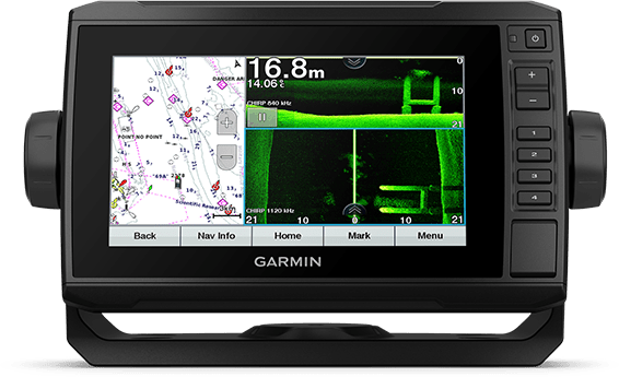
The sunlight-readable 7” touchscreen chartplotter features a quick-release bail mount, and the transducer bundle adds Ultra High-Definition scanning sonar and CHIRP traditional sonar.
See below and around your boat in incredible detail with included transducer.
Navigate any waters with preloaded Australia and New Zealand BlueChart® g3 coastal charts.
Share data and maps with select ECHOMAP devices on your network.
Manage your marine experience from nearly anywhere1.
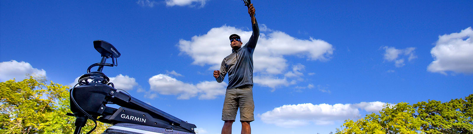
Control the most powerful trolling motor available2.
Create your own maps on the fly and tailor them to fit your needs.
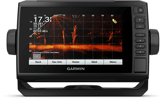
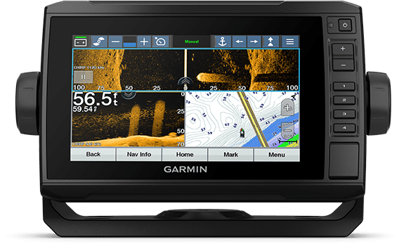
This chartplotter supports a variety of Garmin transducers (sold separately), including the Panoptix LiveScope™ scanning sonar system, which lets you see all around your boat in real time.
High-contrast vivid scanning sonar color palettes make it easier than ever to distinguish targets and structure.
This chartplotter comes with a GT56 transducer for Garmin CHIRP traditional sonar and Ultra High-Definition ClearVü and SideVü scanning sonars. With three scanning sonar frequencies and 20% greater range for our UHD SideVü sonar, you’ll get top performance at all depths.
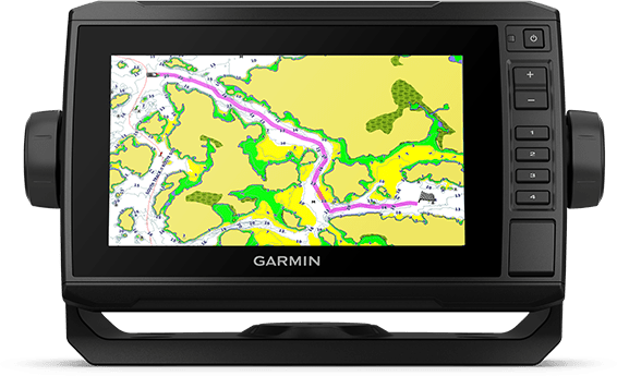
Experience unparalleled coverage and detail with preloaded Experience unparalleled coverage and detail with preloaded Australia and New Zealand BlueChart g3 coastal charts featuring integrated Navionics® data.
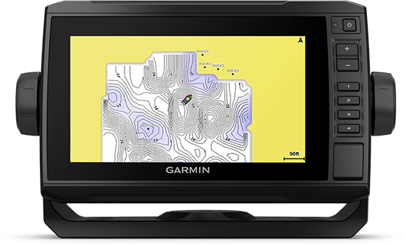
Create personalized fishing maps on-screen with 1’ contours. Keep the data to yourself, or share it with the Quickdraw Community on the Garmin Connect™ app3.
If you have multiple compatible ECHOMAP UHD or ECHOMAP Ultra devices on your boat, the 7” and 9” models can share information — such as sonar, user data and charts — with them.
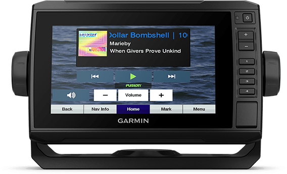
Connect to your compatible autopilots, digital switching, weather, Fusion-Link™ audio system, media, VHF, AIS, engine data, heading sensors — such as the SteadyCast™ sensor — and more from one screen.
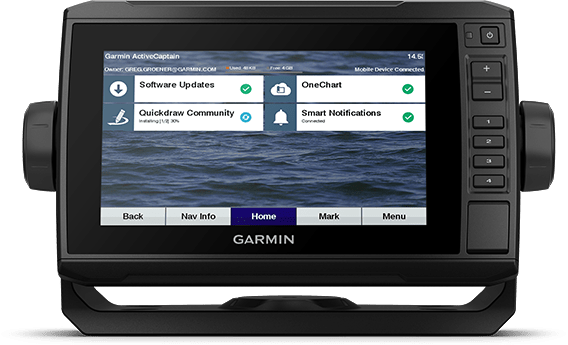
Built-in Wi-Fi® connectivity pairs with the free all-in-one mobile app for access to the OneChart™ feature, smart notifications, software updates, Garmin Quickdraw™ Community data and more1.
Take control of the most powerful and efficient trolling motor available2, route it to waypoints, follow tracks and more from the screen of your chartplotter.
The GT54UHD-TM transducer provides image details so clear and precise, you can actually see fish hanging just off branches of submerged trees, brush and rocks. You can see size differences between bigger and smaller fish and even see individual fish swimming in bait balls. You get the highest resolution ClearVü and SideVü scanning sonar images available plus amazingly clear high wide CHIRP traditional sonar1 — all in one transducer.
Ultra High-Definition scanning sonar provides extended range and depth performance. It shows you incredibly detailed images of fish and structure up to 200’ below your boat with 800 kHz ClearVü, while two SideVü sonar frequency settings (455/1200 kHz) provide options for extended range of up to 500’. It’s easy to install with included transom and trolling motor mounts so you can start fishing faster.
¹For use with GPSMAP® 8400xsv/8600xsv chartplotter/sonar combos