-
×
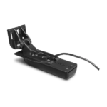 Garmin GT54UHD-TM Transducer - Ultra High-Definition Scanning Sonar All-in-one Transducer
1 × $549.00
Garmin GT54UHD-TM Transducer - Ultra High-Definition Scanning Sonar All-in-one Transducer
1 × $549.00
Subtotal: $549.00
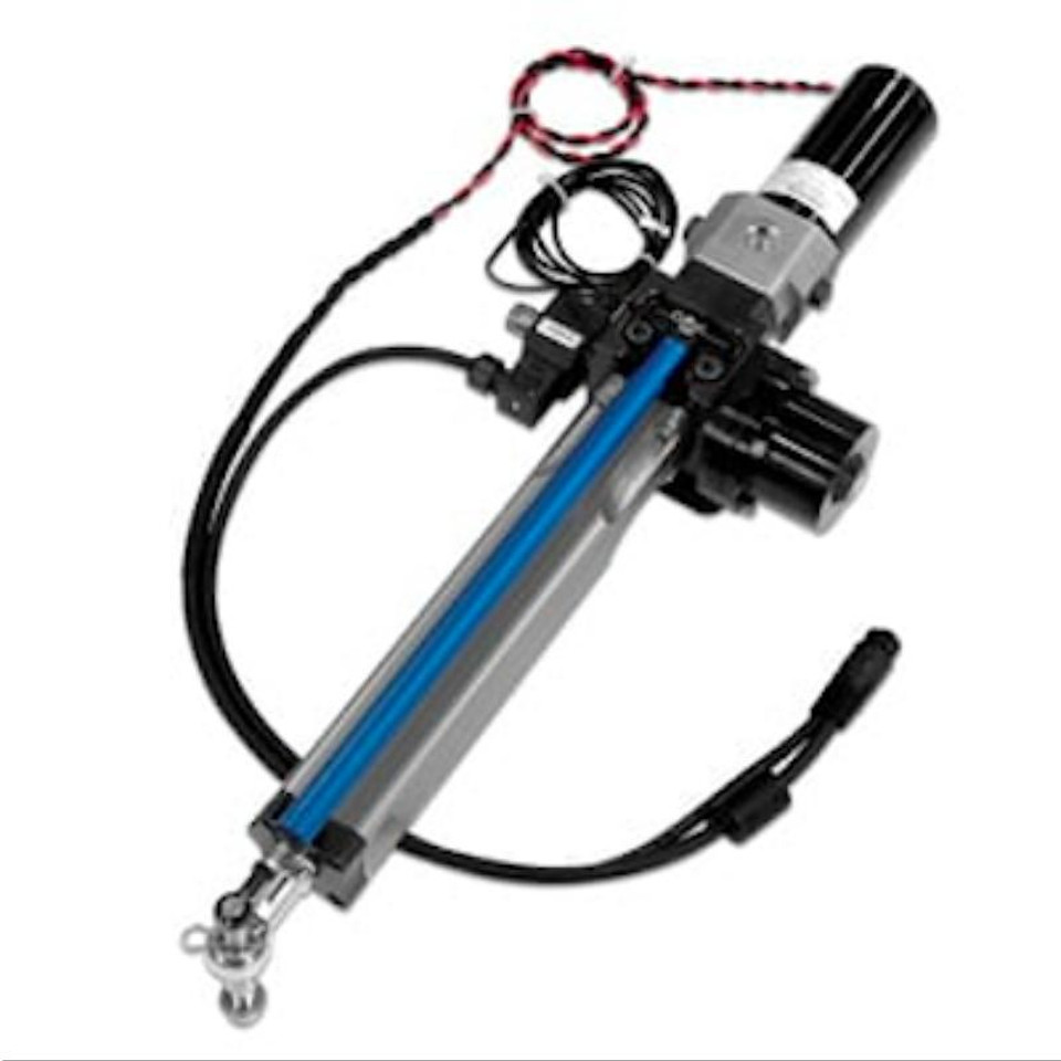
The Class B Compact Drive Unit works with the GHP™ 12 marine autopilot system to control your sailboat’s steering system. This device is designed for use with sailboats with up to 48,400 lbs of displacement.
| Weight | 11.5 kg |
|---|
Drive Unit Type: Integrated Hydraulic linear
Stroke Length: 254 mm
Maximum Thrust: 730 kg
Dimensions, WxHxD (centered): 810 x 120 x 225 mm
Supply Voltage: 10V to 30V (regulated to 12V by the ECU)
Average Clutch Current at 12V: 1 Amp
Average Motor Current at 12V: 2-4 Amps
Operating Temperature: -15° C to 50° C
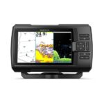
See fish and structure in maximum detail when you pick your display colour, your location and your sonar for your day on the water with the STRIKER Vivid 7cv fishfinder with transducer.
![]()
The sonar colour you pick says a lot about your fishing style. Good thing there are 7 new vivid options.
![]()
What a view. Use the included transducer to get CHIRP traditional and ClearVü sonars.
![]()
Never lose a hot spot again. Use waypoint marking to find your way back.
![]()
What’s under the water’s surface looks pretty good as 1-foot contours, just saying.
![]()
Wi-Fi® connection1 on land opens up a world of possibilities on the water.
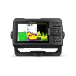
See fish and structure in maximum detail when you pick your display colour, your location and your sonar for your day on the water with the STRIKER Vivid 5cv fishfinder with transducer.
![]()
The sonar colour you pick says a lot about your fishing style. Good thing there are 7 new vivid options.
![]()
What a view. Use the included transducer to get CHIRP traditional and ClearVü sonars.
![]()
Never lose a hot spot again. Use waypoint marking to find your way back.
![]()
What’s under the water’s surface looks pretty good as 1′ contours, just saying.
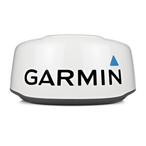
This 24-inch high-definition radar dome pairs ease of use with advanced features typically found on open arrays for enhanced situational awareness.
![]()
This 24-inch radar dome is easy to use and has options to make installation simple. What could be better?
![]()
It packs the power and echo definition you need, at all ranges.
![]()
When weather and sea conditions shift, the gain and sea filter do too — automatically.
![]()
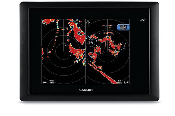
See what’s close and far away with dual-range operation.
This 24-inch dome radar delivers 4-kW transmit power and clear echo definition at all ranges. It has a maximum range of 48 nautical miles (88 km) and 48- or 24-RPM rotation speeds for fast screen refreshes.
GMR™ 24 xHD features 8-bit true colour high resolution for outstanding target separation with less screen clutter on your chartplotter.
This radar doesn’t have any complex user settings to deal with, so it’s easy to install and start using.
Gain levels automatically adjust to optimum settings for harbours, near shore and offshore in open waters.
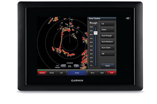
Gain automatically adjusts sea clutter for calm, medium and rough sea conditions.
This feature enables the fully independent split-screen display of far and close radar views.
You have the option to protect areas behind the radar from being radiated while providing full forward-looking radar capability. This also makes installation more flexible.
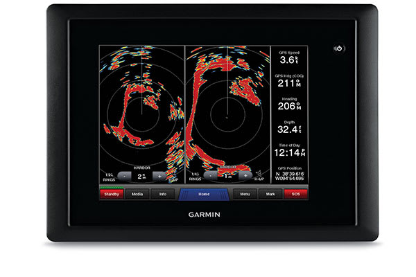
Overlay radar images onto your chartplotter’s map page. You can add an optional autopilot or heading sensor (sold separately) for best results.
GMR™ 24 xHD provides MARPA target tracking when combined with a multifunction display and heading sensor (sold separately).
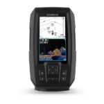
See fish and structure in maximum detail when you pick your display colour, your location and your sonar for your day on the water with the STRIKER Vivid 4cv fishfinder with transducer.
![]()
The sonar colour you pick says a lot about your fishing style. Good thing there are 7 new vivid options.
![]()
What a view. Use the included transducer to get CHIRP traditional and ClearVü sonars.
![]()
Never lose a hot spot again. Use waypoint marking to find your way back.
![]()
What’s under the water’s surface looks pretty good as 1-foot contours, just saying.