-
×
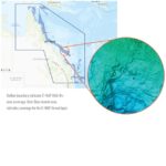 C-MAP Reveal Tweed to Weipa
1 × $299.00
C-MAP Reveal Tweed to Weipa
1 × $299.00
Subtotal: $299.00
$79.00
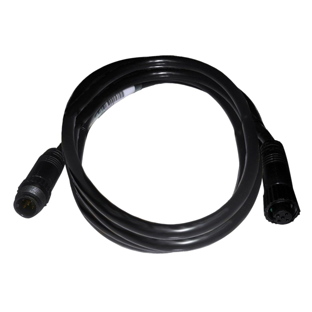
The N2KEXT-6RD is a 6-foot extension cable for NMEA 2000 network backbones and network devices.
| Weight | 0.2 kg |
|---|
HALO24 revolutionizes radar by offering an almost real-time view, with industry-first 60 RPM operation at close range for the ultimate in collision avoidance. Identify hazards in an instant with VelocityTrack™ Doppler technology, and enjoy simultaneous short and long-range coverage—up to 48 nautical miles—from one compact 24-inch dome antenna.
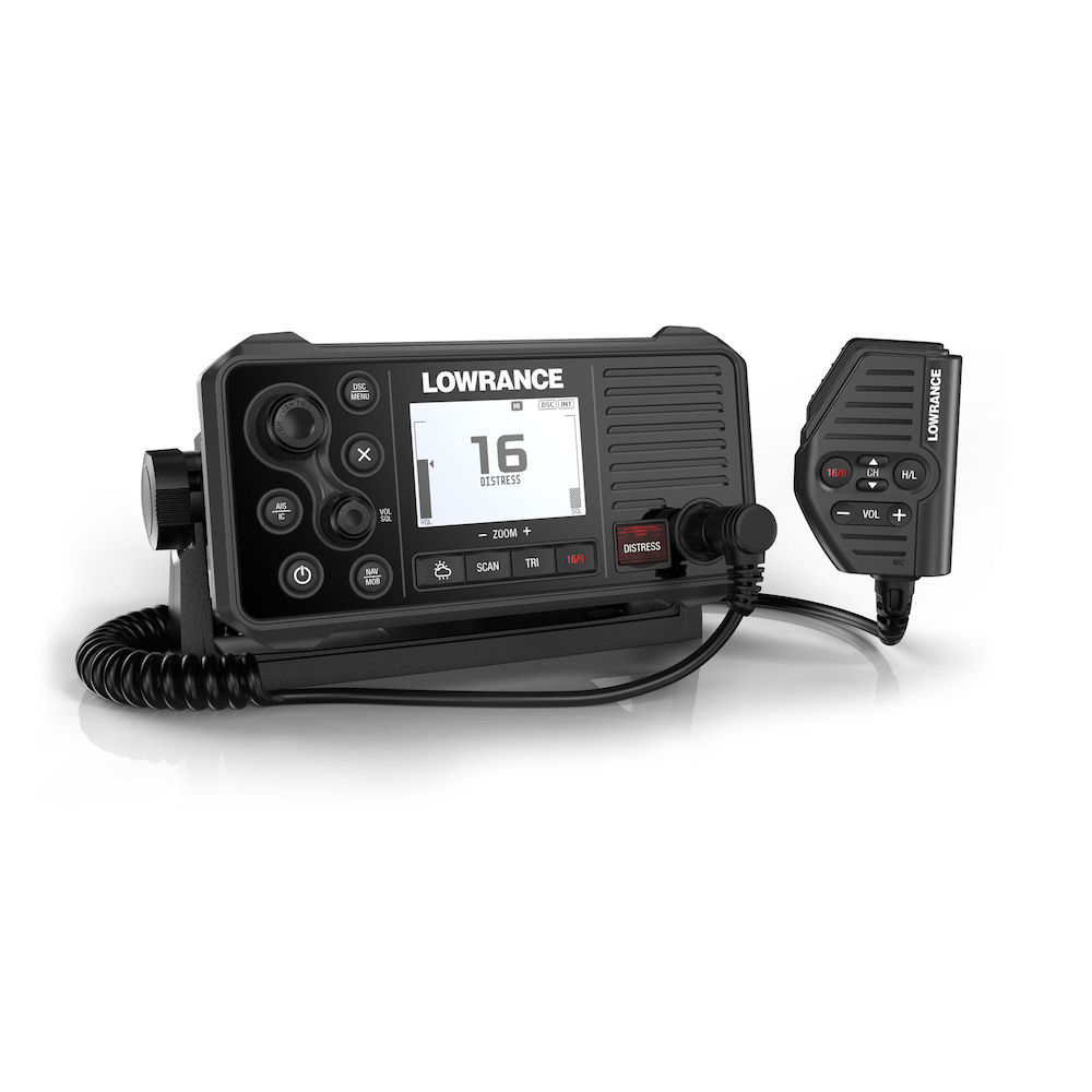
GPS 4-Ways
With the integrated GPS receiver the Link-9 has four ways to ensure you have a GPS fix in the event of an emergency – built-in antenna, SMA connector for GPS-500 antenna, NMEA 0183 for chartplotter GPS and NMEA 2000® for network antenna connection.
Built-in AIS
A dual-channel AIS receiver monitors the position of nearby AIS-equipped vessels, helping you to avoid collisions in crowded harbours and waterways. AIS information can be viewed on the Link-9’s built-in screen, or overlaid on your chart or radar screen through a compatible multifunction display.
Remote Mountable Fist Mic
The Link-9’s removable fist mic can be connected to the front or rear of the radio – optional extension cable allows the radio and mic to be mounted separately. This offers a simple and cost-effective solution for any mounting location, with no cable clutter.
Easier Front-Mount Installation
Link-9 features easily removable top and bottom bezels which reveal mounting holes allowing the same style of mounting from the front that is featured on Lowrance MFDs.
Navigation Mode
Press the NAV button on the Link-9 to turn it into a navigational instrument displaying your Speed and Course. Link-9 also contains a Man Overboard (MOB) function, hold down the NAV/MOB button to drop a waypoint on your current location and the Link-9 will enter MOB mode to show you how far away you are and where you need to steer to get back to the person in the water. The MOB waypoint is also transmitted over NMEA 2000 to the rest of your network.
Details:
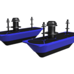
Designed for boats with steep or variable deadrise hulls, StructureScan 3D Dual Thru-Hull Transducers, provide a seamless display of 3D, SideScan and DownScan images. StructureScan 3D gives freshwater and saltwater anglers a unique, three-dimensional view of fish, structure and bottom contours — making it easier to understand where fish and structure are located in relation to your boat. With StructureScan 3D, anglers spend less time searching for productive water and more time catching fish. StructureScan 3D is powered by a multi-beam sonar technology that not only produces picture-like, three-dimensional views of underwater structures and bottom contours but also boosts the performance of two-dimensional Downscan and StructureScan HD imaging, providing views up to 600 feet to each side of your boat.