-
×
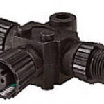 Lowrance/Simrad N2K-T-RD - NMEA 2000 Micro-C T-connector for connection of an additional network device (Part No.: 000-0119-79)
1 × $59.00
Lowrance/Simrad N2K-T-RD - NMEA 2000 Micro-C T-connector for connection of an additional network device (Part No.: 000-0119-79)
1 × $59.00
Subtotal: $59.00

・Waterproof speaker microphone
・Floats in water with the radio
| Weight | 0.2 kg |
|---|
| Connector information | 1 pin 4 poles |
|---|---|
| Cable Length | 415mm; 16.3 in (when curled) |
| Waterproof | IPX7 |
| Weight | 127 g |
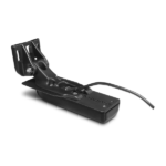
The GT54UHD-TM transducer provides image details so clear and precise, you can actually see fish hanging just off branches of submerged trees, brush and rocks. You can see size differences between bigger and smaller fish and even see individual fish swimming in bait balls. You get the highest resolution ClearVü and SideVü scanning sonar images available plus amazingly clear high wide CHIRP traditional sonar1 — all in one transducer.
Ultra High-Definition scanning sonar provides extended range and depth performance. It shows you incredibly detailed images of fish and structure up to 200’ below your boat with 800 kHz ClearVü, while two SideVü sonar frequency settings (455/1200 kHz) provide options for extended range of up to 500’. It’s easy to install with included transom and trolling motor mounts so you can start fishing faster.
¹For use with GPSMAP® 8400xsv/8600xsv chartplotter/sonar combos
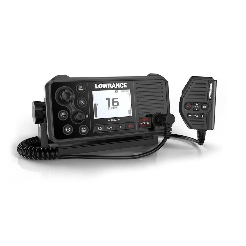
GPS 4-Ways
With the integrated GPS receiver the Link-9 has four ways to ensure you have a GPS fix in the event of an emergency – built-in antenna, SMA connector for GPS-500 antenna, NMEA 0183 for chartplotter GPS and NMEA 2000® for network antenna connection.
Built-in AIS
A dual-channel AIS receiver monitors the position of nearby AIS-equipped vessels, helping you to avoid collisions in crowded harbours and waterways. AIS information can be viewed on the Link-9’s built-in screen, or overlaid on your chart or radar screen through a compatible multifunction display.
Remote Mountable Fist Mic
The Link-9’s removable fist mic can be connected to the front or rear of the radio – optional extension cable allows the radio and mic to be mounted separately. This offers a simple and cost-effective solution for any mounting location, with no cable clutter.
Easier Front-Mount Installation
Link-9 features easily removable top and bottom bezels which reveal mounting holes allowing the same style of mounting from the front that is featured on Lowrance MFDs.
Navigation Mode
Press the NAV button on the Link-9 to turn it into a navigational instrument displaying your Speed and Course. Link-9 also contains a Man Overboard (MOB) function, hold down the NAV/MOB button to drop a waypoint on your current location and the Link-9 will enter MOB mode to show you how far away you are and where you need to steer to get back to the person in the water. The MOB waypoint is also transmitted over NMEA 2000 to the rest of your network.
Details:
### GARMIN SALE – ONLINE ONLY DEAL – WHILE STOCKS LAST – MUST END###
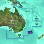
Garmin BlueChart g2 Vision – East Coast of Australia [Garmin Part Number: 010-C0756-00] – RRP $399
Get a fresh perspective when you take to the water with BlueChart® g2 Vision®. With BlueChart g2 Vision data, you’ll get detailed marine cartography that provides convenient viewing of nautical content and other premium features. BlueChart g2 Vision allows you to see your vessel’s precise, on-chart position in relation to naviads, coastal features, anchorages, obstructions, waterways, restricted areas and more. You will also have access to detailed mapping capabilities that include Safety Shading, Fishing Charts, smooth data transition between zoom levels, harmonious transition across chart borders, and reduction of chart discontinuities. Premium features include 3-D perspective above and below the waterline, Auto Guidance, high-resolution imagery, and “real picture” aerial photos of ports, harbours, marinas, waterways, landmarks and other points of interest. It’s the most realistic mapping display Garmin has ever offered.
Detailed coverage of the Eastern coast of Australia from Mornington Island to Fowlers Bay (VPC022R). Also includes detailed coverage of Cape York, the Great Barrier Reef, Brisbane, Sydney, Melbourne, Adelaide, Tasmania, and Norfolk Island (if another region is required please contact us for availability).
THIS IS SUITABLE FOR CURRENT MODEL GARMIN GPSMAP 7407xsv, GPSMAP 7408xsv, GPSMAP 7410xsv, GPSMAP 7412xsv, echoMAP 75dv, echoMAP 75sv & echoMAP 95sv SOUNDER/GPS COMBO UNITS, PLEASE SEE RELATED PRODUCTS OR ASK FOR FURTHER INFORMATION.
WARRANTY:
We are an authorised Australian Garmin retailer, as such Full Australian Manufacturers Warranty is applicable for this item. Please note if a Garmin unit is purchased overseas or from a non-authorised Garmin retailer you may not receive warranty coverage in Australia.
*Specifications from suppliers’ information. Actual depth capabilities depend on transducer installation, bottom type & water conditions. All sonars typically read deeper in freshwater than in saltwater. Images for display purposes only.
Garmin AIS™ 800 Blackbox Transceiver – Help Avoid Running into Trouble on the Water
Increase your situational awareness and confidence on the water with the Garmin AIS 800 transceiver. It has 5 watts of transmit power and provides faster position reporting than ever before¹. It transmits your vessel information to other AIS receivers in your area while it receives their AIS target data. Garmin AIS 800 has an internal VHF antenna splitter, which allows the VHF and AIS to share a single antenna. It includes a built-in GPS (with connector for optional external antenna) and integrates seamlessly into the Garmin onboard system. The transceiver features NMEA 2000/0183 connectivity for easy integration with compatible chartplotters and multifunction displays. And it’s all packed into an easy-to-install black box unit with a small footprint.
¹When cruising above 14 knots
Specs
In the Box