### GARMIN SALE – ONLINE ONLY DEAL – WHILE STOCKS LAST – MUST END###
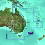
Garmin BlueChart g2 Vision – East Coast of Australia [Garmin Part Number: 010-C0756-00] – RRP $399
Get a fresh perspective when you take to the water with BlueChart® g2 Vision®. With BlueChart g2 Vision data, you’ll get detailed marine cartography that provides convenient viewing of nautical content and other premium features. BlueChart g2 Vision allows you to see your vessel’s precise, on-chart position in relation to naviads, coastal features, anchorages, obstructions, waterways, restricted areas and more. You will also have access to detailed mapping capabilities that include Safety Shading, Fishing Charts, smooth data transition between zoom levels, harmonious transition across chart borders, and reduction of chart discontinuities. Premium features include 3-D perspective above and below the waterline, Auto Guidance, high-resolution imagery, and “real picture” aerial photos of ports, harbours, marinas, waterways, landmarks and other points of interest. It’s the most realistic mapping display Garmin has ever offered.
Detailed coverage of the Eastern coast of Australia from Mornington Island to Fowlers Bay (VPC022R). Also includes detailed coverage of Cape York, the Great Barrier Reef, Brisbane, Sydney, Melbourne, Adelaide, Tasmania, and Norfolk Island (if another region is required please contact us for availability).
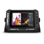
THIS IS SUITABLE FOR CURRENT MODEL GARMIN GPSMAP 7407xsv, GPSMAP 7408xsv, GPSMAP 7410xsv, GPSMAP 7412xsv, echoMAP 75dv, echoMAP 75sv & echoMAP 95sv SOUNDER/GPS COMBO UNITS, PLEASE SEE RELATED PRODUCTS OR ASK FOR FURTHER INFORMATION.
WARRANTY:
We are an authorised Australian Garmin retailer, as such Full Australian Manufacturers Warranty is applicable for this item. Please note if a Garmin unit is purchased overseas or from a non-authorised Garmin retailer you may not receive warranty coverage in Australia.
*Specifications from suppliers’ information. Actual depth capabilities depend on transducer installation, bottom type & water conditions. All sonars typically read deeper in freshwater than in saltwater. Images for display purposes only.
![Raymarine Axiom 7 - 7" Touch Screen Multifunction Navigation with integrated RealVision 3D, 600W Sonar with RV-100 transducer and AUS Mapping [Part Number #E70365-03-AUS]](https://www.northsidemarine.com.au/online-store/wp-content/uploads/sites/9/nc/catalog/Raymarine/Axiom7-tran-150x150.jpg) Raymarine Axiom 7 - 7" Touch Screen Multifunction Navigation with integrated RealVision 3D, 600W Sonar with RV-100 transducer and AUS Mapping [Part Number #E70365-03-AUS]
1 × $1,899.00
Raymarine Axiom 7 - 7" Touch Screen Multifunction Navigation with integrated RealVision 3D, 600W Sonar with RV-100 transducer and AUS Mapping [Part Number #E70365-03-AUS]
1 × $1,899.00