Sanctuary Cove
Showing 151–180 of 186 results
-
Garmin, Garmin Sonar & Transducers, Sanctuary Cove
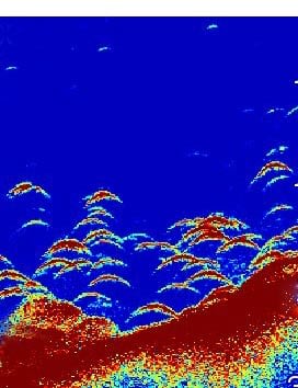
Garmin LiveScope™ Plus LVS34 Transducer only
Garmin LiveScope™ Plus LVS34 Transducer – THE BEST OF THE BEST JUST GOT BETTER
The latest in LiveScope technology, the LiveScope Plus System offers improved resolution, reduced noise, clearer images and better target separation.

See images clearly with improved screen clarity, transducer sensitivity and target separation.

Scan surroundings with sharper images, reduced noise and fewer sonar artifacts.

Upgrade your current LiveScope System black box (GLS™ 10 sonar module) with just a new transducer.

Get maximum contrast and clarity in your images with vivid colour palettes.

Don’t miss a thing with supported Forward, Down and Perspective modes and necessary mount.
SKU: 010-02706-10 -
Easter, EOFY, Garmin, Garmin Sonar & Transducers, Sanctuary Cove
Garmin LiveScope™ Plus System – with GLS 10™ and LVS34 Transducer
-3% Easter, EOFY, Garmin, Garmin Sonar & Transducers, Sanctuary Cove
Garmin LiveScope™ Plus System – with GLS 10™ and LVS34 Transducer
Garmin LiveScope™ Plus System – THE BEST OF THE BEST JUST GOT BETTER
The latest in LiveScope technology, the LiveScope Plus System offers improved resolution, reduced noise, clearer images and better target separation.
See images clearly with improved screen clarity, transducer sensitivity and target separation.
Scan surroundings with sharper images, reduced noise and fewer sonar artifacts.
Upgrade your current LiveScope System black box (GLS™ 10 sonar module) with just a new transducer.
Get maximum contrast and clarity in your images with vivid colour palettes.
Don’t miss a thing with supported Forward, Down and Perspective modes and necessary mount.
SKU: 010-02706-00 -
Garmin, Garmin Accessories, Sanctuary Cove
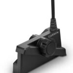
Garmin MSC 10 Marine Satellite Compass – Black
Garmin MSC 10 Marine Satellite Compass – KNOW EXACTLY WHERE YOU’RE HEADED
Get reliable, accurate heading information with the easy-to-install GPS-based MSC™ 10 Marine Satellite Compass.

Accuracy comes easy when you’ve got a multi-band GNSS receiver on board.

Faster updates. More detailed tracking.

Rough waters got you worried? MSC 10 delivers pitch, roll and heave info, too.

If other onboard systems need a heading sensor, we’ve got you covered.
SKU: 010-02407-10 -
Garmin, Garmin Accessories, Sanctuary Cove
Garmin MSC 10 Marine Satellite Compass – White
Garmin MSC 10 Marine Satellite Compass – KNOW EXACTLY WHERE YOU’RE HEADED
Get reliable, accurate heading information with the easy-to-install GPS-based MSC™ 10 Marine Satellite Compass.
Accuracy comes easy when you’ve got a multi-band GNSS receiver on board.
Faster updates. More detailed tracking.
Rough waters got you worried? MSC 10 delivers pitch, roll and heave info, too.
If other onboard systems need a heading sensor, we’ve got you covered.
SKU: 010-02407-00 -
Charts & Maps, EOFY, Garmin, Sanctuary Cove
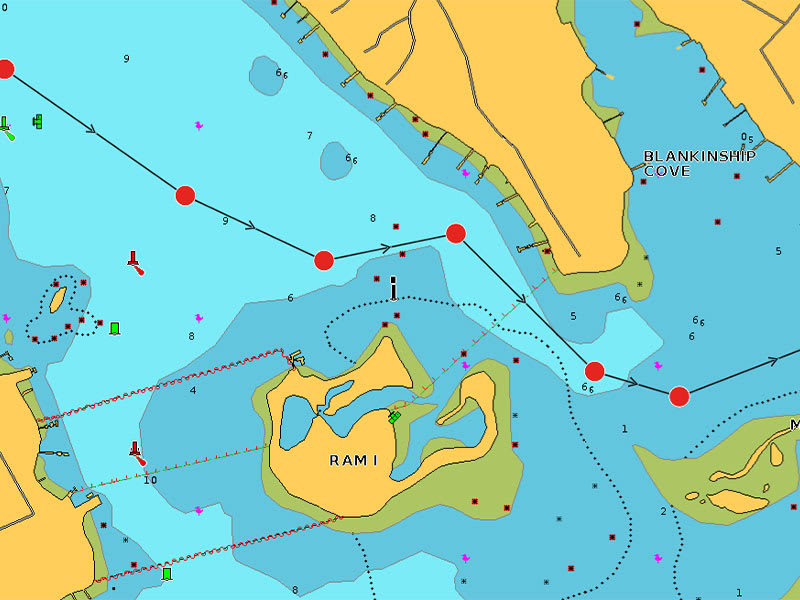
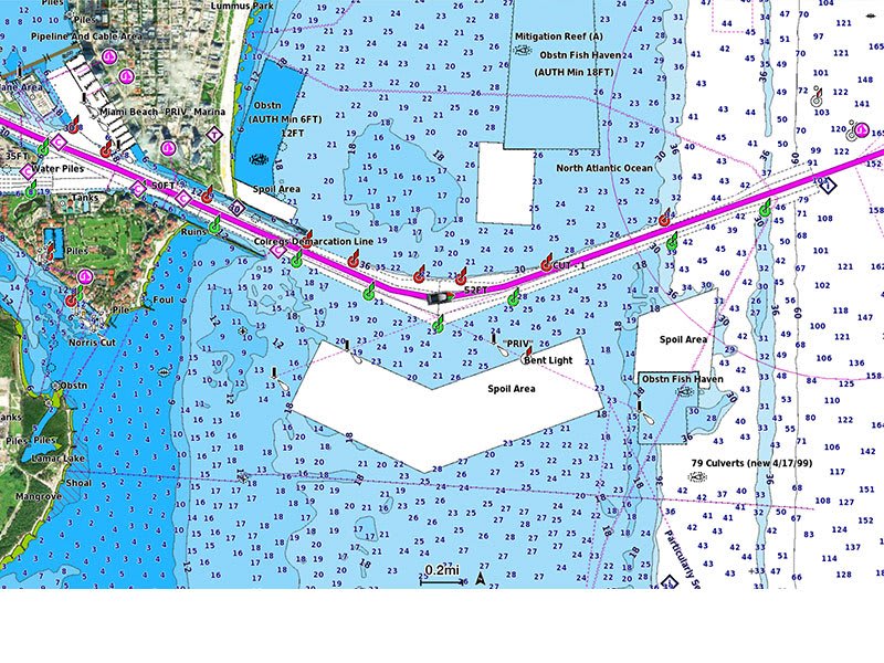
Garmin Navionics Platinum+™ Australia, Northeast – Marine Charts
-10% Charts & Maps, EOFY, Garmin, Sanctuary Cove
Garmin Navionics Platinum+™ Australia, Northeast – Marine Charts
Garmin Navionics Platinum+™ Australia, Northeast – Marine Charts
INTEGRATED MAPPING FOR A WIDE RANGE OF CHARTPLOTTERS
A comprehensive, all-in-one solution, Navionics+ charts and maps combine clear, reliable coastal/inland content with advanced guidance features and compatibility with a wide range of chartplotter brands.
 Navigate with our best offshore and inland lake coverage for your compatible chartplotter1.
 See it your way. Customise your view with various chart layers and overlay combinations.
 With your included 1-year subscription, access daily updates via the Navionics® chart installer software.
 Advanced route guidance technology2 lets you navigate with suggested dock-to-dock routings.
 Selectable map options let you highlight shallow areas, adjust contour density or select a fishing range.
 Save money — while continuing to access daily updates plus new content downloads — by renewing your subscription3.
Seamlessly navigate on coastal or inland waters.
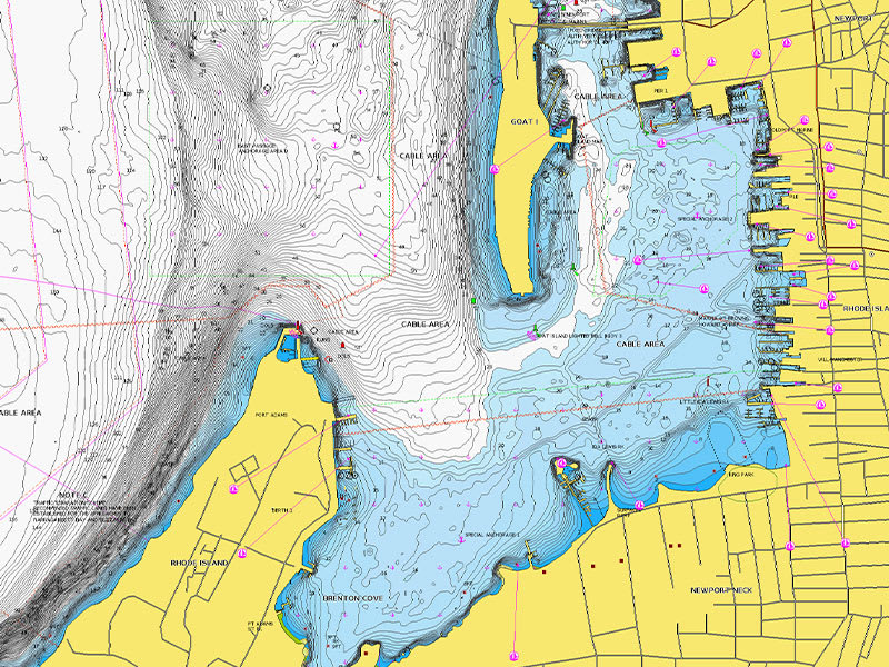
ALL-IN-ONE MAP SOLUTION
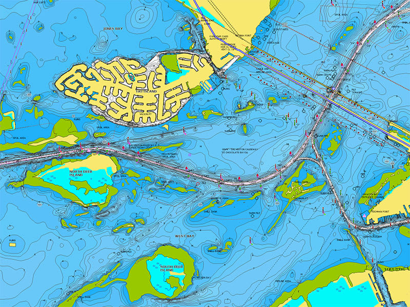
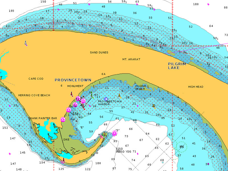
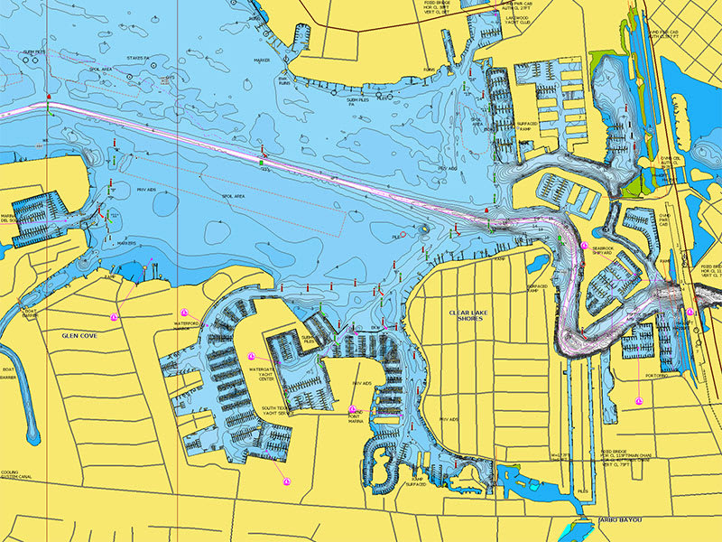
Access detail-rich mapping of coastal features, lakes, rivers and more on a wide range of compatible chartplotters. Integrated coastal and inland lake content offers coverage for boaters worldwide.

DAILY CHART UPDATES
Charts are constantly being enhanced with new and amended content — thousands of updates are made every day. The included 1-year subscription gives you access to daily chart updates via the Navionics chart installer software.
DOCK-TO-DOCK ROUTE GUIDANCE
Advanced route guidance technology2 uses your boat settings, along with chart data and frequently traveled routes, to calculate a suggested path to follow from dock to dock.
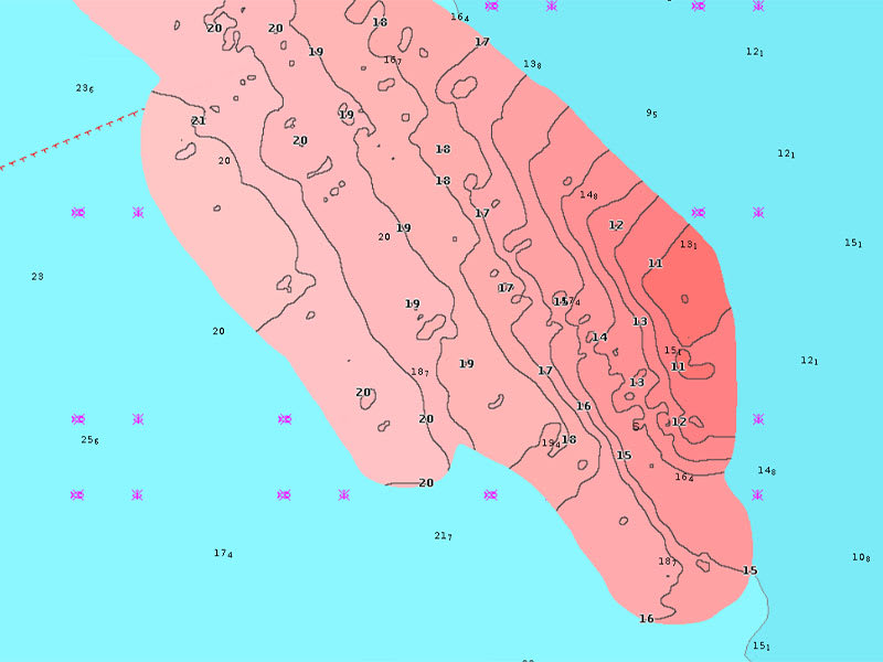
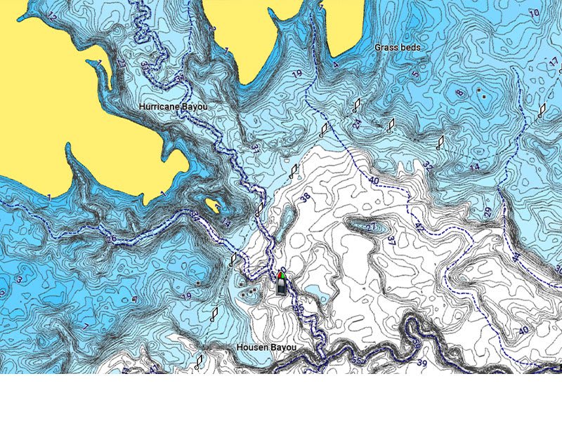
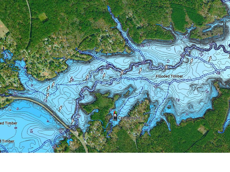
UP TO 0.5 M CONTOURS
For improved fishing and navigation, up to 0,5 m contours provide a clear depiction of bottom structure for fishing charts as well as enhanced detail in swamps, canals, harbours, marinas and more.
ADVANCED MAP OPTIONS
Change the way you view Navionics charts to focus on the details that matter most to you. Highlight shallow areas, adjust contour density, or select a fishing range.

COMMUNITY EDITS
Download community edits for useful local knowledge added by users of the Navionics Boating app, and view the data on your compatible chartplotter.
PLOTTER SYNC
Transfer routes and markers, update charts and more between your plotter card and mobile app — wirelessly. You can even activate or renew your cartography subscription and upload sonar logs4.
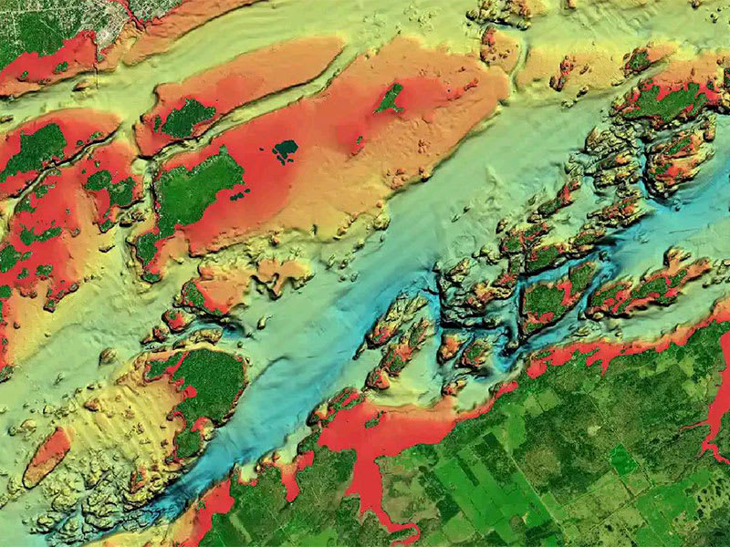
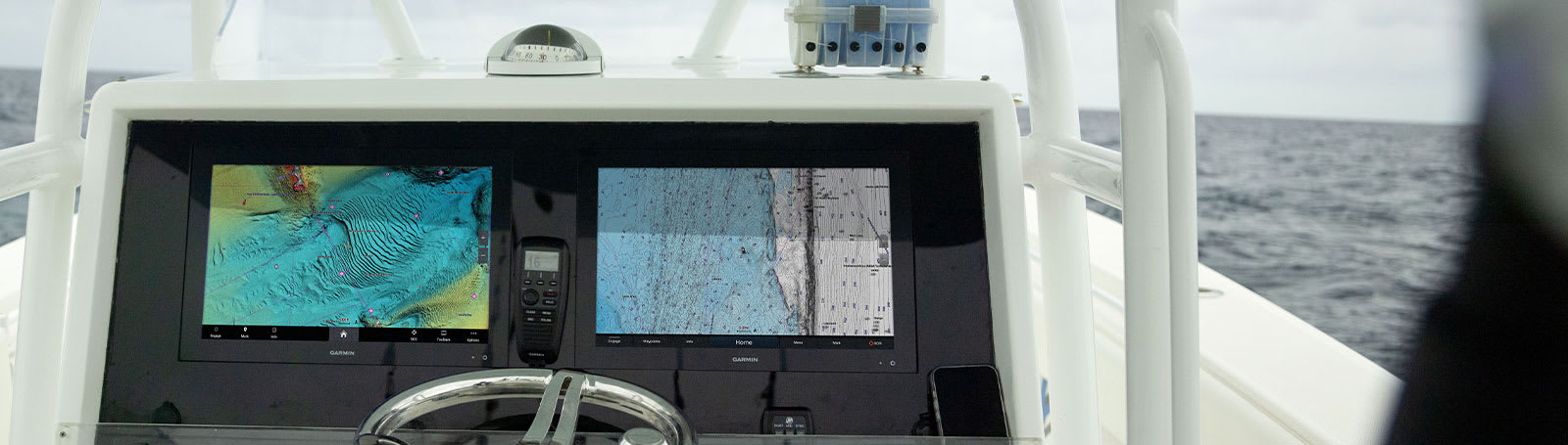
SONARCHART™ LIVE MAPPING
Create your own maps on the fly. Watch new 1’ HD bathymetry maps develop in real time as your boat moves through the water.
Add premium features with Navionics Platinum+™ mapping solutions.
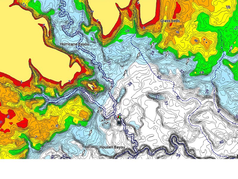
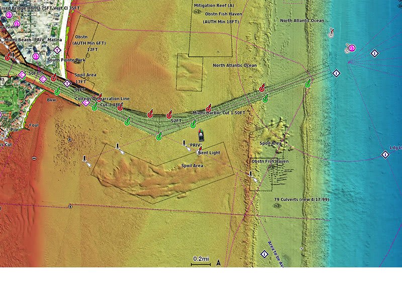
RELIEF SHADING
This downloadable shading feature5 combines color and shadow to give you an easy-to-interpret, clearer view of bottom structure than contour lines alone.
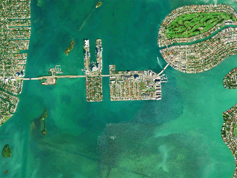
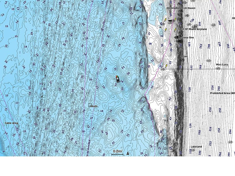
HIGH-RESOLUTION SATELLITE IMAGERY
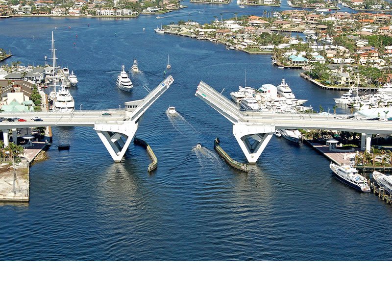
Downloadable high-resolution satellite imagery5 provides a realistic view of your surroundings — ideal for entering unfamiliar harbors or ports.
AERIAL PHOTOGRAPHY
Crystal-clear aerial and surface photos of ports, marinas, bridges, docks, boat ramps, dams and navigational landmarks provide a better sense of your surroundings above the waterline.
3D VIEW
Unique 3D views provide additional perspective, both above and below the water’s surface, to highlight key features and aid in situational awareness.
SKU: 010-C1360-40 -
Charts & Maps, EOFY, Garmin, Sanctuary Cove
Garmin Navionics Vision+™ Australia, East & Central to New Zealand – Marine Charts
-10% Charts & Maps, EOFY, Garmin, Sanctuary Cove
Garmin Navionics Vision+™ Australia, East & Central to New Zealand – Marine Charts
Garmin Navionics Vision+™ Australia, East & Central to New Zealand – Marine Charts
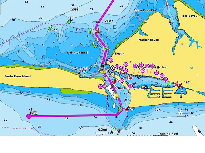
IT’S A WHOLE NEW LOOK ON YOUR CHARTPLOTTER
Featuring vibrant colors, a streamlined interface and combined coastal/inland content with a popular Navionics® style color palette, Garmin Navionics+ cartography makes it easy to plot your course with the world’s No. 1 name in marine mapping1.
 Navigate with our best offshore and inland lake coverage for your Garmin chartplotter.
 See it your way. Customize your view with various chart layers and overlay combinations.
 With your included one-year subscription, access daily updates via the ActiveCaptain® smart-device app.
 Auto Guidance+™ technology2 lets you navigate with suggested dock-to-dock routings.
 Select up to 10 color-shaded target depth ranges to scope out the best fishing spots. Save money by renewing your subscription — and continue accessing daily updates plus new content downloads.
Plot your paradise on coastal or inland waters.
ALL-IN-ONE MAP SOLUTION FOR GARMIN CHARTPLOTTERS
Access detail-rich mapping of coastal features, lakes, rivers and more. Integrated Garmin and Navionics® content offers coverage for boaters worldwide.
DAILY CHART UPDATES
Charts are constantly being enhanced with new and amended content: Thousands of updates are made every day. The one-year included subscription gives you access to daily chart updates via the ActiveCaptain app.
AUTO GUIDANCE+ TECHNOLOGY
Combining the best of Garmin and Navionics automatic routing features, built-in Auto Guidance+ technology2 gives you a suggested dock-to-dock path to follow through channels, inlets, marina entrances and more.
DEPTH RANGE SHADING
High-resolution depth range shading lets you select up to 10 color-shaded options and view your designated target depths at a glance.
UP TO 1’ CONTOURS
For improved fishing and navigation, up to 1′ contours provide a clear depiction of bottom structure for improved fishing charts and enhanced detail in swamps, canals, harbors, marinas and more.
SHALLOW WATER SHADING
To give a clear picture of shallow waters to avoid, this feature allows for shading at a user-defined depth.
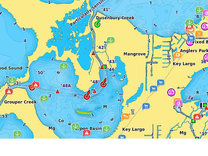
ACTIVECAPTAIN COMMUNITY
Community-sourced content provides useful points of interest, such as marinas, anchorages, hazards, businesses and more. Get recommendations from boaters with firsthand experience of the local environment.
Add premium features with Garmin Navionics Vision+ mapping solutions.
HIGH-RESOLUTION RELIEF SHADING
This detailed shading feature3 combines color and shadow to give you an easy-to-interpret, clearer view of bottom structure than contour lines alone.
HIGH-RESOLUTION SATELLITE IMAGERY
Downloadable high-resolution satellite imagery3 provides superior situational awareness.
AERIAL PHOTOS
Crystal-clear aerial and surface photos of ports, marinas, bridges, docks, boat ramps, dams and navigational landmarks provide a better sense of your surroundings above the waterline.
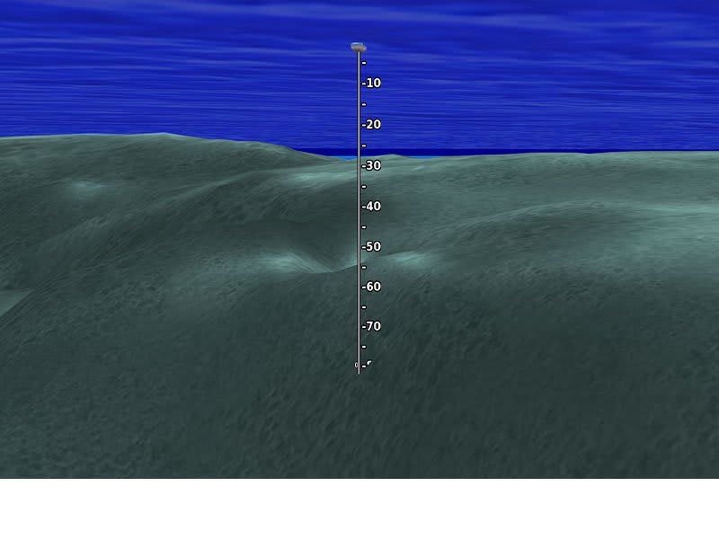
3D FISHEYE VIEW
This underwater perspective shows 3D representation of bottom and contours as seen from below the waterline. Interface with sonar data for a customized view.
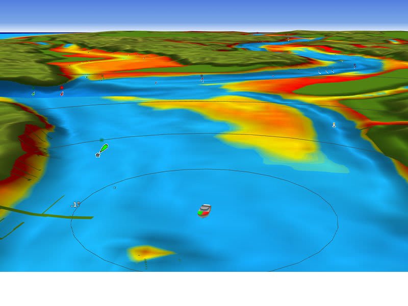
3D MARINEREYE VIEW
This view provides a 3D representation of the surrounding area both above and below the waterline.
DYNAMIC LAKE LEVEL
Adjust your maps to the lake’s current water levels to see if spots are accessible or too shallow to explore.
SKU: 010-C1482-00 -
Charts & Maps, EOFY, Garmin, Sanctuary Cove
Garmin Navionics Vision+™ Australia, Northeast – Inland and Coastal Marine Charts
-10% Charts & Maps, EOFY, Garmin, Sanctuary Cove
Garmin Navionics Vision+™ Australia, Northeast – Inland and Coastal Marine Charts
Garmin Navionics Vision+™ Australia, Northeast – Inland and Coastal Marine Charts
IT’S A WHOLE NEW LOOK ON YOUR CHARTPLOTTER
Featuring vibrant colors, a streamlined interface and combined coastal/inland content with a popular Navionics® style color palette, Garmin Navionics+ cartography makes it easy to plot your course with the world’s No. 1 name in marine mapping1.
Navigate with our best offshore and inland lake coverage for your Garmin chartplotter. See it your way. Customize your view with various chart layers and overlay combinations. With your included one-year subscription, access daily updates via the ActiveCaptain® smart-device app. Auto Guidance+™ technology2 lets you navigate with suggested dock-to-dock routings. Select up to 10 color-shaded target depth ranges to scope out the best fishing spots. Save money by renewing your subscription — and continue accessing daily updates plus new content downloads.Plot your paradise on coastal or inland waters.
ALL-IN-ONE MAP SOLUTION FOR GARMIN CHARTPLOTTERS
Access detail-rich mapping of coastal features, lakes, rivers and more. Integrated Garmin and Navionics® content offers coverage for boaters worldwide.
DAILY CHART UPDATES
Charts are constantly being enhanced with new and amended content: Thousands of updates are made every day. The one-year included subscription gives you access to daily chart updates via the ActiveCaptain app.
AUTO GUIDANCE+ TECHNOLOGY
Combining the best of Garmin and Navionics automatic routing features, built-in Auto Guidance+ technology2 gives you a suggested dock-to-dock path to follow through channels, inlets, marina entrances and more.
DEPTH RANGE SHADING
High-resolution depth range shading lets you select up to 10 color-shaded options and view your designated target depths at a glance.
UP TO 1’ CONTOURS
For improved fishing and navigation, up to 1′ contours provide a clear depiction of bottom structure for improved fishing charts and enhanced detail in swamps, canals, harbors, marinas and more.
SHALLOW WATER SHADING
To give a clear picture of shallow waters to avoid, this feature allows for shading at a user-defined depth.
ACTIVECAPTAIN COMMUNITY
Community-sourced content provides useful points of interest, such as marinas, anchorages, hazards, businesses and more. Get recommendations from boaters with firsthand experience of the local environment.
Add premium features with Garmin Navionics Vision+ mapping solutions.
HIGH-RESOLUTION RELIEF SHADING
This detailed shading feature3 combines color and shadow to give you an easy-to-interpret, clearer view of bottom structure than contour lines alone.
HIGH-RESOLUTION SATELLITE IMAGERY
Downloadable high-resolution satellite imagery3 provides superior situational awareness.
AERIAL PHOTOS
Crystal-clear aerial and surface photos of ports, marinas, bridges, docks, boat ramps, dams and navigational landmarks provide a better sense of your surroundings above the waterline.
3D FISHEYE VIEW
This underwater perspective shows 3D representation of bottom and contours as seen from below the waterline. Interface with sonar data for a customized view.
3D MARINEREYE VIEW
This view provides a 3D representation of the surrounding area both above and below the waterline.
DYNAMIC LAKE LEVEL
Adjust your maps to the lake’s current water levels to see if spots are accessible or too shallow to explore.
SKU: 010-C1281-00 -
Charts & Maps, EOFY, Garmin, Sanctuary Cove
Garmin Navionics Vision+™ Australia, Southeast – Inland and Coastal Marine Charts
-10% Charts & Maps, EOFY, Garmin, Sanctuary Cove
Garmin Navionics Vision+™ Australia, Southeast – Inland and Coastal Marine Charts
Garmin Navionics Vision+™ Australia, Southeast – Inland and Coastal Marine Charts
IT’S A WHOLE NEW LOOK ON YOUR CHARTPLOTTER
Featuring vibrant colors, a streamlined interface and combined coastal/inland content with a popular Navionics® style color palette, Garmin Navionics+ cartography makes it easy to plot your course with the world’s No. 1 name in marine mapping1.
Navigate with our best offshore and inland lake coverage for your Garmin chartplotter. See it your way. Customize your view with various chart layers and overlay combinations. With your included one-year subscription, access daily updates via the ActiveCaptain® smart-device app. Auto Guidance+™ technology2 lets you navigate with suggested dock-to-dock routings. Select up to 10 color-shaded target depth ranges to scope out the best fishing spots. Save money by renewing your subscription — and continue accessing daily updates plus new content downloads.Plot your paradise on coastal or inland waters.
ALL-IN-ONE MAP SOLUTION FOR GARMIN CHARTPLOTTERS
Access detail-rich mapping of coastal features, lakes, rivers and more. Integrated Garmin and Navionics® content offers coverage for boaters worldwide.
DAILY CHART UPDATES
Charts are constantly being enhanced with new and amended content: Thousands of updates are made every day. The one-year included subscription gives you access to daily chart updates via the ActiveCaptain app.
AUTO GUIDANCE+ TECHNOLOGY
Combining the best of Garmin and Navionics automatic routing features, built-in Auto Guidance+ technology2 gives you a suggested dock-to-dock path to follow through channels, inlets, marina entrances and more.
DEPTH RANGE SHADING
High-resolution depth range shading lets you select up to 10 color-shaded options and view your designated target depths at a glance.
UP TO 1’ CONTOURS
For improved fishing and navigation, up to 1′ contours provide a clear depiction of bottom structure for improved fishing charts and enhanced detail in swamps, canals, harbors, marinas and more.
SHALLOW WATER SHADING
To give a clear picture of shallow waters to avoid, this feature allows for shading at a user-defined depth.
ACTIVECAPTAIN COMMUNITY
Community-sourced content provides useful points of interest, such as marinas, anchorages, hazards, businesses and more. Get recommendations from boaters with firsthand experience of the local environment.
Add premium features with Garmin Navionics Vision+ mapping solutions.
HIGH-RESOLUTION RELIEF SHADING
This detailed shading feature3 combines color and shadow to give you an easy-to-interpret, clearer view of bottom structure than contour lines alone.
HIGH-RESOLUTION SATELLITE IMAGERY
Downloadable high-resolution satellite imagery3 provides superior situational awareness.
AERIAL PHOTOS
Crystal-clear aerial and surface photos of ports, marinas, bridges, docks, boat ramps, dams and navigational landmarks provide a better sense of your surroundings above the waterline.
3D FISHEYE VIEW
This underwater perspective shows 3D representation of bottom and contours as seen from below the waterline. Interface with sonar data for a customized view.
3D MARINEREYE VIEW
This view provides a 3D representation of the surrounding area both above and below the waterline.
DYNAMIC LAKE LEVEL
Adjust your maps to the lake’s current water levels to see if spots are accessible or too shallow to explore.
SKU: 010-C1282-00 -
Charts & Maps, EOFY, Garmin, Sanctuary Cove
Garmin Navionics Vision+™ Australia, West – Inland and Coastal Marine Charts
-10% Charts & Maps, EOFY, Garmin, Sanctuary Cove
Garmin Navionics Vision+™ Australia, West – Inland and Coastal Marine Charts
Garmin Navionics Vision+™ Australia, West – Inland and Coastal Marine Charts
IT’S A WHOLE NEW LOOK ON YOUR CHARTPLOTTER
Featuring vibrant colors, a streamlined interface and combined coastal/inland content with a popular Navionics® style color palette, Garmin Navionics+ cartography makes it easy to plot your course with the world’s No. 1 name in marine mapping1.
Navigate with our best offshore and inland lake coverage for your Garmin chartplotter. See it your way. Customize your view with various chart layers and overlay combinations. With your included one-year subscription, access daily updates via the ActiveCaptain® smart-device app. Auto Guidance+™ technology2 lets you navigate with suggested dock-to-dock routings. Select up to 10 color-shaded target depth ranges to scope out the best fishing spots. Save money by renewing your subscription — and continue accessing daily updates plus new content downloads.Plot your paradise on coastal or inland waters.
ALL-IN-ONE MAP SOLUTION FOR GARMIN CHARTPLOTTERS
Access detail-rich mapping of coastal features, lakes, rivers and more. Integrated Garmin and Navionics® content offers coverage for boaters worldwide.
DAILY CHART UPDATES
Charts are constantly being enhanced with new and amended content: Thousands of updates are made every day. The one-year included subscription gives you access to daily chart updates via the ActiveCaptain app.
AUTO GUIDANCE+ TECHNOLOGY
Combining the best of Garmin and Navionics automatic routing features, built-in Auto Guidance+ technology2 gives you a suggested dock-to-dock path to follow through channels, inlets, marina entrances and more.
DEPTH RANGE SHADING
High-resolution depth range shading lets you select up to 10 color-shaded options and view your designated target depths at a glance.
UP TO 1’ CONTOURS
For improved fishing and navigation, up to 1′ contours provide a clear depiction of bottom structure for improved fishing charts and enhanced detail in swamps, canals, harbors, marinas and more.
SHALLOW WATER SHADING
To give a clear picture of shallow waters to avoid, this feature allows for shading at a user-defined depth.
ACTIVECAPTAIN COMMUNITY
Community-sourced content provides useful points of interest, such as marinas, anchorages, hazards, businesses and more. Get recommendations from boaters with firsthand experience of the local environment.
Add premium features with Garmin Navionics Vision+ mapping solutions.
HIGH-RESOLUTION RELIEF SHADING
This detailed shading feature3 combines color and shadow to give you an easy-to-interpret, clearer view of bottom structure than contour lines alone.
HIGH-RESOLUTION SATELLITE IMAGERY
Downloadable high-resolution satellite imagery3 provides superior situational awareness.
AERIAL PHOTOS
Crystal-clear aerial and surface photos of ports, marinas, bridges, docks, boat ramps, dams and navigational landmarks provide a better sense of your surroundings above the waterline.
3D FISHEYE VIEW
This underwater perspective shows 3D representation of bottom and contours as seen from below the waterline. Interface with sonar data for a customized view.
3D MARINEREYE VIEW
This view provides a 3D representation of the surrounding area both above and below the waterline.
DYNAMIC LAKE LEVEL
Adjust your maps to the lake’s current water levels to see if spots are accessible or too shallow to explore.
SKU: 010-C1280-00 -
Charts & Maps, EOFY, Garmin, Sanctuary Cove
Garmin Navionics Vision+™ Australia, West & Central – Marine Charts
-10% Charts & Maps, EOFY, Garmin, Sanctuary Cove
Garmin Navionics Vision+™ Australia, West & Central – Marine Charts
Garmin Navionics Vision+™ Australia, West & Central – Marine Charts
IT’S A WHOLE NEW LOOK ON YOUR CHARTPLOTTER
Featuring vibrant colors, a streamlined interface and combined coastal/inland content with a popular Navionics® style color palette, Garmin Navionics+ cartography makes it easy to plot your course with the world’s No. 1 name in marine mapping1.
Navigate with our best offshore and inland lake coverage for your Garmin chartplotter. See it your way. Customize your view with various chart layers and overlay combinations. With your included one-year subscription, access daily updates via the ActiveCaptain® smart-device app. Auto Guidance+™ technology2 lets you navigate with suggested dock-to-dock routings. Select up to 10 color-shaded target depth ranges to scope out the best fishing spots. Save money by renewing your subscription — and continue accessing daily updates plus new content downloads.Plot your paradise on coastal or inland waters.
ALL-IN-ONE MAP SOLUTION FOR GARMIN CHARTPLOTTERS
Access detail-rich mapping of coastal features, lakes, rivers and more. Integrated Garmin and Navionics® content offers coverage for boaters worldwide.
DAILY CHART UPDATES
Charts are constantly being enhanced with new and amended content: Thousands of updates are made every day. The one-year included subscription gives you access to daily chart updates via the ActiveCaptain app.
AUTO GUIDANCE+ TECHNOLOGY
Combining the best of Garmin and Navionics automatic routing features, built-in Auto Guidance+ technology2 gives you a suggested dock-to-dock path to follow through channels, inlets, marina entrances and more.
DEPTH RANGE SHADING
High-resolution depth range shading lets you select up to 10 color-shaded options and view your designated target depths at a glance.
UP TO 1’ CONTOURS
For improved fishing and navigation, up to 1′ contours provide a clear depiction of bottom structure for improved fishing charts and enhanced detail in swamps, canals, harbors, marinas and more.
SHALLOW WATER SHADING
To give a clear picture of shallow waters to avoid, this feature allows for shading at a user-defined depth.
ACTIVECAPTAIN COMMUNITY
Community-sourced content provides useful points of interest, such as marinas, anchorages, hazards, businesses and more. Get recommendations from boaters with firsthand experience of the local environment.
Add premium features with Garmin Navionics Vision+ mapping solutions.
HIGH-RESOLUTION RELIEF SHADING
This detailed shading feature3 combines color and shadow to give you an easy-to-interpret, clearer view of bottom structure than contour lines alone.
HIGH-RESOLUTION SATELLITE IMAGERY
Downloadable high-resolution satellite imagery3 provides superior situational awareness.
AERIAL PHOTOS
Crystal-clear aerial and surface photos of ports, marinas, bridges, docks, boat ramps, dams and navigational landmarks provide a better sense of your surroundings above the waterline.
3D FISHEYE VIEW
This underwater perspective shows 3D representation of bottom and contours as seen from below the waterline. Interface with sonar data for a customized view.
3D MARINEREYE VIEW
This view provides a 3D representation of the surrounding area both above and below the waterline.
DYNAMIC LAKE LEVEL
Adjust your maps to the lake’s current water levels to see if spots are accessible or too shallow to explore.
SKU: 010-C1483-00 -
Charts & Maps, EOFY, Garmin, Sanctuary Cove
Garmin Navionics®+ Australia, Northeast – Marine Charts
-10% Charts & Maps, EOFY, Garmin, Sanctuary Cove
Garmin Navionics®+ Australia, Northeast – Marine Charts
Garmin Navionics®+ Australia, Northeast – Marine Charts
INTEGRATED MAPPING FOR A WIDE RANGE OF CHARTPLOTTERS
A comprehensive, all-in-one solution, Navionics+ charts and maps combine clear, reliable coastal/inland content with advanced guidance features and compatibility with a wide range of chartplotter brands.
Navigate with our best offshore and inland lake coverage for your compatible chartplotter1. See it your way. Customise your view with various chart layers and overlay combinations. With your included 1-year subscription, access daily updates via the Navionics® chart installer software. Advanced route guidance technology2 lets you navigate with suggested dock-to-dock routings. Selectable map options let you highlight shallow areas, adjust contour density or select a fishing range. Save money — while continuing to access daily updates plus new content downloads — by renewing your subscription3.SKU: 010-C1360-30 -
Charts & Maps, EOFY, Garmin, Sanctuary Cove
Garmin Navionics®+ Australia, Southeast – Marine Charts
-10% Charts & Maps, EOFY, Garmin, Sanctuary Cove
Garmin Navionics®+ Australia, Southeast – Marine Charts
Garmin Navionics®+ Australia, Southeast – Marine Charts
INTEGRATED MAPPING FOR A WIDE RANGE OF CHARTPLOTTERS
A comprehensive, all-in-one solution, Navionics+ charts and maps combine clear, reliable coastal/inland content with advanced guidance features and compatibility with a wide range of chartplotter brands.
Navigate with our best offshore and inland lake coverage for your compatible chartplotter1. See it your way. Customise your view with various chart layers and overlay combinations. With your included 1-year subscription, access daily updates via the Navionics® chart installer software. Advanced route guidance technology2 lets you navigate with suggested dock-to-dock routings. Selectable map options let you highlight shallow areas, adjust contour density or select a fishing range. Save money — while continuing to access daily updates plus new content downloads — by renewing your subscription3.SKU: 010-C1361-30 -
Charts & Maps, EOFY, Garmin, Sanctuary Cove
Garmin Navionics+™ Australia, East & Central to New Zealand – Marine Charts
-10% Charts & Maps, EOFY, Garmin, Sanctuary Cove
Garmin Navionics+™ Australia, East & Central to New Zealand – Marine Charts
Garmin Navionics+™ Australia, East & Central to New Zealand – Marine Charts
IT’S A WHOLE NEW LOOK ON YOUR CHARTPLOTTER
Featuring vibrant colors, a streamlined interface and combined coastal/inland content with a popular Navionics® style color palette, Garmin Navionics+ cartography makes it easy to plot your course with the world’s No. 1 name in marine mapping1.
Navigate with our best offshore and inland lake coverage for your Garmin chartplotter. See it your way. Customize your view with various chart layers and overlay combinations. With your included one-year subscription, access daily updates via the ActiveCaptain® smart-device app. Auto Guidance+™ technology2 lets you navigate with suggested dock-to-dock routings. Select up to 10 color-shaded target depth ranges to scope out the best fishing spots. Save money by renewing your subscription — and continue accessing daily updates plus new content downloads.Plot your paradise on coastal or inland waters.
ALL-IN-ONE MAP SOLUTION FOR GARMIN CHARTPLOTTERS
Access detail-rich mapping of coastal features, lakes, rivers and more. Integrated Garmin and Navionics® content offers coverage for boaters worldwide.
DAILY CHART UPDATES
Charts are constantly being enhanced with new and amended content: Thousands of updates are made every day. The one-year included subscription gives you access to daily chart updates via the ActiveCaptain app.
AUTO GUIDANCE+ TECHNOLOGY
Combining the best of Garmin and Navionics automatic routing features, built-in Auto Guidance+ technology2 gives you a suggested dock-to-dock path to follow through channels, inlets, marina entrances and more.
DEPTH RANGE SHADING
High-resolution depth range shading lets you select up to 10 color-shaded options and view your designated target depths at a glance.
UP TO 1’ CONTOURS
For improved fishing and navigation, up to 1′ contours provide a clear depiction of bottom structure for improved fishing charts and enhanced detail in swamps, canals, harbors, marinas and more.
SHALLOW WATER SHADING
To give a clear picture of shallow waters to avoid, this feature allows for shading at a user-defined depth.
ACTIVECAPTAIN COMMUNITY
Community-sourced content provides useful points of interest, such as marinas, anchorages, hazards, businesses and more. Get recommendations from boaters with firsthand experience of the local environment.
Add premium features with Garmin Navionics Vision+ mapping solutions.
HIGH-RESOLUTION RELIEF SHADING
This detailed shading feature3 combines color and shadow to give you an easy-to-interpret, clearer view of bottom structure than contour lines alone.
HIGH-RESOLUTION SATELLITE IMAGERY
Downloadable high-resolution satellite imagery3 provides superior situational awareness.
AERIAL PHOTOS
Crystal-clear aerial and surface photos of ports, marinas, bridges, docks, boat ramps, dams and navigational landmarks provide a better sense of your surroundings above the waterline.
3D FISHEYE VIEW
This underwater perspective shows 3D representation of bottom and contours as seen from below the waterline. Interface with sonar data for a customized view.
3D MARINEREYE VIEW
This view provides a 3D representation of the surrounding area both above and below the waterline.
DYNAMIC LAKE LEVEL
Adjust your maps to the lake’s current water levels to see if spots are accessible or too shallow to explore.
SKU: 010-C1482-20 -
Charts & Maps, EOFY, Garmin, Sanctuary Cove
Garmin Navionics+™ Australia, Northeast – Inland and Coastal Marine Charts
-10% Charts & Maps, EOFY, Garmin, Sanctuary Cove
Garmin Navionics+™ Australia, Northeast – Inland and Coastal Marine Charts
Garmin Navionics+™ Australia, Northeast – Inland and Coastal Marine Charts
IT’S A WHOLE NEW LOOK ON YOUR CHARTPLOTTER
Featuring vibrant colors, a streamlined interface and combined coastal/inland content with a popular Navionics® style color palette, Garmin Navionics+ cartography makes it easy to plot your course with the world’s No. 1 name in marine mapping1.
Navigate with our best offshore and inland lake coverage for your Garmin chartplotter. See it your way. Customize your view with various chart layers and overlay combinations. With your included one-year subscription, access daily updates via the ActiveCaptain® smart-device app. Auto Guidance+™ technology2 lets you navigate with suggested dock-to-dock routings. Select up to 10 color-shaded target depth ranges to scope out the best fishing spots. Save money by renewing your subscription — and continue accessing daily updates plus new content downloads.Plot your paradise on coastal or inland waters.
ALL-IN-ONE MAP SOLUTION FOR GARMIN CHARTPLOTTERS
Access detail-rich mapping of coastal features, lakes, rivers and more. Integrated Garmin and Navionics® content offers coverage for boaters worldwide.
DAILY CHART UPDATES
Charts are constantly being enhanced with new and amended content: Thousands of updates are made every day. The one-year included subscription gives you access to daily chart updates via the ActiveCaptain app.
AUTO GUIDANCE+ TECHNOLOGY
Combining the best of Garmin and Navionics automatic routing features, built-in Auto Guidance+ technology2 gives you a suggested dock-to-dock path to follow through channels, inlets, marina entrances and more.
DEPTH RANGE SHADING
High-resolution depth range shading lets you select up to 10 color-shaded options and view your designated target depths at a glance.
UP TO 1’ CONTOURS
For improved fishing and navigation, up to 1′ contours provide a clear depiction of bottom structure for improved fishing charts and enhanced detail in swamps, canals, harbors, marinas and more.
SHALLOW WATER SHADING
To give a clear picture of shallow waters to avoid, this feature allows for shading at a user-defined depth.
ACTIVECAPTAIN COMMUNITY
Community-sourced content provides useful points of interest, such as marinas, anchorages, hazards, businesses and more. Get recommendations from boaters with firsthand experience of the local environment.
Add premium features with Garmin Navionics Vision+ mapping solutions.
HIGH-RESOLUTION RELIEF SHADING
This detailed shading feature3 combines color and shadow to give you an easy-to-interpret, clearer view of bottom structure than contour lines alone.
HIGH-RESOLUTION SATELLITE IMAGERY
Downloadable high-resolution satellite imagery3 provides superior situational awareness.
AERIAL PHOTOS
Crystal-clear aerial and surface photos of ports, marinas, bridges, docks, boat ramps, dams and navigational landmarks provide a better sense of your surroundings above the waterline.
3D FISHEYE VIEW
This underwater perspective shows 3D representation of bottom and contours as seen from below the waterline. Interface with sonar data for a customized view.
3D MARINEREYE VIEW
This view provides a 3D representation of the surrounding area both above and below the waterline.
DYNAMIC LAKE LEVEL
Adjust your maps to the lake’s current water levels to see if spots are accessible or too shallow to explore.
SKU: 010-C1281-20 -
Charts & Maps, EOFY, Garmin, Sanctuary Cove
Garmin Navionics+™ Australia, Southeast – Inland and Coastal Marine Charts
-10% Charts & Maps, EOFY, Garmin, Sanctuary Cove
Garmin Navionics+™ Australia, Southeast – Inland and Coastal Marine Charts
Garmin Navionics+™ Australia, Southeast – Inland and Coastal Marine Charts
IT’S A WHOLE NEW LOOK ON YOUR CHARTPLOTTER
Featuring vibrant colors, a streamlined interface and combined coastal/inland content with a popular Navionics® style color palette, Garmin Navionics+ cartography makes it easy to plot your course with the world’s No. 1 name in marine mapping1.
Navigate with our best offshore and inland lake coverage for your Garmin chartplotter. See it your way. Customize your view with various chart layers and overlay combinations. With your included one-year subscription, access daily updates via the ActiveCaptain® smart-device app. Auto Guidance+™ technology2 lets you navigate with suggested dock-to-dock routings. Select up to 10 color-shaded target depth ranges to scope out the best fishing spots. Save money by renewing your subscription — and continue accessing daily updates plus new content downloads.Plot your paradise on coastal or inland waters.
ALL-IN-ONE MAP SOLUTION FOR GARMIN CHARTPLOTTERS
Access detail-rich mapping of coastal features, lakes, rivers and more. Integrated Garmin and Navionics® content offers coverage for boaters worldwide.
DAILY CHART UPDATES
Charts are constantly being enhanced with new and amended content: Thousands of updates are made every day. The one-year included subscription gives you access to daily chart updates via the ActiveCaptain app.
AUTO GUIDANCE+ TECHNOLOGY
Combining the best of Garmin and Navionics automatic routing features, built-in Auto Guidance+ technology2 gives you a suggested dock-to-dock path to follow through channels, inlets, marina entrances and more.
DEPTH RANGE SHADING
High-resolution depth range shading lets you select up to 10 color-shaded options and view your designated target depths at a glance.
UP TO 1’ CONTOURS
For improved fishing and navigation, up to 1′ contours provide a clear depiction of bottom structure for improved fishing charts and enhanced detail in swamps, canals, harbors, marinas and more.
SHALLOW WATER SHADING
To give a clear picture of shallow waters to avoid, this feature allows for shading at a user-defined depth.
ACTIVECAPTAIN COMMUNITY
Community-sourced content provides useful points of interest, such as marinas, anchorages, hazards, businesses and more. Get recommendations from boaters with firsthand experience of the local environment.
Add premium features with Garmin Navionics Vision+ mapping solutions.
HIGH-RESOLUTION RELIEF SHADING
This detailed shading feature3 combines color and shadow to give you an easy-to-interpret, clearer view of bottom structure than contour lines alone.
HIGH-RESOLUTION SATELLITE IMAGERY
Downloadable high-resolution satellite imagery3 provides superior situational awareness.
AERIAL PHOTOS
Crystal-clear aerial and surface photos of ports, marinas, bridges, docks, boat ramps, dams and navigational landmarks provide a better sense of your surroundings above the waterline.
3D FISHEYE VIEW
This underwater perspective shows 3D representation of bottom and contours as seen from below the waterline. Interface with sonar data for a customized view.
3D MARINEREYE VIEW
This view provides a 3D representation of the surrounding area both above and below the waterline.
DYNAMIC LAKE LEVEL
Adjust your maps to the lake’s current water levels to see if spots are accessible or too shallow to explore.
SKU: 010-C1282-20 -
Charts & Maps, EOFY, Garmin, Sanctuary Cove
Garmin Navionics+™ Australia, West – Inland and Coastal – Marine Charts
-10% Charts & Maps, EOFY, Garmin, Sanctuary Cove
Garmin Navionics+™ Australia, West – Inland and Coastal – Marine Charts
Garmin Navionics+™ Australia, West & Central – Marine Charts
IT’S A WHOLE NEW LOOK ON YOUR CHARTPLOTTER
Featuring vibrant colors, a streamlined interface and combined coastal/inland content with a popular Navionics® style color palette, Garmin Navionics+ cartography makes it easy to plot your course with the world’s No. 1 name in marine mapping1.
Navigate with our best offshore and inland lake coverage for your Garmin chartplotter. See it your way. Customize your view with various chart layers and overlay combinations. With your included one-year subscription, access daily updates via the ActiveCaptain® smart-device app. Auto Guidance+™ technology2 lets you navigate with suggested dock-to-dock routings. Select up to 10 color-shaded target depth ranges to scope out the best fishing spots. Save money by renewing your subscription — and continue accessing daily updates plus new content downloads.Plot your paradise on coastal or inland waters.
ALL-IN-ONE MAP SOLUTION FOR GARMIN CHARTPLOTTERS
Access detail-rich mapping of coastal features, lakes, rivers and more. Integrated Garmin and Navionics® content offers coverage for boaters worldwide.
DAILY CHART UPDATES
Charts are constantly being enhanced with new and amended content: Thousands of updates are made every day. The one-year included subscription gives you access to daily chart updates via the ActiveCaptain app.
AUTO GUIDANCE+ TECHNOLOGY
Combining the best of Garmin and Navionics automatic routing features, built-in Auto Guidance+ technology2 gives you a suggested dock-to-dock path to follow through channels, inlets, marina entrances and more.
DEPTH RANGE SHADING
High-resolution depth range shading lets you select up to 10 color-shaded options and view your designated target depths at a glance.
UP TO 1’ CONTOURS
For improved fishing and navigation, up to 1′ contours provide a clear depiction of bottom structure for improved fishing charts and enhanced detail in swamps, canals, harbors, marinas and more.
SHALLOW WATER SHADING
To give a clear picture of shallow waters to avoid, this feature allows for shading at a user-defined depth.
ACTIVECAPTAIN COMMUNITY
Community-sourced content provides useful points of interest, such as marinas, anchorages, hazards, businesses and more. Get recommendations from boaters with firsthand experience of the local environment.
Add premium features with Garmin Navionics Vision+ mapping solutions.
HIGH-RESOLUTION RELIEF SHADING
This detailed shading feature3 combines color and shadow to give you an easy-to-interpret, clearer view of bottom structure than contour lines alone.
HIGH-RESOLUTION SATELLITE IMAGERY
Downloadable high-resolution satellite imagery3 provides superior situational awareness.
AERIAL PHOTOS
Crystal-clear aerial and surface photos of ports, marinas, bridges, docks, boat ramps, dams and navigational landmarks provide a better sense of your surroundings above the waterline.
3D FISHEYE VIEW
This underwater perspective shows 3D representation of bottom and contours as seen from below the waterline. Interface with sonar data for a customized view.
3D MARINEREYE VIEW
This view provides a 3D representation of the surrounding area both above and below the waterline.
DYNAMIC LAKE LEVEL
Adjust your maps to the lake’s current water levels to see if spots are accessible or too shallow to explore.
SKU: 010-C1280-20 -
Charts & Maps, EOFY, Garmin, Sanctuary Cove
Garmin Navionics+™ Australia, West & Central – Marine Charts
-10% Charts & Maps, EOFY, Garmin, Sanctuary Cove
Garmin Navionics+™ Australia, West & Central – Marine Charts
Garmin Navionics+™ Australia, West & Central – Marine Charts
IT’S A WHOLE NEW LOOK ON YOUR CHARTPLOTTER
Featuring vibrant colors, a streamlined interface and combined coastal/inland content with a popular Navionics® style color palette, Garmin Navionics+ cartography makes it easy to plot your course with the world’s No. 1 name in marine mapping1.
Navigate with our best offshore and inland lake coverage for your Garmin chartplotter. See it your way. Customize your view with various chart layers and overlay combinations. With your included one-year subscription, access daily updates via the ActiveCaptain® smart-device app. Auto Guidance+™ technology2 lets you navigate with suggested dock-to-dock routings. Select up to 10 color-shaded target depth ranges to scope out the best fishing spots. Save money by renewing your subscription — and continue accessing daily updates plus new content downloads.Plot your paradise on coastal or inland waters.
ALL-IN-ONE MAP SOLUTION FOR GARMIN CHARTPLOTTERS
Access detail-rich mapping of coastal features, lakes, rivers and more. Integrated Garmin and Navionics® content offers coverage for boaters worldwide.
DAILY CHART UPDATES
Charts are constantly being enhanced with new and amended content: Thousands of updates are made every day. The one-year included subscription gives you access to daily chart updates via the ActiveCaptain app.
AUTO GUIDANCE+ TECHNOLOGY
Combining the best of Garmin and Navionics automatic routing features, built-in Auto Guidance+ technology2 gives you a suggested dock-to-dock path to follow through channels, inlets, marina entrances and more.
DEPTH RANGE SHADING
High-resolution depth range shading lets you select up to 10 color-shaded options and view your designated target depths at a glance.
UP TO 1’ CONTOURS
For improved fishing and navigation, up to 1′ contours provide a clear depiction of bottom structure for improved fishing charts and enhanced detail in swamps, canals, harbors, marinas and more.
SHALLOW WATER SHADING
To give a clear picture of shallow waters to avoid, this feature allows for shading at a user-defined depth.
ACTIVECAPTAIN COMMUNITY
Community-sourced content provides useful points of interest, such as marinas, anchorages, hazards, businesses and more. Get recommendations from boaters with firsthand experience of the local environment.
Add premium features with Garmin Navionics Vision+ mapping solutions.
HIGH-RESOLUTION RELIEF SHADING
This detailed shading feature3 combines color and shadow to give you an easy-to-interpret, clearer view of bottom structure than contour lines alone.
HIGH-RESOLUTION SATELLITE IMAGERY
Downloadable high-resolution satellite imagery3 provides superior situational awareness.
AERIAL PHOTOS
Crystal-clear aerial and surface photos of ports, marinas, bridges, docks, boat ramps, dams and navigational landmarks provide a better sense of your surroundings above the waterline.
3D FISHEYE VIEW
This underwater perspective shows 3D representation of bottom and contours as seen from below the waterline. Interface with sonar data for a customized view.
3D MARINEREYE VIEW
This view provides a 3D representation of the surrounding area both above and below the waterline.
DYNAMIC LAKE LEVEL
Adjust your maps to the lake’s current water levels to see if spots are accessible or too shallow to explore.
SKU: 010-C1483-20 -
Garmin, Garmin Accessories, Sanctuary Cove
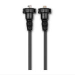
Garmin NMEA 2000 Starter Kit
Garmin NMEA 2000 Starter Kit
Our starter kit has everything you need to build a basic NMEA 2000 network on your boat. The kit includes an NMEA 2000 drop cable (2 m), backbone cable (6 m), power cable (2 m), 2 T-connectors, and male and female terminator connectors.
SKU: 010-11442-00 -
Easter, EOFY, Garmin, Garmin Sonar & Transducers, Sanctuary Cove
Garmin Panoptix LiveScope™ XR System – with GLS 10™ and LVS62 Transducer
-39%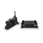 Easter, EOFY, Garmin, Garmin Sonar & Transducers, Sanctuary Cove
Garmin Panoptix LiveScope™ XR System – with GLS 10™ and LVS62 Transducer
Garmin Panoptix LiveScope™ XR System – THE BEST OF THE BEST JUST HIT THE OPEN WATER
You didn’t think it could get better, but it did with the extended range of the LiveScope XR System. It’s the latest in LiveScope technology, now for coastal and open-water fishing.

Explore the deep with an extended range up to 500’ in freshwater and 350’ in saltwater.

Find fish circling your boat with clear views close around your hull.

Upgrade your current LiveScope System black box (GLS™ 10 sonar module) with just a new transducer.

Get maximum contrast and clarity in your images with vivid color palettes.

Don’t miss a thing with supported Forward, Down and Perspective modes plus necessary mount.
SKU: 010-02719-00 -
Garmin, Garmin Sonar & Transducers, Sanctuary Cove
Garmin Panoptix™ PS51-TH – Premium FrontVü Forward-looking Sonar
 Garmin, Garmin Sonar & Transducers, Sanctuary Cove
Garmin Panoptix™ PS51-TH – Premium FrontVü Forward-looking Sonar
Garmin Panoptix™ PS51-TH – Premium FrontVü Forward-looking Sonar
- Premium FrontVü forward-looking sonar helps you avoid running aground¹
- Narrow beam, forward-looking sonar that focuses on the bottom in front of your boat
- Displays the bottom up to 300 feet ahead of your boat in real time
- Delivers nearly instant feedback to give you more time to react
- Also offers LiveVü forward for fishing – see fish swimming in front of your boat, even when stationary
The Panoptix multibeam thru-hull transducer with premium FrontVü forward-looking sonar helps you avoid running aground¹ by displaying the bottom ahead of your boat in real time on your chartplotter. It also includes LiveVü Forward sonar to give you the unique ability to see fish — even divers — swimming in real time under and ahead of your boat with a 100-foot forward range.
Panoptix FrontVü sonar displays bottom up to 300 feet ahead of the boat (at 8 to 10 times the current depth) and delivers nearly instant feedback to give you more time to react. You can be more confident when navigating unfamiliar water because Panoptix FrontVü has a narrow beam, forward-looking sonar (20 degrees). This allows you to focus on the bottom in front of your boat and not be confused with what is off to each side. It also includes an AHRS sensor for motion stabilization that allows you to see what is in front of your boat even in rough water conditions. And all the FrontVü forward-looking sonar image data can be easily shared with other chartplotters across the Garmin Marine Network.
SKU: 010-01753-00 -
Garmin, Garmin Sonar & Transducers, Sanctuary Cove
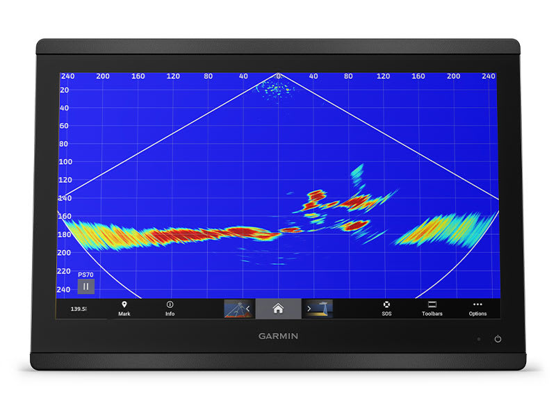
Garmin Panoptix™ PS70 Sonar with Transducer and Fairing Block
-2%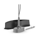 Garmin, Garmin Sonar & Transducers, Sanctuary Cove
Garmin Panoptix™ PS70 Sonar with Transducer and Fairing Block
Garmin Panoptix™ PS70 Sonar with Transducer and Fairing Block – SEE FISH LIVE. CATCH FISH DEEP.
The Panoptix™ PS70 stainless steel thru-hull transducer is powered by Garmin RapidReturn™ sonar, which gives you live sonar views up to 300 metres below the surface.
LIVE SONAR UP TO 300 METRES
MULTIPLE SONAR MODES

WIDE SONAR BEAM

IMAGE STABILISATION

THRU-HULL MOUNTING

800-WATT POWER OUTPUT
WHAT YOU’LL LOVE
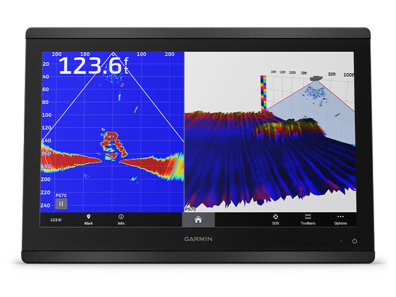
GARMIN RAPIDRETURN SONAR
This sonar sends multiple simultaneous pings through the water column. The result is live sonar capabilities up to 300 metres, giving deep sea anglers a real-time view of what’s below the surface.
LIVEVÜ™ DOWN SONAR
See real-time live sonar images up to 300 metres. With Garmin RapidReturn, anglers can see small baitfish and target game fish in real time. The wide 120-degree beam angle covers huge areas of water.
TRADITIONAL SONAR
View crisp, clear fish arches with excellent separation of targets under the boat.
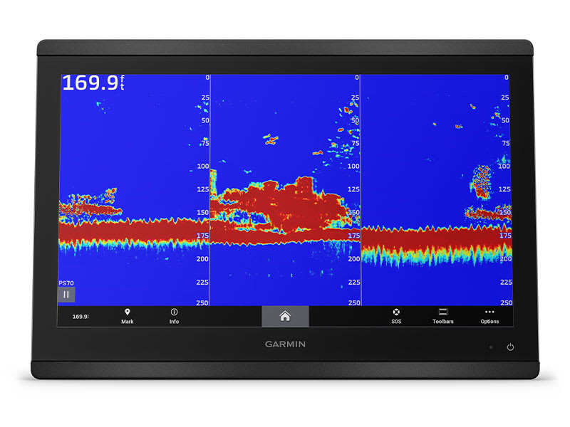
TRIPLE-BEAM SONAR
Get a 3-way traditional sonar split that gives sonar returns from the port and starboard directions, as well as targets directly under the boat, in an easy-to-understand traditional sonar view. Adjust the beam angles to fine-tune your 3 columns of sonar data.
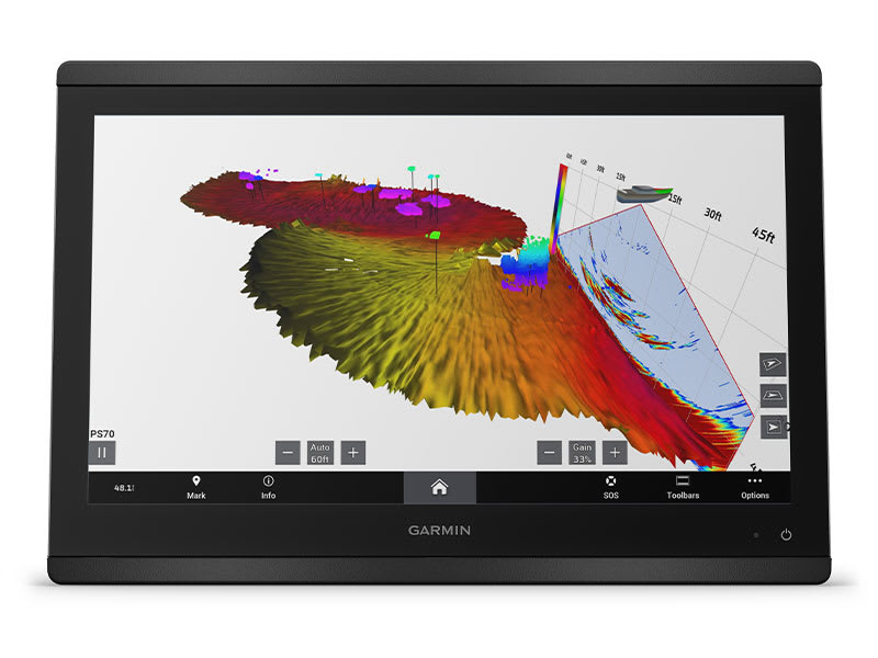
REALVÜ™ 3D SONAR
Historical scanning technology helps find fish and build a map of the ocean floor while your boat is moving. It shows the entire water column you have passed over in 3D, from the bottom to the surface and all fish in between. The True Motion 3D sonar returns feature now follows the vessel’s course over ground.
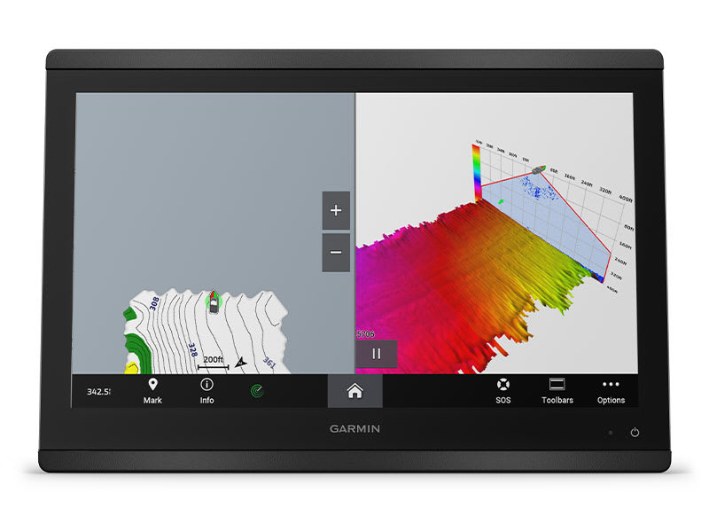
QUICKDRAW CONTOURS FEATURE
Survey areas of the ocean floor in great detail. New QuickDraw Contours feature improvement allows users to survey wide swaths of the ocean floor, even at depths up to 300 metres.
GET THE PERFORMANCE YOU NEED FOR DEEP-SEA FISHING
Catch more fish
LIVE SONAR DISPLAY RATE
Panoptix PS70 will display at a minimum of 10 frames per second (6 to 8 times faster than the competition), which results in faster sonar returns.
WIDE SONAR BEAM
Locate bait and fish quickly with wide 120-degree by 8-degree sonar beam, which covers more of the water column at once.
IMAGE STABILISATION
An internal sensor will stabilise sonar returns, so you see a clear view even in rough waters.
THRU-HULL INSTALLATION
The stainless steel thru-hull transducer can be flush mount or pocket mounted. A fairing block allows for deadrise angles of 0 to 20 degrees. The optional fairing block can survive high operating speeds and withstand the rough conditions found offshore.
HIGH-POWER SONAR
800-watt power output gives you stronger sonar penetration through the water.
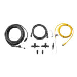
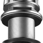
In the box
- PS70 down-looking thru-hull down transducer
- Fairing block
- Stainless steel thru-hull mounting hardware
- Power cable
- Network cable 12 metres (40 ft) with network adapter
- Documentation
Installation Instructions
Garmin | Panoptix PS70 | Sonar Transducer
SKU: 010-02768-00 -
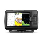
Garmin, Garmin Chartplotters, Sanctuary Cove
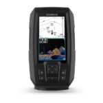
Garmin Striker Plus 4 with Dual-Beam Transducer
Garmin Striker Plus 4 with Dual-Beam Transducer – 4” GPS Fishfinder with Industry-leading Sonar and Quickdraw Contours Mapping Software
- Includes dual-beam transducer with Garmin CHIRP traditional sonar for crystal-clear images and remarkable target separation
- Built-in Garmin Quickdraw™ Contours mapping software lets you create and store maps with 1’ contours for up to 2 million acres
- Built-in GPS lets you mark waypoints, create routes and view boat’s speed
- Bright, sunlight-readable 4.3” display and intuitive user interface
- Rugged design for every fishing environment
The STRIKER Plus 4 fishfinder with a bright 4.3” display and built-in GPS features CHIRP sonar for crystal-clear images and Quickdraw Contours map drawing software, which stores up to 2 million acres of content with 1’ contours. The built-in GPS lets you mark and navigate to waypoints and shows your boat’s speed.
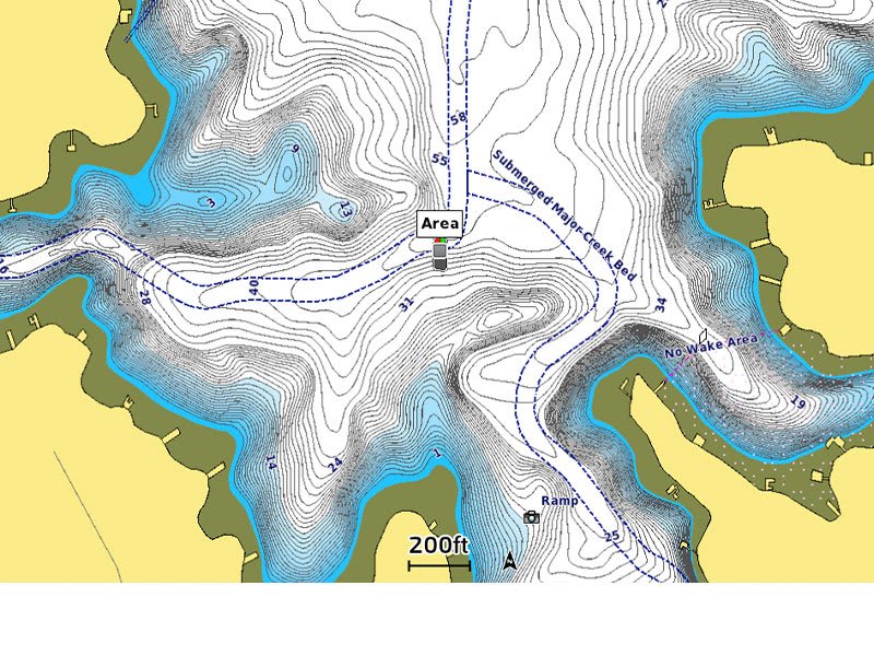
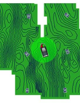
Garmin Quickdraw Contours
Nobody knows the waters you fish better than you and your fellow fishermen. While you are trolling the shorelines and the depths, Quickdraw Contours mapping software creates HD fishing maps of the places you’ve been. No special knowledge is required. STRIKER Plus 4 can now store up to 2 million acres of your Quickdraw Contours maps with 1’ contours.
CHIRP Sonar Clarity
The STRIKER Plus 4 fishfinder includes Garmin CHIRP technology for a higher level of clarity and detail that you have come to expect from Garmin. Crystal-clear sonar images provide remarkable target separation and resolution in shallow and deeper water. Bottom contours are more visible, even at higher speeds, and signal noise can be suppressed at greater depths for a timely interpretation of what’s below.
GPS Fishfinder
The built-in, high-sensitivity GPS finds and maintains your position anywhere you go on the water. The GPS allows you to mark waypoints for different locations. So, if the fish are biting in 1 spot, you can mark it, and return to it on your next trip. Mark docks, boat ramps and other locations on the lake, and create routes back to them for your next trip.
GPS also allows STRIKER Plus 4 to show your speed on screen, so you can be sure you’re trolling at the right speed for the lure you’re using or in wake-controlled areas.
Built for You
The STRIKER Plus 4 fishfinder makes fishing a breeze, and it’s built to work in any environment. The bright, sunlight-readable display gives you a clear view of what is below your boat, even on the brightest days. And the larger screen gives you a better view of what is happening below the boat. The intuitive user interface makes it simple to navigate to whatever feature you need, so you are ready for anything on the water.
In the Box
- STRIKER Plus 4 fishfinder
- Garmin dual beam transducer with 20′ cable
- Power/data cable
- Tilt/swivel mount
- Hardware
- Documentation
Owner’s Manual
Installation Instructions
SKU: 010-01870-01 -
EOFY, Garmin, Garmin Fishfinder, Sanctuary Cove
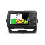
Garmin STRIKER Vivid 4cv with GT20-TM Transducer
Garmin STRIKER Vivid 4cv with GT20-TM Transducer – THE CHOICE IS YOURS
See fish and structure in maximum detail when you pick your display colour, your location and your sonar for your day on the water with the STRIKER Vivid 4cv fishfinder with transducer.
The sonar colour you pick says a lot about your fishing style. Good thing there are 7 new vivid options.
What a view. Use the included transducer to get CHIRP traditional and ClearVü sonars.

Never lose a hot spot again. Use waypoint marking to find your way back.
What’s under the water’s surface looks pretty good as 1-foot contours, just saying.
SKU: 010-02550-01 -
Garmin, Garmin Fishfinder, Sanctuary Cove
Garmin STRIKER Vivid 5cv with GT20-TM Transducer
Garmin STRIKER Vivid 5cv with GT20-TM Transducer – THE CHOICE IS YOURS
See fish and structure in maximum detail when you pick your display colour, your location and your sonar for your day on the water with the STRIKER Vivid 5cv fishfinder with transducer.
The sonar colour you pick says a lot about your fishing style. Good thing there are 7 new vivid options.
What a view. Use the included transducer to get CHIRP traditional and ClearVü sonars.
Never lose a hot spot again. Use waypoint marking to find your way back.
What’s under the water’s surface looks pretty good as 1′ contours, just saying.
SKU: 010-02551-01 -
EOFY, Garmin, Garmin Fishfinder, Sanctuary Cove
Garmin STRIKER Vivid 7cv with GT20-TM Transducer
Garmin STRIKER Vivid 7cv with GT20-TM Transducer – THE CHOICE IS YOURS
See fish and structure in maximum detail when you pick your display colour, your location and your sonar for your day on the water with the STRIKER Vivid 7cv fishfinder with transducer.
The sonar colour you pick says a lot about your fishing style. Good thing there are 7 new vivid options.
What a view. Use the included transducer to get CHIRP traditional and ClearVü sonars.
Never lose a hot spot again. Use waypoint marking to find your way back.
What’s under the water’s surface looks pretty good as 1-foot contours, just saying.

Wi-Fi® connection1 on land opens up a world of possibilities on the water.
SKU: 010-02552-01 -
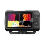
Garmin, Garmin Fishfinder, Sanctuary Cove
Garmin STRIKER Vivid 7sv with GT52HW-TM Transducer
Garmin STRIKER Vivid 7sv With GT52HW-TM Transducer – THE CHOICE IS YOURS
See fish and structure in maximum detail when you pick your display colour, your location and your sonar for your day on the water with the STRIKER Vivid 7sv fishfinder with transducer.
The sonar colour you pick says a lot about your fishing style. Good thing there are 7 new vivid options.
What a view. Use the included transducer to get CHIRP traditional and ClearVü sonars.
Never lose a hot spot again. Use waypoint marking to find your way back.
What’s under the water’s surface looks pretty good as 1-foot contours, just saying.
Wi-Fi® connection1 on land opens up a world of possibilities on the water.
SKU: 010-02553-01 -
EOFY, Garmin, Garmin Fishfinder, Sanctuary Cove
Garmin STRIKER Vivid 9sv with GT52HW-TM Transducer
-9% EOFY, Garmin, Garmin Fishfinder, Sanctuary Cove
Garmin STRIKER Vivid 9sv with GT52HW-TM Transducer
Garmin STRIKER Vivid 9sv with GT52HW-TM Transducer – THE CHOICE IS YOURS
See fish and structure in maximum detail when you pick your display colour, your location and your sonar for your day on the water with the STRIKER Vivid 9sv fishfinder with transducer.
The sonar colour you pick says a lot about your fishing style. Good thing there are 7 new vivid options.
What a view. Use the included transducer to get CHIRP traditional and ClearVü sonars.
Never lose a hot spot again. Use waypoint marking to find your way back.
What’s under the water’s surface looks pretty good as 1-foot contours, just saying.
Wi-Fi® connection1 on land opens up a world of possibilities on the water.
SKU: 010-02554-01