EOFY
Showing 31–58 of 58 results
-
EOFY, Garmin, Garmin Chartplotters, Sanctuary Cove
Garmin GPSMAP 9017xsv – Premium chartplotter with worldwide basemap and sonar
-8% EOFY, Garmin, Garmin Chartplotters, Sanctuary Cove
Garmin GPSMAP 9017xsv – Premium chartplotter with worldwide basemap and sonar
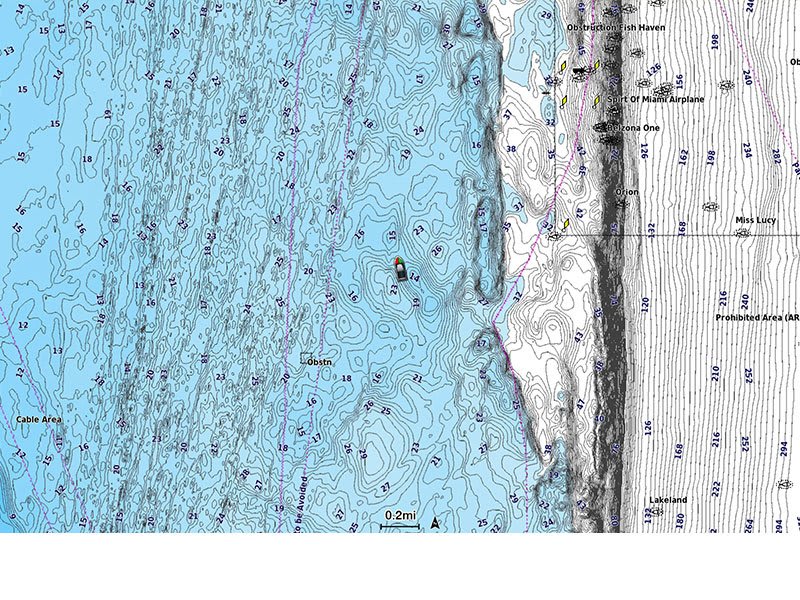
Garmin GPSMAP 9010xsv is a premium chartplotter with a 10-inch HD touchscreen display, worldwide basemap, built-in sonar and Garmin BlueNet gigabit network connectivity.
SKU: 010-03177-02 -
EOFY, Garmin, Garmin Chartplotters, Sanctuary Cove
Garmin GPSMAP 9019 – 19inch Premium chartplotter with worldwide basemap
-6%EOFY, Garmin, Garmin Chartplotters, Sanctuary CoveGarmin GPSMAP 9019 – 19inch Premium chartplotter with worldwide basemap
Garmin GPSMAP 9022 – 19inch Premium Chartplotter with worldwide basemap
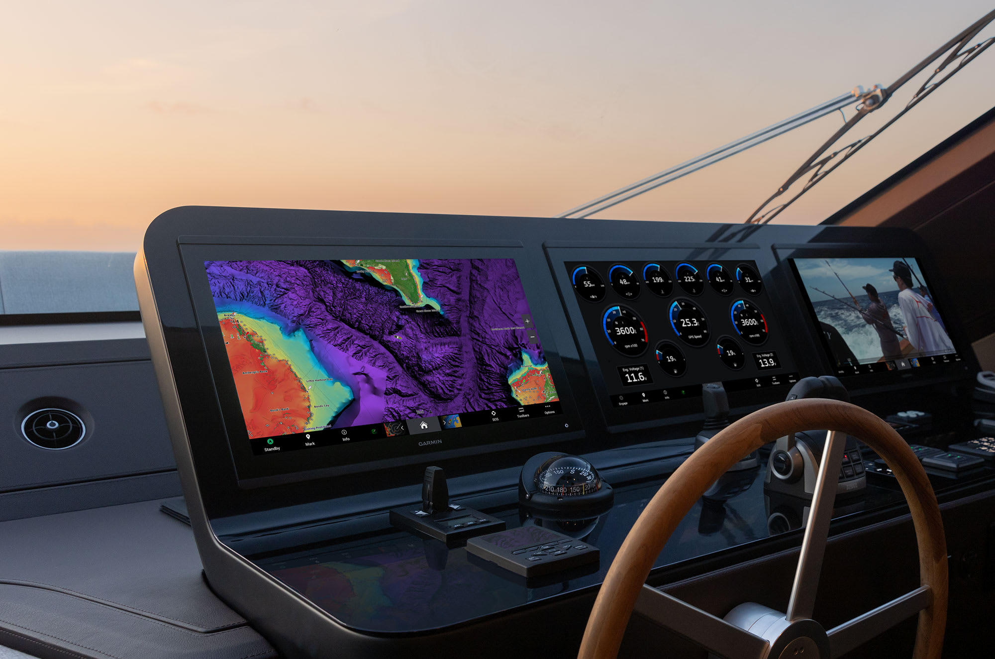
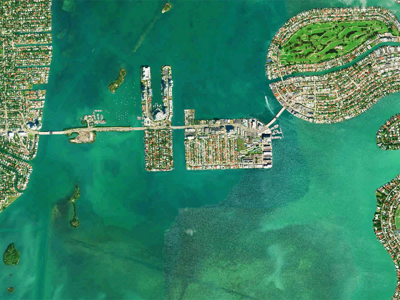
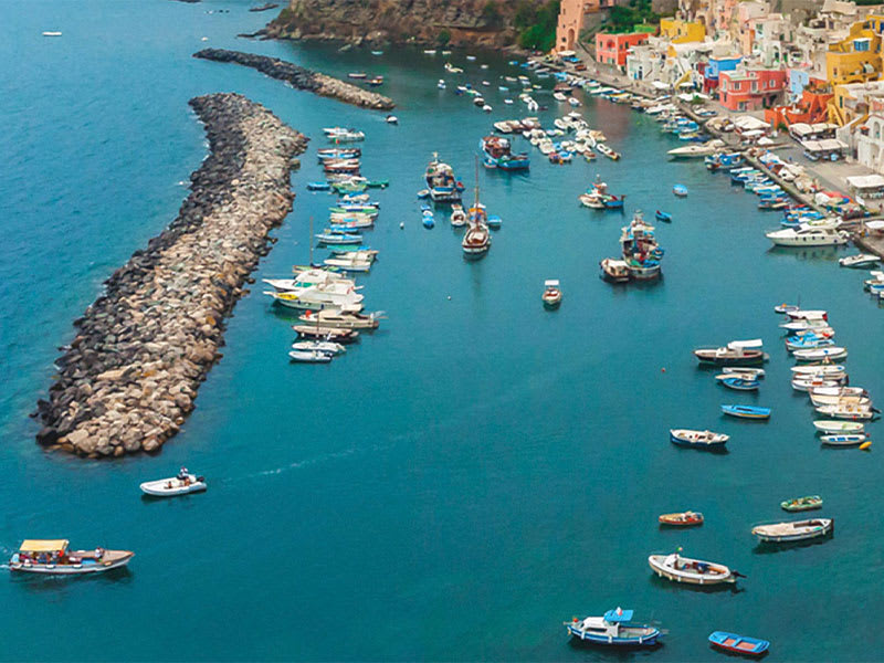
Plot your paradise
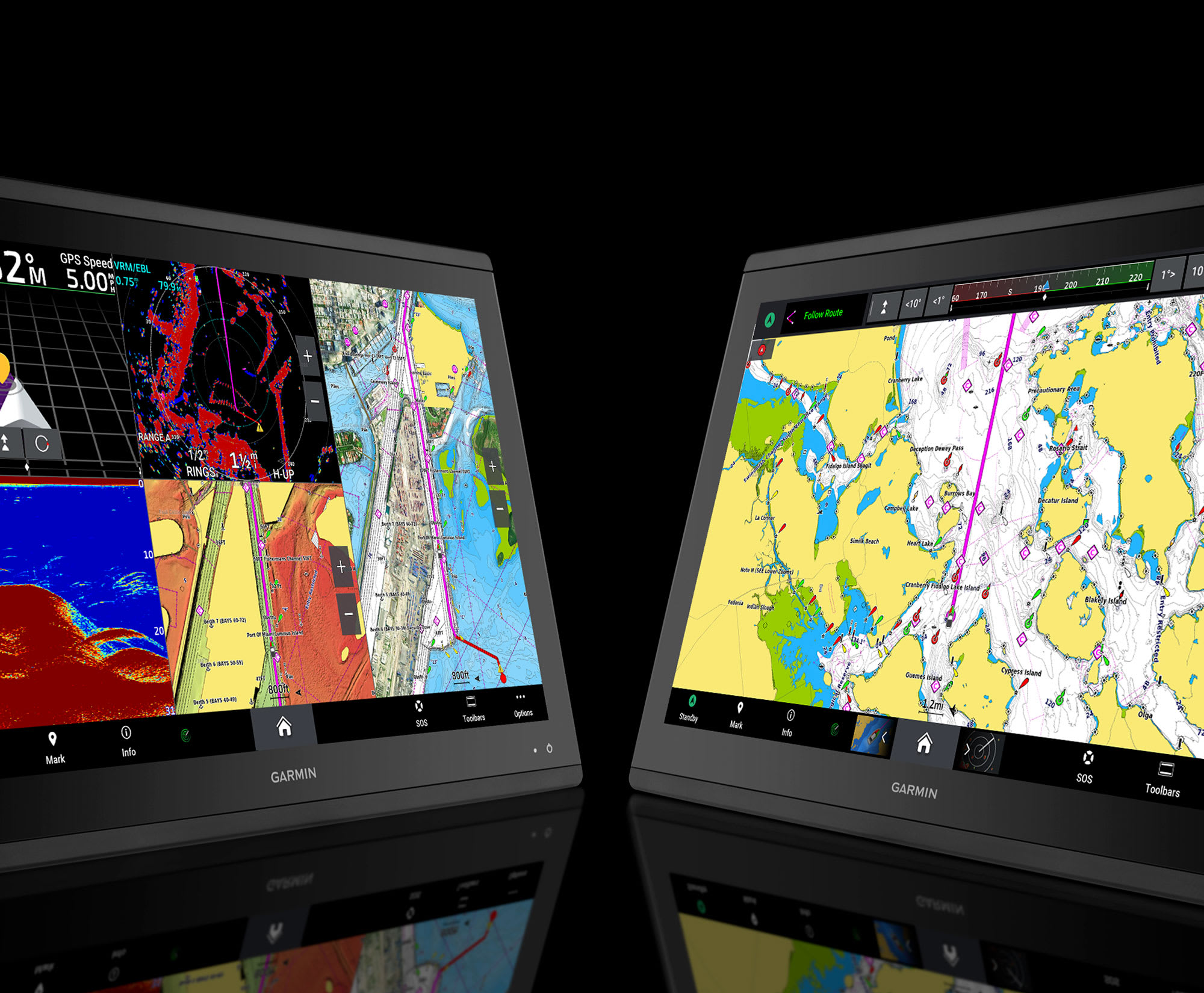
FROM YOUR PARADISESEE YOUR CHARTS, VIEW ENTERTAINMENT AND MORE IN 4K
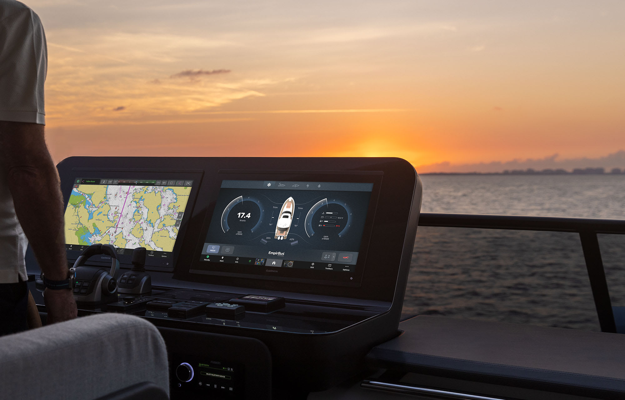
CLARITY, CONTROL AND LUXURY AT THE HELM

THE SPEED YOU NEEDUP TO SEVEN TIMES FASTER PROCESSING POWER AND GIGABIT SPEEDS ON THE GARMIN BLUENET™ NETWORK
CONNECTION IS KEYBUILD AN EXTENSIVE, TOP-OF-THE-LINE ECOSYSTEM
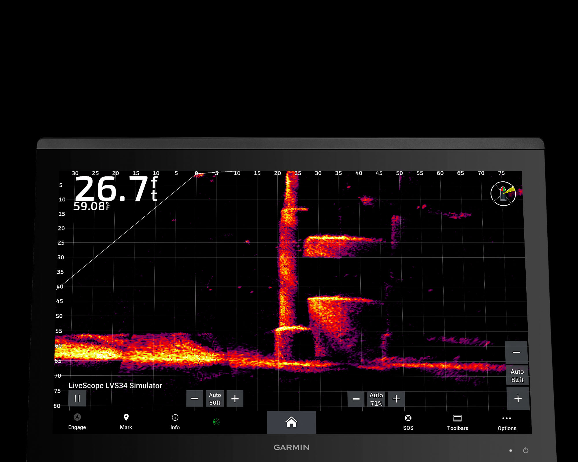
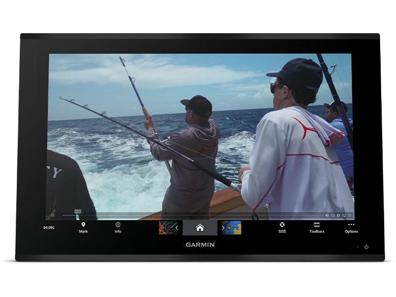
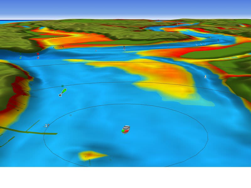
YOU’VE NEVER SEEN FISH THIS CLEARLY
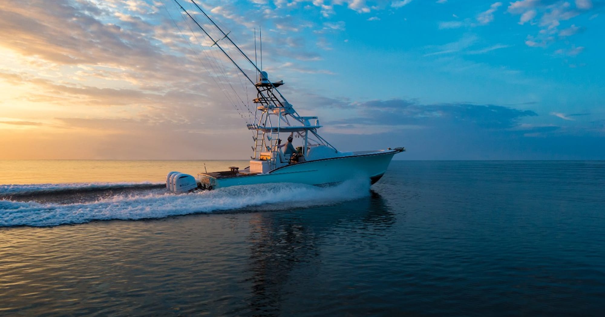
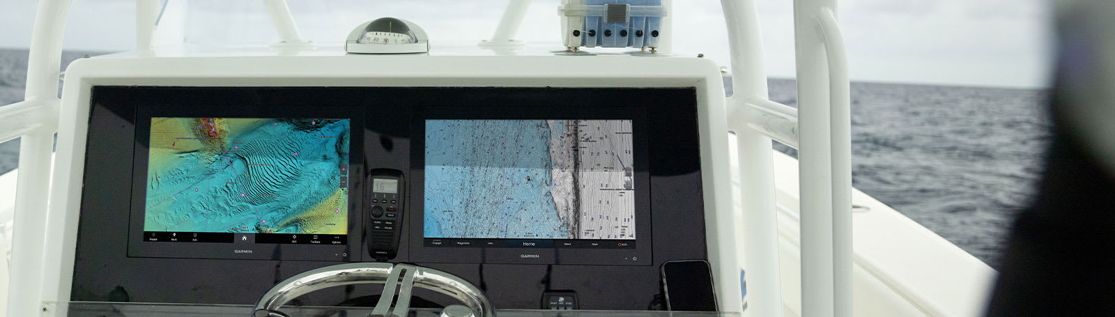
WELCOME TO 4K PARADISE
It’s the industry’s first integrated 4K resolution touchscreen chartplotter. Enjoy edge-to-edge clarity and luxury on a glass helm with premium design and materials plus enhanced connectivity and speed.
 PREMIUM 4K IPS SUNLIGHT-READABLE TOUCHSCREEN DISPLAY
 UP TO 7 TIMES FASTER PROCESSING POWER THAN PREVIOUS GENERATIONS
 GIGABIT SPEEDS ON THE GARMIN BLUENET™ NETWORK
 VIDEO INTEGRATION CAPABILITIES WITH HDCP DISTRIBUTION
 SEE SONAR TARGETS LIKE NEVER BEFORE ON THE 4K DISPLAY1
 NETWORK WITH MULTIPLE CHARTPLOTTERS, CAMERAS AND SONARS
WHAT YOU’LL LOVE
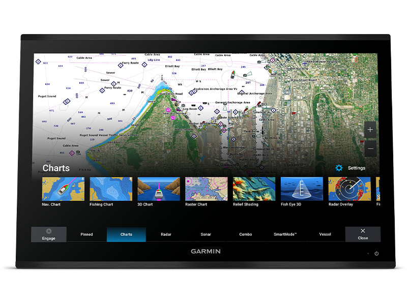
PREMIUM CHARTPLOTTER
The 4K resolution IPS sunlight-readable touchscreen display is available in the industry’s largest integrated chartplotter size. Edge-to-edge design provides a seamless and luxurious modern look.
FASTER. MUCH FASTER.
Processing power is 7 times faster than previous generations for superior performance; draw charts quickly, and calculate Auto Guidance+™ routes2 with lightning speed with an optional Garmin Navionics+™ subscription.
GARMIN BLUENET NETWORK
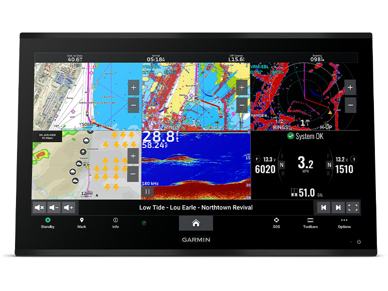
Build extensive networks with multiple chartplotters, cameras, radars and sonars — and enjoy 10 times faster networking speeds with minimal lag.
ENTERTAINMENT OPTIONS
Enjoy audio and video integrations that allow you to show and hear the same video throughout the screens and speakers on your network.
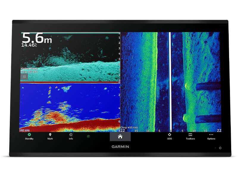
HIGH-DEFINITION SONAR
Fish in stunning high definition. Hook up to any of our sonar modules, and view sonar targets on the 4K display (transducers sold separately).
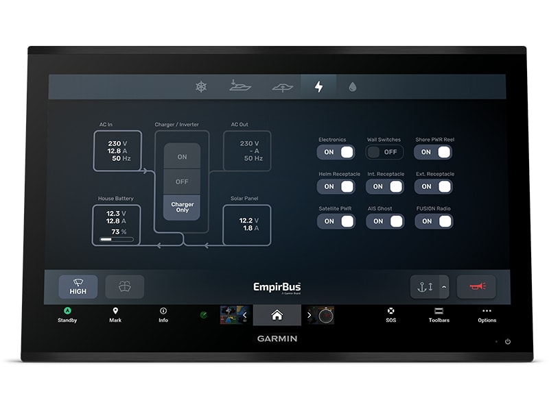
CONNECT YOUR ECOSYSTEM
Take command through digital system integrations to monitor, automate and control your vessel. The chartplotter uses the NMEA 2000® and NMEA 0183 networks to connect to your compatible accessories.
FOR CAPTAINS WHO DEMAND THE BEST CONNECT
 SOFTWARE UPDATES – Get wireless software updates via the ActiveCaptain® app with your compatible smartphone or tablet.
 ENGINE MONITORING – Keep tabs on engine performance with extensive engine integration.
 CUSTOM LOOK – Manufacturers can customise the homepage layout and splash screen for a brand tailored experience.
Navigate
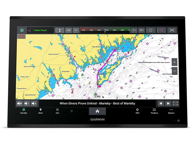
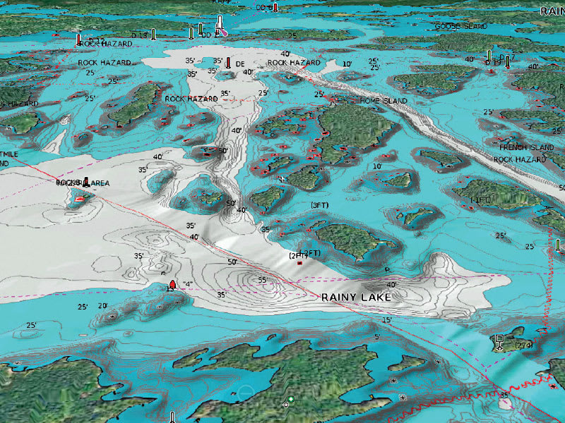
 MAPPING – Navigate with optional Garmin Navionics+™ charts that include Auto Guidance+ technology, daily updates and more2 (subscription required).
 PREMIUM CHARTS – Get support for Garmin Navionics Vision+™ charts with premium relief shading and satellite imagery.
 KNOW WHERE YOU ARE – Get your precise location with the included GPS 24xd position receiver and antenna.
 AUTOPILOT – Control the autopilot with any compatible chartplotter on the network with autopilot integration.
INTEGRATE
CONNECT CAMERAS – Get extensive camera support and control to see footage directly on the chartplotter. SURROUND VIEW SYSTEM – Get a bird’s-eye view with support for our Surround View Camera System (accessory purchase required).
 CONTROL WITH YOUR WATCH – Connect to your chartplotter with your compatible Garmin smartwatch.
 WIRELESS CONNECTIVITY – Connect compatible devices with integrated BLUETOOTH® and ANT® technologies.
 FISH MAPPING – Get comprehensive fishing data with the Fish Mapping™ feature from SiriusXM® Radio (accessory purchase and subscription required).
 VERBAL COMMANDS – Use spoken commands to control the chartplotter through your compatible headset.
 WEATHER-RESISTANT – The GPSMAP 9000 chartplotter is built for harsh marine conditions with an IPX7 water-resistance rating.1Sonar black box and transducers sold separately2Auto Guidance+ is for planning purposes only and does not replace safe navigation operationsThe Bluetooth word mark and logos are registered trademarks owned by Bluetooth SIG, Inc. and any use of such marks by Garmin is under licence. Sirius, XM and all related marks and logos are trademarks of Sirius XM Radio Inc.Engineering enhancements are ongoing and may not be reflected in the pictures, videos and specifications.
In the box
- GPSMAP® 9022 Chartplotter
- Trim snap cover
- Protective cover
- Flush mount hardware
- Power cable
- GPS 24xd NMEA 2000® (with pole mount, flush mount and under deck mount adapters)
- NMEA 2000 backbone/drop cable (2 metres)
- NMEA 2000 power cable
- NMEA 2000 T-connector and terminator kit
- Documentation
Installation Instruction
Owner’s Manual
SKU: 010-02673-00 -
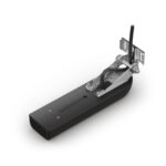
Easter, EOFY, Garmin, Garmin Sonar & Transducers, Sanctuary Cove
Garmin GT51M-TM Transducer
Garmin GT51M-TM Transducer
Perfect for the coastal and offshore fisherman who want CHIRP traditional sonar, CHIRP ClearVü and CHIRP SideVü scanning sonar, this transom mounted transducer consistently displays clear and crisp fish arches with superior target separation as well as clear pictures of objects, structure and fish that pass below and to each side of your boat and is optimized for rough sea conditions.
The CHIRP ClearVü/SideVü elements have a power rating of 500 W per element and operating frequencies of 260/455 kHz. The traditional CHIRP sonar has a power rating of 600 W and operating frequencies of mid-band CHIRP 80-160 kHz. It also includes a built-in fast response temperature sensor.
GT51M-TM includes a 12-pin transducer with mounting hardware and installation instructions. Follow the instructions carefully to avoid damaging your boat.
SKU: 010-01966-00 -
EOFY, Garmin, Garmin Sonar & Transducers, Marine Electronics, Sanctuary Cove, Transducers
Garmin GT56UHD-TM Transducer
-7% EOFY, Garmin, Garmin Sonar & Transducers, Marine Electronics, Sanctuary Cove, Transducers
Garmin GT56UHD-TM Transducer
Garmin GT56UHD-TM Transducer – LESS TIME FINDING. MORE TIME FISHING.
This all-in-one transducer offers ultimate versatility, featuring Ultra High-Definition ClearVü and SideVü scanning sonars, high wide CHIRP traditional sonar and more, so you can spend more time catching fish.

See everything below and around your boat with Ultra High-Definition scanning sonar.

High wide CHIRP traditional sonar delivers target separation like no other.

Multiple sonar frequencies have you covered — no matter what depth you’re fishing.

See targets and structure in bright, vivid colour.

Mount this transducer your way — transom, trolling motor or thru-hull.
SKU: 010-13073-00 -
Easter, EOFY, Garmin, Garmin Sonar & Transducers, Sanctuary Cove
Garmin LiveScope™ Plus System – with GLS 10™ and LVS34 Transducer
-3% Easter, EOFY, Garmin, Garmin Sonar & Transducers, Sanctuary Cove
Garmin LiveScope™ Plus System – with GLS 10™ and LVS34 Transducer
Garmin LiveScope™ Plus System – THE BEST OF THE BEST JUST GOT BETTER
The latest in LiveScope technology, the LiveScope Plus System offers improved resolution, reduced noise, clearer images and better target separation.

See images clearly with improved screen clarity, transducer sensitivity and target separation.
Scan surroundings with sharper images, reduced noise and fewer sonar artifacts.

Upgrade your current LiveScope System black box (GLS™ 10 sonar module) with just a new transducer.

Get maximum contrast and clarity in your images with vivid colour palettes.
Don’t miss a thing with supported Forward, Down and Perspective modes and necessary mount.
SKU: 010-02706-00 -
Charts & Maps, EOFY, Garmin, Sanctuary Cove
Garmin Navionics Platinum+™ Australia, Northeast – Marine Charts
-10% Charts & Maps, EOFY, Garmin, Sanctuary Cove
Garmin Navionics Platinum+™ Australia, Northeast – Marine Charts
Garmin Navionics Platinum+™ Australia, Northeast – Marine Charts
INTEGRATED MAPPING FOR A WIDE RANGE OF CHARTPLOTTERS
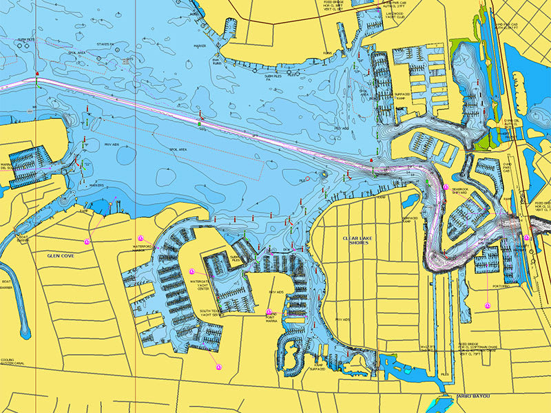
A comprehensive, all-in-one solution, Navionics+ charts and maps combine clear, reliable coastal/inland content with advanced guidance features and compatibility with a wide range of chartplotter brands.
 Navigate with our best offshore and inland lake coverage for your compatible chartplotter1.
 See it your way. Customise your view with various chart layers and overlay combinations. With your included 1-year subscription, access daily updates via the Navionics® chart installer software.
 Advanced route guidance technology2 lets you navigate with suggested dock-to-dock routings.
 Selectable map options let you highlight shallow areas, adjust contour density or select a fishing range.
 Save money — while continuing to access daily updates plus new content downloads — by renewing your subscription3.
Seamlessly navigate on coastal or inland waters.
ALL-IN-ONE MAP SOLUTION
Access detail-rich mapping of coastal features, lakes, rivers and more on a wide range of compatible chartplotters. Integrated coastal and inland lake content offers coverage for boaters worldwide.

DAILY CHART UPDATES
Charts are constantly being enhanced with new and amended content — thousands of updates are made every day. The included 1-year subscription gives you access to daily chart updates via the Navionics chart installer software.
DOCK-TO-DOCK ROUTE GUIDANCE
Advanced route guidance technology2 uses your boat settings, along with chart data and frequently traveled routes, to calculate a suggested path to follow from dock to dock.
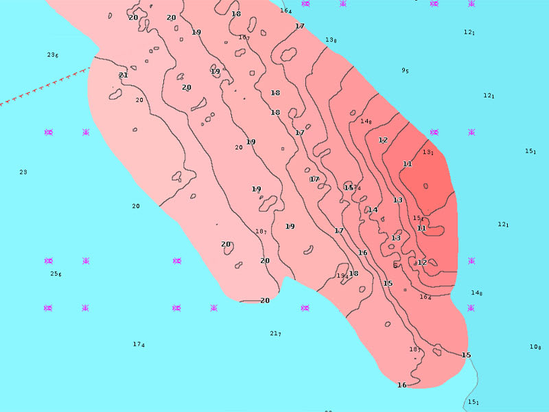
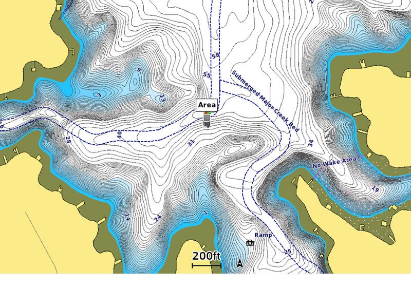
UP TO 0.5 M CONTOURS
For improved fishing and navigation, up to 0,5 m contours provide a clear depiction of bottom structure for fishing charts as well as enhanced detail in swamps, canals, harbours, marinas and more.
ADVANCED MAP OPTIONS
Change the way you view Navionics charts to focus on the details that matter most to you. Highlight shallow areas, adjust contour density, or select a fishing range.

COMMUNITY EDITS
Download community edits for useful local knowledge added by users of the Navionics Boating app, and view the data on your compatible chartplotter.
PLOTTER SYNC
Transfer routes and markers, update charts and more between your plotter card and mobile app — wirelessly. You can even activate or renew your cartography subscription and upload sonar logs4.
SONARCHART™ LIVE MAPPING
Create your own maps on the fly. Watch new 1’ HD bathymetry maps develop in real time as your boat moves through the water.
Add premium features with Navionics Platinum+™ mapping solutions.
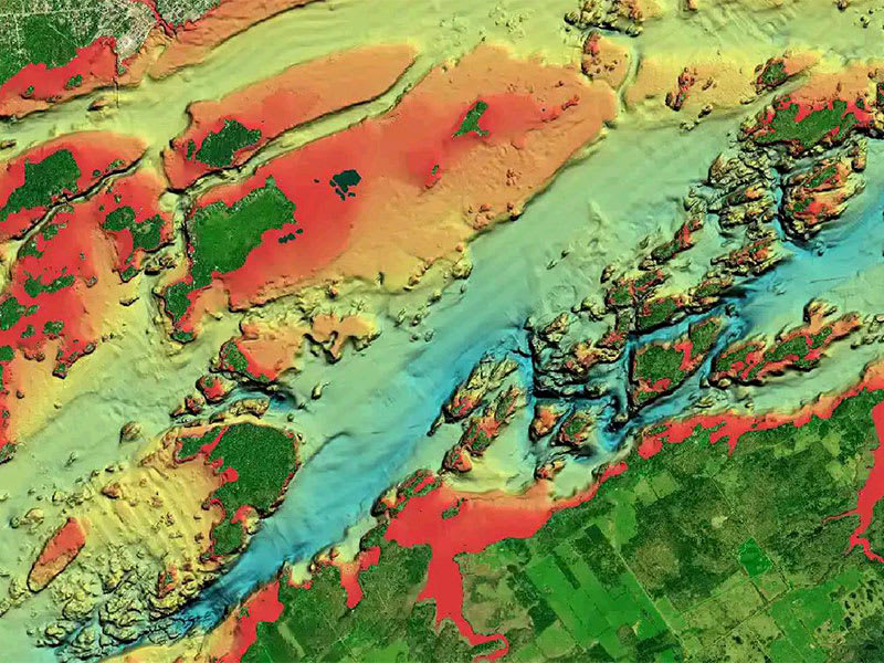
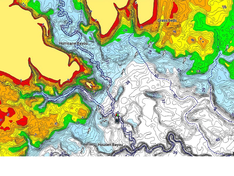
RELIEF SHADING
This downloadable shading feature5 combines color and shadow to give you an easy-to-interpret, clearer view of bottom structure than contour lines alone.
HIGH-RESOLUTION SATELLITE IMAGERY
Downloadable high-resolution satellite imagery5 provides a realistic view of your surroundings — ideal for entering unfamiliar harbors or ports.
AERIAL PHOTOGRAPHY
Crystal-clear aerial and surface photos of ports, marinas, bridges, docks, boat ramps, dams and navigational landmarks provide a better sense of your surroundings above the waterline.
3D VIEW
Unique 3D views provide additional perspective, both above and below the water’s surface, to highlight key features and aid in situational awareness.
SKU: 010-C1360-40 -
Charts & Maps, EOFY, Garmin, Sanctuary Cove
Garmin Navionics Vision+™ Australia, East & Central to New Zealand – Marine Charts
-10% Charts & Maps, EOFY, Garmin, Sanctuary Cove
Garmin Navionics Vision+™ Australia, East & Central to New Zealand – Marine Charts
Garmin Navionics Vision+™ Australia, East & Central to New Zealand – Marine Charts
IT’S A WHOLE NEW LOOK ON YOUR CHARTPLOTTER
Featuring vibrant colors, a streamlined interface and combined coastal/inland content with a popular Navionics® style color palette, Garmin Navionics+ cartography makes it easy to plot your course with the world’s No. 1 name in marine mapping1.
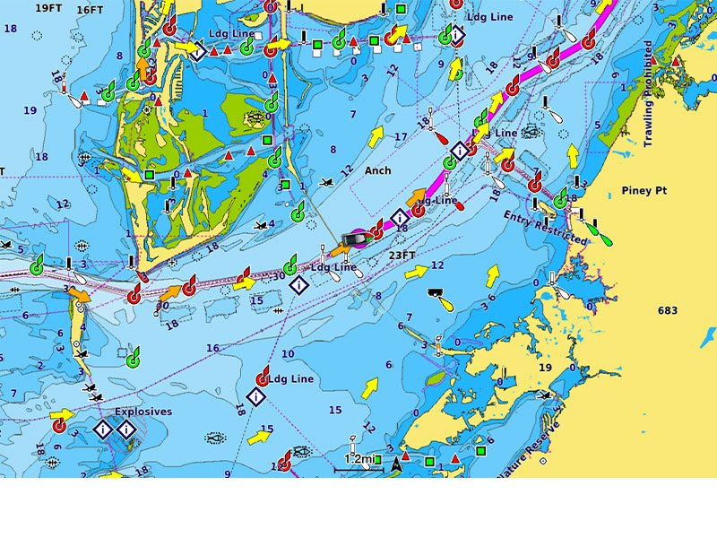
 Navigate with our best offshore and inland lake coverage for your Garmin chartplotter.
 See it your way. Customize your view with various chart layers and overlay combinations.
 With your included one-year subscription, access daily updates via the ActiveCaptain® smart-device app.
 Auto Guidance+™ technology2 lets you navigate with suggested dock-to-dock routings.
 Select up to 10 color-shaded target depth ranges to scope out the best fishing spots. Save money by renewing your subscription — and continue accessing daily updates plus new content downloads.
Plot your paradise on coastal or inland waters.
ALL-IN-ONE MAP SOLUTION FOR GARMIN CHARTPLOTTERS
Access detail-rich mapping of coastal features, lakes, rivers and more. Integrated Garmin and Navionics® content offers coverage for boaters worldwide.
DAILY CHART UPDATES
Charts are constantly being enhanced with new and amended content: Thousands of updates are made every day. The one-year included subscription gives you access to daily chart updates via the ActiveCaptain app.
AUTO GUIDANCE+ TECHNOLOGY
Combining the best of Garmin and Navionics automatic routing features, built-in Auto Guidance+ technology2 gives you a suggested dock-to-dock path to follow through channels, inlets, marina entrances and more.
DEPTH RANGE SHADING
High-resolution depth range shading lets you select up to 10 color-shaded options and view your designated target depths at a glance.
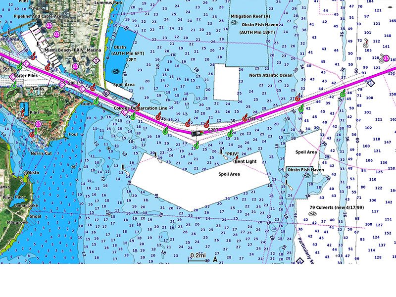
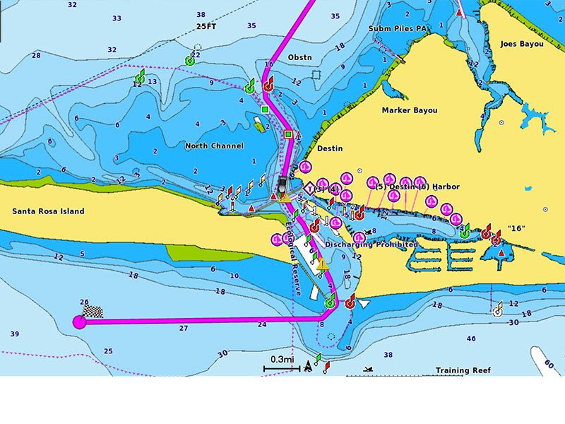
UP TO 1’ CONTOURS
For improved fishing and navigation, up to 1′ contours provide a clear depiction of bottom structure for improved fishing charts and enhanced detail in swamps, canals, harbors, marinas and more.
SHALLOW WATER SHADING
To give a clear picture of shallow waters to avoid, this feature allows for shading at a user-defined depth.
ACTIVECAPTAIN COMMUNITY
Community-sourced content provides useful points of interest, such as marinas, anchorages, hazards, businesses and more. Get recommendations from boaters with firsthand experience of the local environment.
Add premium features with Garmin Navionics Vision+ mapping solutions.
HIGH-RESOLUTION RELIEF SHADING
This detailed shading feature3 combines color and shadow to give you an easy-to-interpret, clearer view of bottom structure than contour lines alone.
HIGH-RESOLUTION SATELLITE IMAGERY
Downloadable high-resolution satellite imagery3 provides superior situational awareness.
AERIAL PHOTOS
Crystal-clear aerial and surface photos of ports, marinas, bridges, docks, boat ramps, dams and navigational landmarks provide a better sense of your surroundings above the waterline.
3D FISHEYE VIEW
This underwater perspective shows 3D representation of bottom and contours as seen from below the waterline. Interface with sonar data for a customized view.
3D MARINEREYE VIEW
This view provides a 3D representation of the surrounding area both above and below the waterline.
DYNAMIC LAKE LEVEL
Adjust your maps to the lake’s current water levels to see if spots are accessible or too shallow to explore.
SKU: 010-C1482-00 -
Charts & Maps, EOFY, Garmin, Sanctuary Cove
Garmin Navionics Vision+™ Australia, Northeast – Inland and Coastal Marine Charts
-10% Charts & Maps, EOFY, Garmin, Sanctuary Cove
Garmin Navionics Vision+™ Australia, Northeast – Inland and Coastal Marine Charts
Garmin Navionics Vision+™ Australia, Northeast – Inland and Coastal Marine Charts
IT’S A WHOLE NEW LOOK ON YOUR CHARTPLOTTER
Featuring vibrant colors, a streamlined interface and combined coastal/inland content with a popular Navionics® style color palette, Garmin Navionics+ cartography makes it easy to plot your course with the world’s No. 1 name in marine mapping1.
Navigate with our best offshore and inland lake coverage for your Garmin chartplotter. See it your way. Customize your view with various chart layers and overlay combinations. With your included one-year subscription, access daily updates via the ActiveCaptain® smart-device app. Auto Guidance+™ technology2 lets you navigate with suggested dock-to-dock routings. Select up to 10 color-shaded target depth ranges to scope out the best fishing spots. Save money by renewing your subscription — and continue accessing daily updates plus new content downloads.Plot your paradise on coastal or inland waters.
ALL-IN-ONE MAP SOLUTION FOR GARMIN CHARTPLOTTERS
Access detail-rich mapping of coastal features, lakes, rivers and more. Integrated Garmin and Navionics® content offers coverage for boaters worldwide.
DAILY CHART UPDATES
Charts are constantly being enhanced with new and amended content: Thousands of updates are made every day. The one-year included subscription gives you access to daily chart updates via the ActiveCaptain app.
AUTO GUIDANCE+ TECHNOLOGY
Combining the best of Garmin and Navionics automatic routing features, built-in Auto Guidance+ technology2 gives you a suggested dock-to-dock path to follow through channels, inlets, marina entrances and more.
DEPTH RANGE SHADING
High-resolution depth range shading lets you select up to 10 color-shaded options and view your designated target depths at a glance.
UP TO 1’ CONTOURS
For improved fishing and navigation, up to 1′ contours provide a clear depiction of bottom structure for improved fishing charts and enhanced detail in swamps, canals, harbors, marinas and more.
SHALLOW WATER SHADING
To give a clear picture of shallow waters to avoid, this feature allows for shading at a user-defined depth.
ACTIVECAPTAIN COMMUNITY
Community-sourced content provides useful points of interest, such as marinas, anchorages, hazards, businesses and more. Get recommendations from boaters with firsthand experience of the local environment.
Add premium features with Garmin Navionics Vision+ mapping solutions.
HIGH-RESOLUTION RELIEF SHADING
This detailed shading feature3 combines color and shadow to give you an easy-to-interpret, clearer view of bottom structure than contour lines alone.
HIGH-RESOLUTION SATELLITE IMAGERY
Downloadable high-resolution satellite imagery3 provides superior situational awareness.
AERIAL PHOTOS
Crystal-clear aerial and surface photos of ports, marinas, bridges, docks, boat ramps, dams and navigational landmarks provide a better sense of your surroundings above the waterline.
3D FISHEYE VIEW
This underwater perspective shows 3D representation of bottom and contours as seen from below the waterline. Interface with sonar data for a customized view.
3D MARINEREYE VIEW
This view provides a 3D representation of the surrounding area both above and below the waterline.
DYNAMIC LAKE LEVEL
Adjust your maps to the lake’s current water levels to see if spots are accessible or too shallow to explore.
SKU: 010-C1281-00 -
Charts & Maps, EOFY, Garmin, Sanctuary Cove
Garmin Navionics Vision+™ Australia, Southeast – Inland and Coastal Marine Charts
-10% Charts & Maps, EOFY, Garmin, Sanctuary Cove
Garmin Navionics Vision+™ Australia, Southeast – Inland and Coastal Marine Charts
Garmin Navionics Vision+™ Australia, Southeast – Inland and Coastal Marine Charts
IT’S A WHOLE NEW LOOK ON YOUR CHARTPLOTTER
Featuring vibrant colors, a streamlined interface and combined coastal/inland content with a popular Navionics® style color palette, Garmin Navionics+ cartography makes it easy to plot your course with the world’s No. 1 name in marine mapping1.
Navigate with our best offshore and inland lake coverage for your Garmin chartplotter. See it your way. Customize your view with various chart layers and overlay combinations. With your included one-year subscription, access daily updates via the ActiveCaptain® smart-device app. Auto Guidance+™ technology2 lets you navigate with suggested dock-to-dock routings. Select up to 10 color-shaded target depth ranges to scope out the best fishing spots. Save money by renewing your subscription — and continue accessing daily updates plus new content downloads.Plot your paradise on coastal or inland waters.
ALL-IN-ONE MAP SOLUTION FOR GARMIN CHARTPLOTTERS
Access detail-rich mapping of coastal features, lakes, rivers and more. Integrated Garmin and Navionics® content offers coverage for boaters worldwide.
DAILY CHART UPDATES
Charts are constantly being enhanced with new and amended content: Thousands of updates are made every day. The one-year included subscription gives you access to daily chart updates via the ActiveCaptain app.
AUTO GUIDANCE+ TECHNOLOGY
Combining the best of Garmin and Navionics automatic routing features, built-in Auto Guidance+ technology2 gives you a suggested dock-to-dock path to follow through channels, inlets, marina entrances and more.
DEPTH RANGE SHADING
High-resolution depth range shading lets you select up to 10 color-shaded options and view your designated target depths at a glance.
UP TO 1’ CONTOURS
For improved fishing and navigation, up to 1′ contours provide a clear depiction of bottom structure for improved fishing charts and enhanced detail in swamps, canals, harbors, marinas and more.
SHALLOW WATER SHADING
To give a clear picture of shallow waters to avoid, this feature allows for shading at a user-defined depth.
ACTIVECAPTAIN COMMUNITY
Community-sourced content provides useful points of interest, such as marinas, anchorages, hazards, businesses and more. Get recommendations from boaters with firsthand experience of the local environment.
Add premium features with Garmin Navionics Vision+ mapping solutions.
HIGH-RESOLUTION RELIEF SHADING
This detailed shading feature3 combines color and shadow to give you an easy-to-interpret, clearer view of bottom structure than contour lines alone.
HIGH-RESOLUTION SATELLITE IMAGERY
Downloadable high-resolution satellite imagery3 provides superior situational awareness.
AERIAL PHOTOS
Crystal-clear aerial and surface photos of ports, marinas, bridges, docks, boat ramps, dams and navigational landmarks provide a better sense of your surroundings above the waterline.
3D FISHEYE VIEW
This underwater perspective shows 3D representation of bottom and contours as seen from below the waterline. Interface with sonar data for a customized view.
3D MARINEREYE VIEW
This view provides a 3D representation of the surrounding area both above and below the waterline.
DYNAMIC LAKE LEVEL
Adjust your maps to the lake’s current water levels to see if spots are accessible or too shallow to explore.
SKU: 010-C1282-00 -
Charts & Maps, EOFY, Garmin, Sanctuary Cove
Garmin Navionics Vision+™ Australia, West – Inland and Coastal Marine Charts
-10% Charts & Maps, EOFY, Garmin, Sanctuary Cove
Garmin Navionics Vision+™ Australia, West – Inland and Coastal Marine Charts
Garmin Navionics Vision+™ Australia, West – Inland and Coastal Marine Charts
IT’S A WHOLE NEW LOOK ON YOUR CHARTPLOTTER
Featuring vibrant colors, a streamlined interface and combined coastal/inland content with a popular Navionics® style color palette, Garmin Navionics+ cartography makes it easy to plot your course with the world’s No. 1 name in marine mapping1.
Navigate with our best offshore and inland lake coverage for your Garmin chartplotter. See it your way. Customize your view with various chart layers and overlay combinations. With your included one-year subscription, access daily updates via the ActiveCaptain® smart-device app. Auto Guidance+™ technology2 lets you navigate with suggested dock-to-dock routings. Select up to 10 color-shaded target depth ranges to scope out the best fishing spots. Save money by renewing your subscription — and continue accessing daily updates plus new content downloads.Plot your paradise on coastal or inland waters.
ALL-IN-ONE MAP SOLUTION FOR GARMIN CHARTPLOTTERS
Access detail-rich mapping of coastal features, lakes, rivers and more. Integrated Garmin and Navionics® content offers coverage for boaters worldwide.
DAILY CHART UPDATES
Charts are constantly being enhanced with new and amended content: Thousands of updates are made every day. The one-year included subscription gives you access to daily chart updates via the ActiveCaptain app.
AUTO GUIDANCE+ TECHNOLOGY
Combining the best of Garmin and Navionics automatic routing features, built-in Auto Guidance+ technology2 gives you a suggested dock-to-dock path to follow through channels, inlets, marina entrances and more.
DEPTH RANGE SHADING
High-resolution depth range shading lets you select up to 10 color-shaded options and view your designated target depths at a glance.
UP TO 1’ CONTOURS
For improved fishing and navigation, up to 1′ contours provide a clear depiction of bottom structure for improved fishing charts and enhanced detail in swamps, canals, harbors, marinas and more.
SHALLOW WATER SHADING
To give a clear picture of shallow waters to avoid, this feature allows for shading at a user-defined depth.
ACTIVECAPTAIN COMMUNITY
Community-sourced content provides useful points of interest, such as marinas, anchorages, hazards, businesses and more. Get recommendations from boaters with firsthand experience of the local environment.
Add premium features with Garmin Navionics Vision+ mapping solutions.
HIGH-RESOLUTION RELIEF SHADING
This detailed shading feature3 combines color and shadow to give you an easy-to-interpret, clearer view of bottom structure than contour lines alone.
HIGH-RESOLUTION SATELLITE IMAGERY
Downloadable high-resolution satellite imagery3 provides superior situational awareness.
AERIAL PHOTOS
Crystal-clear aerial and surface photos of ports, marinas, bridges, docks, boat ramps, dams and navigational landmarks provide a better sense of your surroundings above the waterline.
3D FISHEYE VIEW
This underwater perspective shows 3D representation of bottom and contours as seen from below the waterline. Interface with sonar data for a customized view.
3D MARINEREYE VIEW
This view provides a 3D representation of the surrounding area both above and below the waterline.
DYNAMIC LAKE LEVEL
Adjust your maps to the lake’s current water levels to see if spots are accessible or too shallow to explore.
SKU: 010-C1280-00 -
Charts & Maps, EOFY, Garmin, Sanctuary Cove
Garmin Navionics Vision+™ Australia, West & Central – Marine Charts
-10% Charts & Maps, EOFY, Garmin, Sanctuary Cove
Garmin Navionics Vision+™ Australia, West & Central – Marine Charts
Garmin Navionics Vision+™ Australia, West & Central – Marine Charts
IT’S A WHOLE NEW LOOK ON YOUR CHARTPLOTTER
Featuring vibrant colors, a streamlined interface and combined coastal/inland content with a popular Navionics® style color palette, Garmin Navionics+ cartography makes it easy to plot your course with the world’s No. 1 name in marine mapping1.
Navigate with our best offshore and inland lake coverage for your Garmin chartplotter. See it your way. Customize your view with various chart layers and overlay combinations. With your included one-year subscription, access daily updates via the ActiveCaptain® smart-device app. Auto Guidance+™ technology2 lets you navigate with suggested dock-to-dock routings. Select up to 10 color-shaded target depth ranges to scope out the best fishing spots. Save money by renewing your subscription — and continue accessing daily updates plus new content downloads.Plot your paradise on coastal or inland waters.
ALL-IN-ONE MAP SOLUTION FOR GARMIN CHARTPLOTTERS
Access detail-rich mapping of coastal features, lakes, rivers and more. Integrated Garmin and Navionics® content offers coverage for boaters worldwide.
DAILY CHART UPDATES
Charts are constantly being enhanced with new and amended content: Thousands of updates are made every day. The one-year included subscription gives you access to daily chart updates via the ActiveCaptain app.
AUTO GUIDANCE+ TECHNOLOGY
Combining the best of Garmin and Navionics automatic routing features, built-in Auto Guidance+ technology2 gives you a suggested dock-to-dock path to follow through channels, inlets, marina entrances and more.
DEPTH RANGE SHADING
High-resolution depth range shading lets you select up to 10 color-shaded options and view your designated target depths at a glance.
UP TO 1’ CONTOURS
For improved fishing and navigation, up to 1′ contours provide a clear depiction of bottom structure for improved fishing charts and enhanced detail in swamps, canals, harbors, marinas and more.
SHALLOW WATER SHADING
To give a clear picture of shallow waters to avoid, this feature allows for shading at a user-defined depth.
ACTIVECAPTAIN COMMUNITY
Community-sourced content provides useful points of interest, such as marinas, anchorages, hazards, businesses and more. Get recommendations from boaters with firsthand experience of the local environment.
Add premium features with Garmin Navionics Vision+ mapping solutions.
HIGH-RESOLUTION RELIEF SHADING
This detailed shading feature3 combines color and shadow to give you an easy-to-interpret, clearer view of bottom structure than contour lines alone.
HIGH-RESOLUTION SATELLITE IMAGERY
Downloadable high-resolution satellite imagery3 provides superior situational awareness.
AERIAL PHOTOS
Crystal-clear aerial and surface photos of ports, marinas, bridges, docks, boat ramps, dams and navigational landmarks provide a better sense of your surroundings above the waterline.
3D FISHEYE VIEW
This underwater perspective shows 3D representation of bottom and contours as seen from below the waterline. Interface with sonar data for a customized view.
3D MARINEREYE VIEW
This view provides a 3D representation of the surrounding area both above and below the waterline.
DYNAMIC LAKE LEVEL
Adjust your maps to the lake’s current water levels to see if spots are accessible or too shallow to explore.
SKU: 010-C1483-00 -
Charts & Maps, EOFY, Garmin, Sanctuary Cove
Garmin Navionics®+ Australia, Northeast – Marine Charts
-10% Charts & Maps, EOFY, Garmin, Sanctuary Cove
Garmin Navionics®+ Australia, Northeast – Marine Charts
Garmin Navionics®+ Australia, Northeast – Marine Charts
INTEGRATED MAPPING FOR A WIDE RANGE OF CHARTPLOTTERS
A comprehensive, all-in-one solution, Navionics+ charts and maps combine clear, reliable coastal/inland content with advanced guidance features and compatibility with a wide range of chartplotter brands.
Navigate with our best offshore and inland lake coverage for your compatible chartplotter1. See it your way. Customise your view with various chart layers and overlay combinations. With your included 1-year subscription, access daily updates via the Navionics® chart installer software. Advanced route guidance technology2 lets you navigate with suggested dock-to-dock routings. Selectable map options let you highlight shallow areas, adjust contour density or select a fishing range. Save money — while continuing to access daily updates plus new content downloads — by renewing your subscription3.SKU: 010-C1360-30 -
Charts & Maps, EOFY, Garmin, Sanctuary Cove
Garmin Navionics®+ Australia, Southeast – Marine Charts
-10% Charts & Maps, EOFY, Garmin, Sanctuary Cove
Garmin Navionics®+ Australia, Southeast – Marine Charts
Garmin Navionics®+ Australia, Southeast – Marine Charts
INTEGRATED MAPPING FOR A WIDE RANGE OF CHARTPLOTTERS
A comprehensive, all-in-one solution, Navionics+ charts and maps combine clear, reliable coastal/inland content with advanced guidance features and compatibility with a wide range of chartplotter brands.
Navigate with our best offshore and inland lake coverage for your compatible chartplotter1. See it your way. Customise your view with various chart layers and overlay combinations. With your included 1-year subscription, access daily updates via the Navionics® chart installer software. Advanced route guidance technology2 lets you navigate with suggested dock-to-dock routings. Selectable map options let you highlight shallow areas, adjust contour density or select a fishing range. Save money — while continuing to access daily updates plus new content downloads — by renewing your subscription3.SKU: 010-C1361-30 -
Charts & Maps, EOFY, Garmin, Sanctuary Cove
Garmin Navionics+™ Australia, East & Central to New Zealand – Marine Charts
-10% Charts & Maps, EOFY, Garmin, Sanctuary Cove
Garmin Navionics+™ Australia, East & Central to New Zealand – Marine Charts
Garmin Navionics+™ Australia, East & Central to New Zealand – Marine Charts
IT’S A WHOLE NEW LOOK ON YOUR CHARTPLOTTER
Featuring vibrant colors, a streamlined interface and combined coastal/inland content with a popular Navionics® style color palette, Garmin Navionics+ cartography makes it easy to plot your course with the world’s No. 1 name in marine mapping1.
Navigate with our best offshore and inland lake coverage for your Garmin chartplotter. See it your way. Customize your view with various chart layers and overlay combinations. With your included one-year subscription, access daily updates via the ActiveCaptain® smart-device app. Auto Guidance+™ technology2 lets you navigate with suggested dock-to-dock routings. Select up to 10 color-shaded target depth ranges to scope out the best fishing spots. Save money by renewing your subscription — and continue accessing daily updates plus new content downloads.Plot your paradise on coastal or inland waters.
ALL-IN-ONE MAP SOLUTION FOR GARMIN CHARTPLOTTERS
Access detail-rich mapping of coastal features, lakes, rivers and more. Integrated Garmin and Navionics® content offers coverage for boaters worldwide.
DAILY CHART UPDATES
Charts are constantly being enhanced with new and amended content: Thousands of updates are made every day. The one-year included subscription gives you access to daily chart updates via the ActiveCaptain app.
AUTO GUIDANCE+ TECHNOLOGY
Combining the best of Garmin and Navionics automatic routing features, built-in Auto Guidance+ technology2 gives you a suggested dock-to-dock path to follow through channels, inlets, marina entrances and more.
DEPTH RANGE SHADING
High-resolution depth range shading lets you select up to 10 color-shaded options and view your designated target depths at a glance.
UP TO 1’ CONTOURS
For improved fishing and navigation, up to 1′ contours provide a clear depiction of bottom structure for improved fishing charts and enhanced detail in swamps, canals, harbors, marinas and more.
SHALLOW WATER SHADING
To give a clear picture of shallow waters to avoid, this feature allows for shading at a user-defined depth.
ACTIVECAPTAIN COMMUNITY
Community-sourced content provides useful points of interest, such as marinas, anchorages, hazards, businesses and more. Get recommendations from boaters with firsthand experience of the local environment.
Add premium features with Garmin Navionics Vision+ mapping solutions.
HIGH-RESOLUTION RELIEF SHADING
This detailed shading feature3 combines color and shadow to give you an easy-to-interpret, clearer view of bottom structure than contour lines alone.
HIGH-RESOLUTION SATELLITE IMAGERY
Downloadable high-resolution satellite imagery3 provides superior situational awareness.
AERIAL PHOTOS
Crystal-clear aerial and surface photos of ports, marinas, bridges, docks, boat ramps, dams and navigational landmarks provide a better sense of your surroundings above the waterline.
3D FISHEYE VIEW
This underwater perspective shows 3D representation of bottom and contours as seen from below the waterline. Interface with sonar data for a customized view.
3D MARINEREYE VIEW
This view provides a 3D representation of the surrounding area both above and below the waterline.
DYNAMIC LAKE LEVEL
Adjust your maps to the lake’s current water levels to see if spots are accessible or too shallow to explore.
SKU: 010-C1482-20 -
Charts & Maps, EOFY, Garmin, Sanctuary Cove
Garmin Navionics+™ Australia, Northeast – Inland and Coastal Marine Charts
-10% Charts & Maps, EOFY, Garmin, Sanctuary Cove
Garmin Navionics+™ Australia, Northeast – Inland and Coastal Marine Charts
Garmin Navionics+™ Australia, Northeast – Inland and Coastal Marine Charts
IT’S A WHOLE NEW LOOK ON YOUR CHARTPLOTTER
Featuring vibrant colors, a streamlined interface and combined coastal/inland content with a popular Navionics® style color palette, Garmin Navionics+ cartography makes it easy to plot your course with the world’s No. 1 name in marine mapping1.
Navigate with our best offshore and inland lake coverage for your Garmin chartplotter. See it your way. Customize your view with various chart layers and overlay combinations. With your included one-year subscription, access daily updates via the ActiveCaptain® smart-device app. Auto Guidance+™ technology2 lets you navigate with suggested dock-to-dock routings. Select up to 10 color-shaded target depth ranges to scope out the best fishing spots. Save money by renewing your subscription — and continue accessing daily updates plus new content downloads.Plot your paradise on coastal or inland waters.
ALL-IN-ONE MAP SOLUTION FOR GARMIN CHARTPLOTTERS
Access detail-rich mapping of coastal features, lakes, rivers and more. Integrated Garmin and Navionics® content offers coverage for boaters worldwide.
DAILY CHART UPDATES
Charts are constantly being enhanced with new and amended content: Thousands of updates are made every day. The one-year included subscription gives you access to daily chart updates via the ActiveCaptain app.
AUTO GUIDANCE+ TECHNOLOGY
Combining the best of Garmin and Navionics automatic routing features, built-in Auto Guidance+ technology2 gives you a suggested dock-to-dock path to follow through channels, inlets, marina entrances and more.
DEPTH RANGE SHADING
High-resolution depth range shading lets you select up to 10 color-shaded options and view your designated target depths at a glance.
UP TO 1’ CONTOURS
For improved fishing and navigation, up to 1′ contours provide a clear depiction of bottom structure for improved fishing charts and enhanced detail in swamps, canals, harbors, marinas and more.
SHALLOW WATER SHADING
To give a clear picture of shallow waters to avoid, this feature allows for shading at a user-defined depth.
ACTIVECAPTAIN COMMUNITY
Community-sourced content provides useful points of interest, such as marinas, anchorages, hazards, businesses and more. Get recommendations from boaters with firsthand experience of the local environment.
Add premium features with Garmin Navionics Vision+ mapping solutions.
HIGH-RESOLUTION RELIEF SHADING
This detailed shading feature3 combines color and shadow to give you an easy-to-interpret, clearer view of bottom structure than contour lines alone.
HIGH-RESOLUTION SATELLITE IMAGERY
Downloadable high-resolution satellite imagery3 provides superior situational awareness.
AERIAL PHOTOS
Crystal-clear aerial and surface photos of ports, marinas, bridges, docks, boat ramps, dams and navigational landmarks provide a better sense of your surroundings above the waterline.
3D FISHEYE VIEW
This underwater perspective shows 3D representation of bottom and contours as seen from below the waterline. Interface with sonar data for a customized view.
3D MARINEREYE VIEW
This view provides a 3D representation of the surrounding area both above and below the waterline.
DYNAMIC LAKE LEVEL
Adjust your maps to the lake’s current water levels to see if spots are accessible or too shallow to explore.
SKU: 010-C1281-20 -
Charts & Maps, EOFY, Garmin, Sanctuary Cove
Garmin Navionics+™ Australia, Southeast – Inland and Coastal Marine Charts
-10% Charts & Maps, EOFY, Garmin, Sanctuary Cove
Garmin Navionics+™ Australia, Southeast – Inland and Coastal Marine Charts
Garmin Navionics+™ Australia, Southeast – Inland and Coastal Marine Charts
IT’S A WHOLE NEW LOOK ON YOUR CHARTPLOTTER
Featuring vibrant colors, a streamlined interface and combined coastal/inland content with a popular Navionics® style color palette, Garmin Navionics+ cartography makes it easy to plot your course with the world’s No. 1 name in marine mapping1.
Navigate with our best offshore and inland lake coverage for your Garmin chartplotter. See it your way. Customize your view with various chart layers and overlay combinations. With your included one-year subscription, access daily updates via the ActiveCaptain® smart-device app. Auto Guidance+™ technology2 lets you navigate with suggested dock-to-dock routings. Select up to 10 color-shaded target depth ranges to scope out the best fishing spots. Save money by renewing your subscription — and continue accessing daily updates plus new content downloads.Plot your paradise on coastal or inland waters.
ALL-IN-ONE MAP SOLUTION FOR GARMIN CHARTPLOTTERS
Access detail-rich mapping of coastal features, lakes, rivers and more. Integrated Garmin and Navionics® content offers coverage for boaters worldwide.
DAILY CHART UPDATES
Charts are constantly being enhanced with new and amended content: Thousands of updates are made every day. The one-year included subscription gives you access to daily chart updates via the ActiveCaptain app.
AUTO GUIDANCE+ TECHNOLOGY
Combining the best of Garmin and Navionics automatic routing features, built-in Auto Guidance+ technology2 gives you a suggested dock-to-dock path to follow through channels, inlets, marina entrances and more.
DEPTH RANGE SHADING
High-resolution depth range shading lets you select up to 10 color-shaded options and view your designated target depths at a glance.
UP TO 1’ CONTOURS
For improved fishing and navigation, up to 1′ contours provide a clear depiction of bottom structure for improved fishing charts and enhanced detail in swamps, canals, harbors, marinas and more.
SHALLOW WATER SHADING
To give a clear picture of shallow waters to avoid, this feature allows for shading at a user-defined depth.
ACTIVECAPTAIN COMMUNITY
Community-sourced content provides useful points of interest, such as marinas, anchorages, hazards, businesses and more. Get recommendations from boaters with firsthand experience of the local environment.
Add premium features with Garmin Navionics Vision+ mapping solutions.
HIGH-RESOLUTION RELIEF SHADING
This detailed shading feature3 combines color and shadow to give you an easy-to-interpret, clearer view of bottom structure than contour lines alone.
HIGH-RESOLUTION SATELLITE IMAGERY
Downloadable high-resolution satellite imagery3 provides superior situational awareness.
AERIAL PHOTOS
Crystal-clear aerial and surface photos of ports, marinas, bridges, docks, boat ramps, dams and navigational landmarks provide a better sense of your surroundings above the waterline.
3D FISHEYE VIEW
This underwater perspective shows 3D representation of bottom and contours as seen from below the waterline. Interface with sonar data for a customized view.
3D MARINEREYE VIEW
This view provides a 3D representation of the surrounding area both above and below the waterline.
DYNAMIC LAKE LEVEL
Adjust your maps to the lake’s current water levels to see if spots are accessible or too shallow to explore.
SKU: 010-C1282-20 -
Charts & Maps, EOFY, Garmin, Sanctuary Cove
Garmin Navionics+™ Australia, West – Inland and Coastal – Marine Charts
-10% Charts & Maps, EOFY, Garmin, Sanctuary Cove
Garmin Navionics+™ Australia, West – Inland and Coastal – Marine Charts
Garmin Navionics+™ Australia, West & Central – Marine Charts
IT’S A WHOLE NEW LOOK ON YOUR CHARTPLOTTER
Featuring vibrant colors, a streamlined interface and combined coastal/inland content with a popular Navionics® style color palette, Garmin Navionics+ cartography makes it easy to plot your course with the world’s No. 1 name in marine mapping1.
Navigate with our best offshore and inland lake coverage for your Garmin chartplotter. See it your way. Customize your view with various chart layers and overlay combinations. With your included one-year subscription, access daily updates via the ActiveCaptain® smart-device app. Auto Guidance+™ technology2 lets you navigate with suggested dock-to-dock routings. Select up to 10 color-shaded target depth ranges to scope out the best fishing spots. Save money by renewing your subscription — and continue accessing daily updates plus new content downloads.Plot your paradise on coastal or inland waters.
ALL-IN-ONE MAP SOLUTION FOR GARMIN CHARTPLOTTERS
Access detail-rich mapping of coastal features, lakes, rivers and more. Integrated Garmin and Navionics® content offers coverage for boaters worldwide.
DAILY CHART UPDATES
Charts are constantly being enhanced with new and amended content: Thousands of updates are made every day. The one-year included subscription gives you access to daily chart updates via the ActiveCaptain app.
AUTO GUIDANCE+ TECHNOLOGY
Combining the best of Garmin and Navionics automatic routing features, built-in Auto Guidance+ technology2 gives you a suggested dock-to-dock path to follow through channels, inlets, marina entrances and more.
DEPTH RANGE SHADING
High-resolution depth range shading lets you select up to 10 color-shaded options and view your designated target depths at a glance.
UP TO 1’ CONTOURS
For improved fishing and navigation, up to 1′ contours provide a clear depiction of bottom structure for improved fishing charts and enhanced detail in swamps, canals, harbors, marinas and more.
SHALLOW WATER SHADING
To give a clear picture of shallow waters to avoid, this feature allows for shading at a user-defined depth.
ACTIVECAPTAIN COMMUNITY
Community-sourced content provides useful points of interest, such as marinas, anchorages, hazards, businesses and more. Get recommendations from boaters with firsthand experience of the local environment.
Add premium features with Garmin Navionics Vision+ mapping solutions.
HIGH-RESOLUTION RELIEF SHADING
This detailed shading feature3 combines color and shadow to give you an easy-to-interpret, clearer view of bottom structure than contour lines alone.
HIGH-RESOLUTION SATELLITE IMAGERY
Downloadable high-resolution satellite imagery3 provides superior situational awareness.
AERIAL PHOTOS
Crystal-clear aerial and surface photos of ports, marinas, bridges, docks, boat ramps, dams and navigational landmarks provide a better sense of your surroundings above the waterline.
3D FISHEYE VIEW
This underwater perspective shows 3D representation of bottom and contours as seen from below the waterline. Interface with sonar data for a customized view.
3D MARINEREYE VIEW
This view provides a 3D representation of the surrounding area both above and below the waterline.
DYNAMIC LAKE LEVEL
Adjust your maps to the lake’s current water levels to see if spots are accessible or too shallow to explore.
SKU: 010-C1280-20 -
Charts & Maps, EOFY, Garmin, Sanctuary Cove
Garmin Navionics+™ Australia, West & Central – Marine Charts
-10% Charts & Maps, EOFY, Garmin, Sanctuary Cove
Garmin Navionics+™ Australia, West & Central – Marine Charts
Garmin Navionics+™ Australia, West & Central – Marine Charts
IT’S A WHOLE NEW LOOK ON YOUR CHARTPLOTTER
Featuring vibrant colors, a streamlined interface and combined coastal/inland content with a popular Navionics® style color palette, Garmin Navionics+ cartography makes it easy to plot your course with the world’s No. 1 name in marine mapping1.
Navigate with our best offshore and inland lake coverage for your Garmin chartplotter. See it your way. Customize your view with various chart layers and overlay combinations. With your included one-year subscription, access daily updates via the ActiveCaptain® smart-device app. Auto Guidance+™ technology2 lets you navigate with suggested dock-to-dock routings. Select up to 10 color-shaded target depth ranges to scope out the best fishing spots. Save money by renewing your subscription — and continue accessing daily updates plus new content downloads.Plot your paradise on coastal or inland waters.
ALL-IN-ONE MAP SOLUTION FOR GARMIN CHARTPLOTTERS
Access detail-rich mapping of coastal features, lakes, rivers and more. Integrated Garmin and Navionics® content offers coverage for boaters worldwide.
DAILY CHART UPDATES
Charts are constantly being enhanced with new and amended content: Thousands of updates are made every day. The one-year included subscription gives you access to daily chart updates via the ActiveCaptain app.
AUTO GUIDANCE+ TECHNOLOGY
Combining the best of Garmin and Navionics automatic routing features, built-in Auto Guidance+ technology2 gives you a suggested dock-to-dock path to follow through channels, inlets, marina entrances and more.
DEPTH RANGE SHADING
High-resolution depth range shading lets you select up to 10 color-shaded options and view your designated target depths at a glance.
UP TO 1’ CONTOURS
For improved fishing and navigation, up to 1′ contours provide a clear depiction of bottom structure for improved fishing charts and enhanced detail in swamps, canals, harbors, marinas and more.
SHALLOW WATER SHADING
To give a clear picture of shallow waters to avoid, this feature allows for shading at a user-defined depth.
ACTIVECAPTAIN COMMUNITY
Community-sourced content provides useful points of interest, such as marinas, anchorages, hazards, businesses and more. Get recommendations from boaters with firsthand experience of the local environment.
Add premium features with Garmin Navionics Vision+ mapping solutions.
HIGH-RESOLUTION RELIEF SHADING
This detailed shading feature3 combines color and shadow to give you an easy-to-interpret, clearer view of bottom structure than contour lines alone.
HIGH-RESOLUTION SATELLITE IMAGERY
Downloadable high-resolution satellite imagery3 provides superior situational awareness.
AERIAL PHOTOS
Crystal-clear aerial and surface photos of ports, marinas, bridges, docks, boat ramps, dams and navigational landmarks provide a better sense of your surroundings above the waterline.
3D FISHEYE VIEW
This underwater perspective shows 3D representation of bottom and contours as seen from below the waterline. Interface with sonar data for a customized view.
3D MARINEREYE VIEW
This view provides a 3D representation of the surrounding area both above and below the waterline.
DYNAMIC LAKE LEVEL
Adjust your maps to the lake’s current water levels to see if spots are accessible or too shallow to explore.
SKU: 010-C1483-20 -
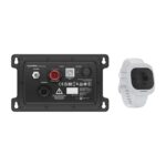
EOFY, Garmin, Garmin Chartplotters
Garmin OnBoard ™ System
Garmin OnBoard ™ System
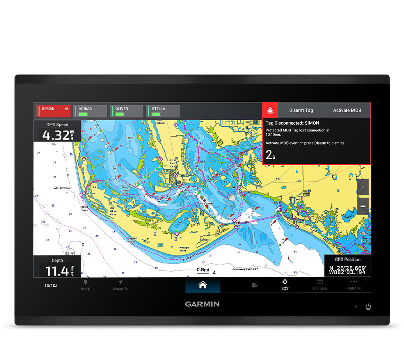
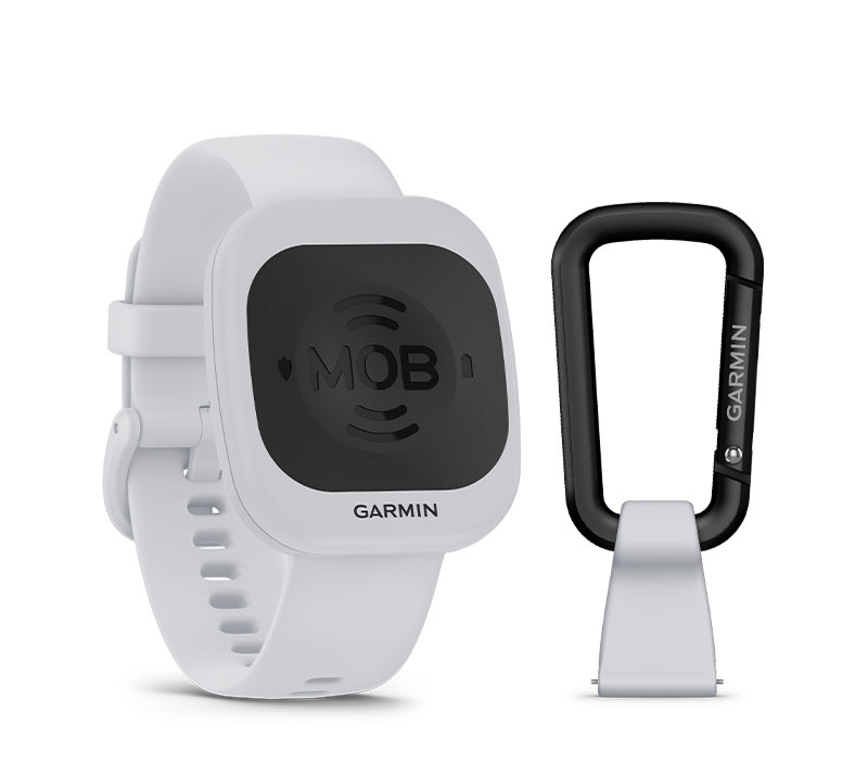
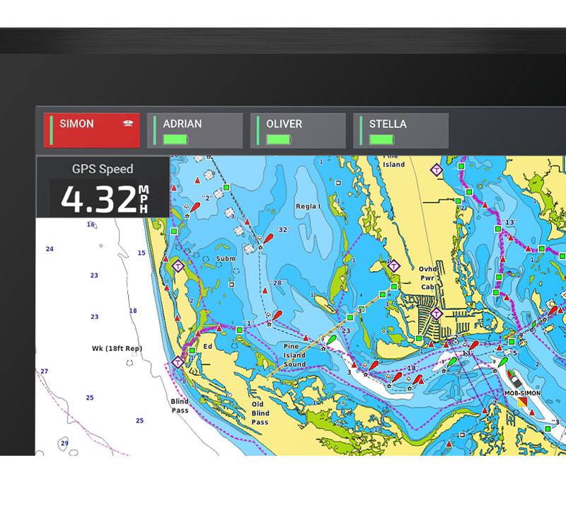
TAG WHAT MATTERS
Built so you can move freely and boat confidently, the Garmin OnBoard™ system uses wireless tags instead of traditional tethered cords — integrating with your compatible Garmin chartplotter.

TAGS ARE WORN ON WRIST, CARABINER OR KEY RING FLOAT

TAGS ARE DESIGNATED AS EITHER CAPTAIN OR PASSENGER
SET MOB TAG AS CAPTAIN TO ENABLE ENGINE CUTOFF

TEMPORARILY DISARM TAGS WITH EASE

THE GOS 10 HUB INCLUDES A LOUD EXTERNAL ALARM

TAG BATTERY LIFE EXCEEDS A SEASON OF TYPICAL USE
WHAT YOU’LL LOVE
CAPTAIN TAG
Captain MOB detection will trigger engine cutoff, a MOB waypoint on the chartplotter and an audible alarm on the MFDs and hub.
WIRELESS: NO STRINGS ATTACHED
The wearable MOB tags are part of a wireless MOB system — letting you move untethered while still being monitored.
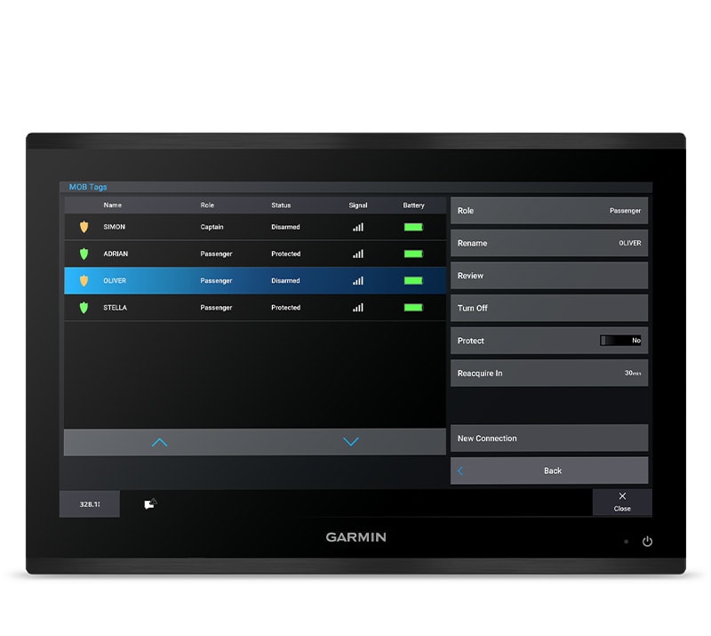
PASSENGER TAG
Passenger MOB detection will trigger a MOB waypoint on MFDs plus an audible alarm on the MFDs and hub.

ENGINE CUTOFF SYSTEM
Should a captain tag trigger an MOB event, the system will cut power to the engines — letting the captain return to the vessel.
CAPTAIN OR PASSENGER TAGS
Through the Garmin chartplotter interface, you can designate each tag as either captain or passenger — changing their MOB action.
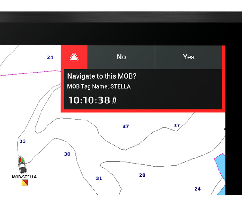
WAYPOINTS
When paired to your compatible Garmin chartplotter, a waypoint will be marked at the location where the MOB tag lost connection with the vessel.
BOAT WITH CONFIDENCE
AUDIO ALARM
The GOS 10 hub includes a loud external alarm — alerting you to a MOB event.

PAIR MULTIPLE TAGS
Provide peace of mind for up to 8 tags at a time.
VAST COMPATIBILITY
This product will work with any boat that has an engine cutoff switch.
SKU: 010-02908-00 -
Easter, EOFY, Garmin, Garmin Sonar & Transducers, Sanctuary Cove
Garmin Panoptix LiveScope™ XR System – with GLS 10™ and LVS62 Transducer
-39%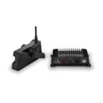 Easter, EOFY, Garmin, Garmin Sonar & Transducers, Sanctuary Cove
Garmin Panoptix LiveScope™ XR System – with GLS 10™ and LVS62 Transducer
Garmin Panoptix LiveScope™ XR System – THE BEST OF THE BEST JUST HIT THE OPEN WATER
You didn’t think it could get better, but it did with the extended range of the LiveScope XR System. It’s the latest in LiveScope technology, now for coastal and open-water fishing.

Explore the deep with an extended range up to 500’ in freshwater and 350’ in saltwater.

Find fish circling your boat with clear views close around your hull.
Upgrade your current LiveScope System black box (GLS™ 10 sonar module) with just a new transducer.

Get maximum contrast and clarity in your images with vivid color palettes.

Don’t miss a thing with supported Forward, Down and Perspective modes plus necessary mount.
SKU: 010-02719-00 -
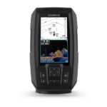
EOFY, Garmin, Garmin Fishfinder, Sanctuary Cove
Garmin STRIKER Vivid 4cv with GT20-TM Transducer
Garmin STRIKER Vivid 4cv with GT20-TM Transducer – THE CHOICE IS YOURS
See fish and structure in maximum detail when you pick your display colour, your location and your sonar for your day on the water with the STRIKER Vivid 4cv fishfinder with transducer.
The sonar colour you pick says a lot about your fishing style. Good thing there are 7 new vivid options.
What a view. Use the included transducer to get CHIRP traditional and ClearVü sonars.

Never lose a hot spot again. Use waypoint marking to find your way back.
What’s under the water’s surface looks pretty good as 1-foot contours, just saying.
SKU: 010-02550-01 -
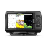
EOFY, Garmin, Garmin Fishfinder, Sanctuary Cove
Garmin STRIKER Vivid 7cv with GT20-TM Transducer
Garmin STRIKER Vivid 7cv with GT20-TM Transducer – THE CHOICE IS YOURS
See fish and structure in maximum detail when you pick your display colour, your location and your sonar for your day on the water with the STRIKER Vivid 7cv fishfinder with transducer.
The sonar colour you pick says a lot about your fishing style. Good thing there are 7 new vivid options.
What a view. Use the included transducer to get CHIRP traditional and ClearVü sonars.
Never lose a hot spot again. Use waypoint marking to find your way back.
What’s under the water’s surface looks pretty good as 1-foot contours, just saying.

Wi-Fi® connection1 on land opens up a world of possibilities on the water.
SKU: 010-02552-01 -
EOFY, Garmin, Garmin Fishfinder, Sanctuary Cove
Garmin STRIKER Vivid 9sv with GT52HW-TM Transducer
-9%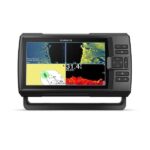 EOFY, Garmin, Garmin Fishfinder, Sanctuary Cove
Garmin STRIKER Vivid 9sv with GT52HW-TM Transducer
Garmin STRIKER Vivid 9sv with GT52HW-TM Transducer – THE CHOICE IS YOURS
See fish and structure in maximum detail when you pick your display colour, your location and your sonar for your day on the water with the STRIKER Vivid 9sv fishfinder with transducer.
The sonar colour you pick says a lot about your fishing style. Good thing there are 7 new vivid options.
What a view. Use the included transducer to get CHIRP traditional and ClearVü sonars.
Never lose a hot spot again. Use waypoint marking to find your way back.
What’s under the water’s surface looks pretty good as 1-foot contours, just saying.
Wi-Fi® connection1 on land opens up a world of possibilities on the water.
SKU: 010-02554-01 -
EOFY, Garmin, Garmin VHF and AIS, Marine Electronics, Sanctuary Cove, VHF & AIS
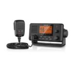
Garmin VHF 215i AIS Marine Radio
-10% EOFY, Garmin, Garmin VHF and AIS, Marine Electronics, Sanctuary Cove, VHF & AIS
Garmin VHF 215i AIS Marine Radio
Garmin VHF 215i AIS Marine Radio – Stay in Contact on the Water
- Displays Automatic Identification System (AIS) on the chartplotter
- Standard Class D Digital Selective Calling (DSC) functionality (distress calling and direct calling with user-programmed MMSI)
- In case of trouble, DSC may improve your chances of a rapid rescue
- 25-watt transmit power with built-in GPS
- Frequency bands include all U.S., Canadian and international marine channels plus 10 NOAA weather channels
Communication and situational awareness are critical on the water. This fixed-mount VHF 215i AIS radio displays AIS on the chartplotter to enhance communication, situational awareness and collision avoidance between you and other mariners worldwide.
Increase Your Peace of Mind
During an emergency situation, the 25-watt transmit power of VHF 215i AIS gives fishermen, sailors and cruisers confidence at their fingertips.Communicate Confidently on the Water
Easy to install and use, just plug and play to compatible Garmin chartplotters and MFDs via the NMEA 2000 network. VHF 215i AIS provides standard Class D DSC functionality (distress calling and direct calling with user-programmed MMSI). The radio includes frequency bands for all U.S., Canadian and international marine channels and 10 NOAA weather channels. It’s also NMEA 0183 compatible and includes a two-way hailer system for onboard communication.Communicate with Style
Because your helm is a source of pride, the VHF 215i AIS marine radio is designed to complement the appearance of GPSMAP® 7×2/9×2, GPMAP 10×2/12×2, GPSMAP 7400/7600 and GPSMAP 8400/8600 chartplotters and MFDs.Specs
- Unit Dimensions, HxWxD: 3.9” x 7.8” x 5.8” (9.8 x 19.7 x 14.9 cm)
- Weight: Radio without microphone 42.8 oz. (1.2 kg); Microphone 8.8 oz. (0.25 kg)
- Water rating: IPX7
- Temperature Range: Operating (from -15ºC to 70ºC; from 5ºF to 158ºF); Storage (from -20ºC to 70ºC; from -4ºF to 158ºF);
- Compass-safe Distance: 29.5” (75 cm)
- NMEA 2000: Yes
- NMEA 0183: Yes
- Digital Selective Calling: Class D
- Frequency Bands: All USA, Canadian, and international marine channels; 10 NOAA weather channels
- Operating Voltage: 10.8 – 15.6 Vdc
- Current Draw: Standby 350 mA; Receive 600 mA; Transmit from 2.0 A to 6.0 A (from 1 W to 25 W)
- Frequency Range: 156.050 MHz to 163.275 MHz (including WX channels)
- Hailer Output Power: 20 W at 4 Ω
- Hailer horn impedance: 4 Ω
- External speaker impedance: 4 Ω
- Antenna connector: S0-239 (50 Ω)
- Maximum antenna gain: 9 dBi
 In the Box
- VHF 215i AIS marine radio
- Removable fist mic
- Fist mic mounting bracket and hardware
- Bail mount with knobs and mounting hardware
- Protective cover
- Trim ring snap cover
- Flush mount gasket
- Power cable
- Documentation
SKU: 010-02098-01 -
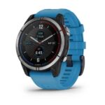
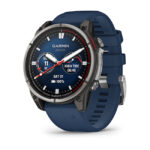
EOFY, Garmin, Garmin Watches
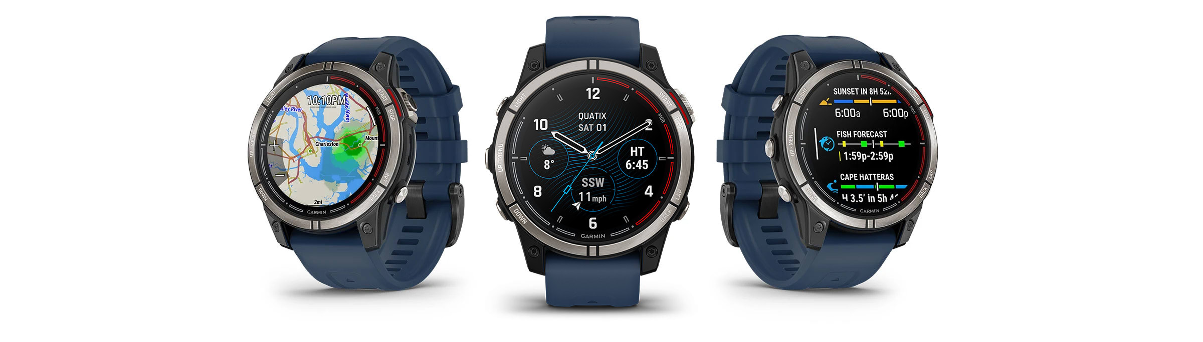
Garmin Watch Quatix 7 – Standard Edition Multisport GPS Watch
Garmin Watch Quatix 7 – Standard Edition Multisport GPS Watch – PLOT YOUR PARADISE ON THE WATER AND BEYOND
With the quatix® 7 multisport GPS smartwatch, you’ll get all the features you need on your boat and the ones you want off it.

Chargers weigh you down, so don’t take one. Go up to 18 days without needing to plug in.

When you own a boat, you want to stay connected. quatix 7 is your answer.

Touch or tap, it’s up to you. Use traditional buttons or the new touchscreen interface.
No matter where you go, know where you are with coastal charts and inland maps.

Kayak or kickbox, SUP or ski, quatix 7 has built-in activity profiles and is made for what you like to do.

Off the grid or at your local spot, text messages and smart notifications1 will be able to find you.
SKU: 010-02540-61 -
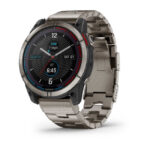
EOFY, Garmin, Garmin Watches, Sanctuary Cove
Garmin Watch Quatix 7 Pro – Marine GPS Smartwatch with OLED Display
-12% EOFY, Garmin, Garmin Watches, Sanctuary Cove
Garmin Watch Quatix 7 Pro – Marine GPS Smartwatch with OLED Display
Garmin Watch Quatix 7 Pro – Marine GPS Smartwatch with OLED Display – PLOT YOUR PARADISE ON THE WATER AND BEYOND
The quatix® 7 Pro multisport GPS smartwatch includes a bright AMOLED display and LED flashlight, so you’ll get all the features you need on your boat and the ones you want off it.
LEAVE THE CHARGER AT THE DOCK WITH UP TO 16 DAYS OF BATTERY LIFEDIRECT SUNLIGHT HAS NOTHING ON THIS BRIGHT AMOLED DISPLAY

USE THE LED FLASHLIGHT FOR CONVENIENT ILLUMINATION

CONNECT TO YOUR COMPATIBLE CHARTPLOTTERS, FORCE® TROLLING MOTOR AND MORE
USE TRADITIONAL BUTTONS OR THE TOUCHSCREEN INTERFACE

READ TEXT MESSAGES AND SMART NOTIFICATIONS1
WHAT YOU’LL LOVE
BATTERY LIFE
An internal, rechargeable lithium battery provides up to 16 days of battery life in smartwatch mode, up to 42 hours in GPS mode and up to 60 hours in UltraTrac™ battery saver mode.
LED FLASHLIGHT
Double-tap the top left button for a bright LED flashlight with different light intensity and modes. Once the sun sets, preserve your night vision at the helm with a red light mode.
ECO-SUPPORTIVE DESIGN
This rugged watch features a large 1.3″ AMOLED display with scratch-resistant sapphire lens. 100% of the plastic used in its eco-friendly housing design comes from recycled ocean-bound plastics.
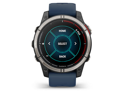
TOUCHSCREEN AND BUTTONS
Traditional button controls that work in any environment are matched with a responsive touchscreen interface for quick access to selections and functions.
COMPREHENSIVE CONNECTIVITY
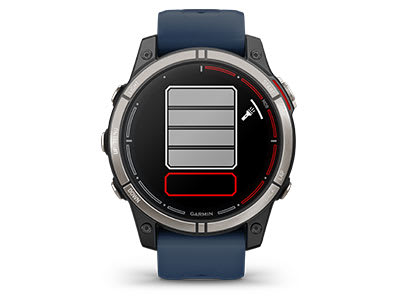
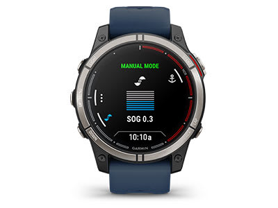
Control your Force trolling motor, compatible chartplotters, Fusion® stereos and more — directly from your wrist.
CAPTAIN YOUR DAY
INTEGRATE
AUTOPILOT CONTROL
Access the autopilot app to change heading, engage pattern steering and follow a GPS route when connected to your chartplotter.
FUSION AUDIO SYSTEM
Control your onboard entertainment system from your watch with the built-in Fusion-Link™ audio app.

BOAT DATA STREAMING
View data — including water depth, engine RPM, wind, custom data and more — from your chartplotter directly on your wrist.

ALERTS AND ALARMS
Get watch alerts for imminent tide changes and anchor drag.

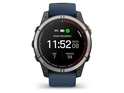
WAYPOINT MARKING
Use your watch to place chartplotter waypoints from anywhere on the boat.
NAVIGATE
BLUECHART® G3 CHARTS
The quatix 7 Pro smartwatch supports premier coastal charts featuring integrated Navionics® data (sold separately).

MULTICONTINENT TOPO MAPS
Download TopoActive maps from around the world to keep your explorations on track.

GOLF COURSE MAPS
Access full-color CourseView maps for more than 43,000 golf courses around the world.

SKIVIEW™ MAPS
View resort maps, run names and difficulty ratings for more than 2,000 ski resorts worldwide.

MULTI-GNSS SUPPORT
Access multiple global navigation satellite systems (GPS, GLONASS and Galileo) to track in more challenging environments than GPS alone.
MULTI-BAND FREQUENCY SUPPORT
Get superior positional accuracy with multi-band frequency support.

ABC SENSORS
Navigate your next trail with an altimeter, barometer and 3-axis electronic compass.
PERFORM

BUILT-IN SPORTS APPS
Use preloaded sport profiles to track the activities you love.

WAKESPORTS ACTIVITIES
Track your stats for water skiing, wakeboarding, wakesurfing and tubing.

SURF-READY FEATURES
Ride in front of a Surfline® camera3, and create a video of your rides with Surfline Sessions™ technology.

SAIL EXPEDITION
Record a multiday sailing activity with a reduced need to charge.

PERFORMANCE METRICS
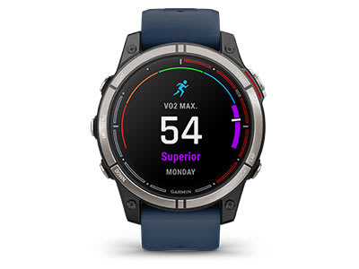
View advanced training metrics that include running dynamics, heat- and altitude-adjusted VO2 max and more.

RECOVERY TIME ADVISOR
After each workout, recovery time lets you know when you’ll be ready for another hard workout.

WRIST-BASED HEART RATE
The watch constantly samples your heart rate4 to help gauge how hard you work during activities — even underwater.

SLEEP SCORE AND ADVANCED SLEEP MONITORING
Get a full breakdown of your light, deep and REM sleep stages4.

HEALTH MONITORING ACTIVITY
Track your daily biometric and wellness trends at a glance with advanced watch sensors.

JET LAG ADVISER
Help minimise the effects of jet lag with guidance on light exposure, sleep schedule and exercise.
CONNECT
SMART NOTIFICATIONS
Receive emails, texts and alerts right on your watch when paired with your compatible device.

GARMIN PAY™ CONTACTLESS PAYMENTS
Breeze through checkout lines with Garmin Pay through participating providers.

MUSIC APPS
Download songs plus playlists from your Spotify, Deezer or Amazon Music accounts (subscription may be required).

SAFETY AND TRACKING FEATURES
Send a message with your location manually or — during select outdoor activities — automatically with built-in incident detection5.

CONNECT IQ™ STORE
Download custom watch faces, add data fields, and get apps and widgets from the Connect IQ Store on your compatible smartphone.
What’s in the Box?
- quatix® 7 Pro
- Charging/data cable
- Documentation
Owner’s Manual
quatix® 7 Pro: Plot your paradise
SKU: 010-02803-82 -
EOFY, Garmin, Garmin Watches
Garmin Watch Quatix 7X – Solar Edition Multisport GPS Watch
Garmin Watch Quatix 7X – Solar Edition Multisport GPS Watch – PLOT YOUR PARADISE ON THE WATER AND BEYOND
With quatix® 7X – Solar Edition, the multisport GPS smartwatch with solar charging, you’ll get all the features you need on your boat and the ones you want off it.
Do more. Charge less. Solar charging yields up to 37 days of battery life in smartwatch mode2.

Get a battery boost from the sunlight, so you can go longer between charges.
When you own a boat, you want to stay connected. quatix 7 is your answer.
Touch or tap, it’s up to you. Use traditional buttons or the new touchscreen interface.
No matter where you go, know where you are with coastal charts and inland maps.
Off the grid or at your local spot, text messages and smart notifications1 will be able to find you.
SKU: 010-02541-62